Maps of Pojbuky

Hinter Strziterz - c9029-1-003 - Kaiserpflichtexemplar der Landkarten des stabilen Katasters
1 : 2880
Hinter Strziterz - c9029-1-001 - Kaiserpflichtexemplar der Landkarten des stabilen Katasters
1 : 2880
Hinter Strziterz - c9029-1-002 - Kaiserpflichtexemplar der Landkarten des stabilen Katasters
1 : 2880
Lomna - c9027-1-002 - Kaiserpflichtexemplar der Landkarten des stabilen Katasters
1 : 2880
Lomna - c9027-1-001 - Kaiserpflichtexemplar der Landkarten des stabilen Katasters
1 : 2880
Zhorz - c9257-1-001 - Kaiserpflichtexemplar der Landkarten des stabilen Katasters
1 : 2880
Zhorz - c9257-1-002 - Kaiserpflichtexemplar der Landkarten des stabilen Katasters
1 : 2880
Tiechobus - c7878-1-002 - Kaiserpflichtexemplar der Landkarten des stabilen Katasters
1 : 2880
Tiechobus - c7878-1-004 - Kaiserpflichtexemplar der Landkarten des stabilen Katasters
1 : 2880
Tiechobus - c7878-1-001 - Kaiserpflichtexemplar der Landkarten des stabilen Katasters
1 : 2880
Tiechobus - c7878-1-003 - Kaiserpflichtexemplar der Landkarten des stabilen Katasters
1 : 2880
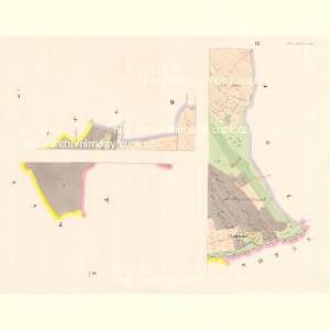
Pogbuk - c5963-1-001 - Kaiserpflichtexemplar der Landkarten des stabilen Katasters
1 : 2880
Pogbuk - c5963-1-004 - Kaiserpflichtexemplar der Landkarten des stabilen Katasters
1 : 2880
Pogbuk - c5963-1-003 - Kaiserpflichtexemplar der Landkarten des stabilen Katasters
1 : 2880
Pogbuk - c5963-1-002 - Kaiserpflichtexemplar der Landkarten des stabilen Katasters
1 : 2880
Rowna - c8404-1-001 - Kaiserpflichtexemplar der Landkarten des stabilen Katasters
1 : 2880
Rowna - c8404-1-003 - Kaiserpflichtexemplar der Landkarten des stabilen Katasters
1 : 2880
Rowna - c8404-1-002 - Kaiserpflichtexemplar der Landkarten des stabilen Katasters
1 : 2880
Ober und Unter Swietla - c2160-1-002 - Kaiserpflichtexemplar der Landkarten des stabilen Katasters
1 : 2880
Ober und Unter Swietla - c2160-1-001 - Kaiserpflichtexemplar der Landkarten des stabilen Katasters
1 : 2880

Podrobné mapy zemí Koruny české v měřítku 1:75.000 a mapy vzdáleností všech míst při silnici ležících
1 : 75000 Mladá Vožice (Česko : oblast) Bělohlav, Josef F. Topič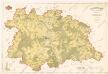
Polohopisná mapa silnic, cest a obecního majetku Táborského
Podrobná místopisná mapa Království Českého

Podrobná mapa Království českého
1 : 100000 Humpolec (Pelhřimov, Česko : oblast) Srp, Jan Jaroslav Bursík
Podrobná místopisná mapa Království Českého

Politický okres Táborský
1 : 100000 Tábor-oblast (Česko) Srp, Jan Schwihlik, F. Jos. R. Vilímek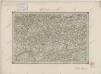
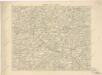
II. vojenské mapování 16
1 : 144000
Kamenitz a./d. Linde (Bohmen).
from Spezialkarte der osterreichisch-ungarischen Monarchie.