Maps of Planá

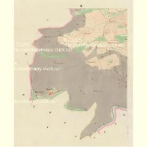
Hohenzetlisch - c8961-1-002 - Kaiserpflichtexemplar der Landkarten des stabilen Katasters
1 : 2880
Hohenzetlisch - c8961-1-004 - Kaiserpflichtexemplar der Landkarten des stabilen Katasters
1 : 2880
Hohenzetlisch - c8961-1-001 - Kaiserpflichtexemplar der Landkarten des stabilen Katasters
1 : 2880
Hohenzetlisch - c8961-1-003 - Kaiserpflichtexemplar der Landkarten des stabilen Katasters
1 : 2880
Porostní mapa revíru Vysoké Sedliště
1 : 5760
Hospodářská mapa revíru Kočov
1 : 4343
Katastrální mapa obce Vysoké Sedliště
1 : 2880
Hospodářská mapa revíru Vysoké Sedliště
1 : 4350
Katastrální mapa obce Týnec
1 : 2880
Katastrální mapa obce Pavlovice
1 : 2880
Katastrální mapa obce Pavlovice ZSL-XIII-19 dh, ch
1 : 2880
Katastrální mapa obce Pavlovice
1 : 2880
Thein - c8148-1-002 - Kaiserpflichtexemplar der Landkarten des stabilen Katasters
1 : 2880
Thein - c8148-1-001 - Kaiserpflichtexemplar der Landkarten des stabilen Katasters
1 : 2880
Thein - c8148-1-003 - Kaiserpflichtexemplar der Landkarten des stabilen Katasters
1 : 2880
Hospodářská mapa revíru Pavlovice
1 : 2880
Porostní mapa revíru Pavlovice
1 : 5760
Hospodářská mapa revíru Kočov
1 : 4343
Hospodářská mapa revíru Pavlovice
1 : 2689
Hospodářská mapa revíru Kočov
1 : 4377
Hospodářská mapa revíru Planá
1 : 4350
Truss - c8271-1-001 - Kaiserpflichtexemplar der Landkarten des stabilen Katasters
1 : 2880
Katastrální mapa obce Pavlovice ZSL-XIV-19 ah, ai
1 : 2880
Katastrální mapa obce Pavlovice
1 : 2880
Pawlowitz (Pawlowice) - c5668-1-002 - Kaiserpflichtexemplar der Landkarten des stabilen Katasters
1 : 2880
Pawlowitz (Pawlowice) - c5668-1-003 - Kaiserpflichtexemplar der Landkarten des stabilen Katasters
1 : 2880
Pawlowitz (Pawlowice) - c5668-1-001 - Kaiserpflichtexemplar der Landkarten des stabilen Katasters
1 : 2880
Pawlowitz (Pawlowice) - c5668-1-004 - Kaiserpflichtexemplar der Landkarten des stabilen Katasters
1 : 2880
Bruck - c0516-1-001 - Kaiserpflichtexemplar der Landkarten des stabilen Katasters
1 : 2880
Bruck - c0516-1-002 - Kaiserpflichtexemplar der Landkarten des stabilen Katasters
1 : 2880
Bruck - c0516-1-003 - Kaiserpflichtexemplar der Landkarten des stabilen Katasters
1 : 2880
Bruck - c0516-1-005 - Kaiserpflichtexemplar der Landkarten des stabilen Katasters
1 : 2880
Bruck - c0516-1-006 - Kaiserpflichtexemplar der Landkarten des stabilen Katasters
1 : 2880