Maps of Kočí

Wltschnow - c8680-1-001 - Kaiserpflichtexemplar der Landkarten des stabilen Katasters
1 : 2880
Wltschnow - c8680-1-002 - Kaiserpflichtexemplar der Landkarten des stabilen Katasters
1 : 2880
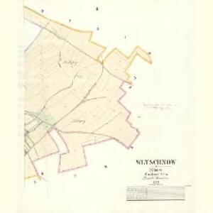
Kotschy (Koči) - c3240-1-001 - Kaiserpflichtexemplar der Landkarten des stabilen Katasters
1 : 2880
Kotschy (Koči) - c3240-1-003 - Kaiserpflichtexemplar der Landkarten des stabilen Katasters
1 : 2880
Kotschy (Koči) - c3240-1-004 - Kaiserpflichtexemplar der Landkarten des stabilen Katasters
1 : 2880
Kotschy (Koči) - c3240-1-002 - Kaiserpflichtexemplar der Landkarten des stabilen Katasters
1 : 2880
Worell (Worel) - c5509-1-002 - Kaiserpflichtexemplar der Landkarten des stabilen Katasters
1 : 2880
Worell (Worel) - c5509-1-001 - Kaiserpflichtexemplar der Landkarten des stabilen Katasters
1 : 2880
Worell (Worel) - c5509-1-004 - Kaiserpflichtexemplar der Landkarten des stabilen Katasters
1 : 2880
Worell (Worel) - c5509-1-003 - Kaiserpflichtexemplar der Landkarten des stabilen Katasters
1 : 2880
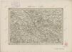
Regni Bohemiae Circulus Chrudimensis
1 : 150000 Chrudim-oblast (Česko) Müller, Johann Christoph ab Homannianis Heredibus
Regni Bohemiae Circulus Chrudimensis
1 : 150000 Chrudim-oblast (Česko) Müller, Johann Christoph ab Homannianis Heredibus
Mapa politického okresu Pardubického...


Eisenbahn Karte Wien-Dresden, Ollmütz-Trübau
1 : 72000 Blatt 10 Minarzik, Anselm J. Rauh
Politická mapa okresu chrudimského a nasavrckého
1 : 100000 Chrudim-oblast (Česko) Homolka, Josef Výbor ku popisu okresu chrudimského a nasavrckého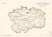
8. Kraj Pardubický

Chrudim a okolí
1 : 75000 Chrudim (Česko : oblast) Vojenský zeměpisný ústav
Mapa horo- a vodopisná okresu chrudimského a nasavrckého
1 : 100000 Chrudim-oblast (Česko) Homolka, Josef Výbor ku popisu okresu chrudimského a nasavrckého
Pardubice a okolí
1 : 75000 Pardubice (Česko : oblast) Vojenský zeměpisný ústav
Katastrální mapa města Rabštejn WC-IX-16 af
1 : 2880
Politický okres Chrudim
1 : 100000 Chrudim-oblast (Česko) Josef Richard Vilímek
Politický okres Chrudim
1 : 100000 Chrudim-oblast (Česko) Kratochvíl, M. Josef Richard Vilímek
Československo v mapách

Mapa politického okresu Pardubického
II. vojenské mapování 21
1 : 144000
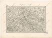
Caslau und Chrudim.
from Spezialkarte der osterreichisch-ungarischen Monarchie.
Hohenmauth und Leitomischl.
from Spezialkarte der osterreichisch-ungarischen Monarchie.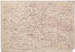
[Časlau und Umgebung]
1 : 144000 Čáslav-oblast (Kutná Hora, Česko) Kořistka, Karel František Edvard