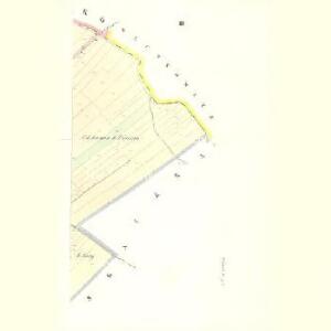
Maps of Hvozdnice

Urbanitz - c8262-1-003 - Kaiserpflichtexemplar der Landkarten des stabilen Katasters
1 : 2880
Urbanitz - c8262-1-001 - Kaiserpflichtexemplar der Landkarten des stabilen Katasters
1 : 2880
Urbanitz - c8262-1-002 - Kaiserpflichtexemplar der Landkarten des stabilen Katasters
1 : 2880
Indikační skica mapy stabilního katastru pro obec Lhota pod Libčany III.
1 : 2880
Woznitz - c2451-1-001 - Kaiserpflichtexemplar der Landkarten des stabilen Katasters
1 : 2880
Woznitz - c2451-1-002 - Kaiserpflichtexemplar der Landkarten des stabilen Katasters
1 : 2880
Indikační skica mapy stabilního katastru pro obec Lhota pod Libčany I.-VI.
1 : 2880
Indikační skica mapy stabilního katastru pro obec Lhota pod Libčany V.
1 : 2880
Lhotta unter Libtschan(Lhotta p.Libčany) - c3939-1-004 - Kaiserpflichtexemplar der Landkarten des stabilen Katasters
1 : 2880
Lhotta unter Libtschan(Lhotta p.Libčany) - c3939-1-001 - Kaiserpflichtexemplar der Landkarten des stabilen Katasters
1 : 2880
Lhotta unter Libtschan(Lhotta p.Libčany) - c3939-1-002 - Kaiserpflichtexemplar der Landkarten des stabilen Katasters
1 : 2880
Lhotta unter Libtschan(Lhotta p.Libčany) - c3939-1-003 - Kaiserpflichtexemplar der Landkarten des stabilen Katasters
1 : 2880
Praskaczka - c6086-1-002 - Kaiserpflichtexemplar der Landkarten des stabilen Katasters
1 : 2880
Praskaczka - c6086-1-001 - Kaiserpflichtexemplar der Landkarten des stabilen Katasters
1 : 2880
Praskaczka - c6086-1-003 - Kaiserpflichtexemplar der Landkarten des stabilen Katasters
1 : 2880
Rzibsko - c2393-1-001 - Kaiserpflichtexemplar der Landkarten des stabilen Katasters
1 : 2880
Rzibsko - c2393-1-002 - Kaiserpflichtexemplar der Landkarten des stabilen Katasters
1 : 2880
Wlczkowitz - c8677-1-001 - Kaiserpflichtexemplar der Landkarten des stabilen Katasters
1 : 2880
Wlczkowitz - c8677-1-002 - Kaiserpflichtexemplar der Landkarten des stabilen Katasters
1 : 2880
Libtschan - c3977-1-002 - Kaiserpflichtexemplar der Landkarten des stabilen Katasters
1 : 2880
Libtschan - c3977-1-003 - Kaiserpflichtexemplar der Landkarten des stabilen Katasters
1 : 2880
Libtschan - c3977-1-001 - Kaiserpflichtexemplar der Landkarten des stabilen Katasters
1 : 2880
Indikační skica mapy stabilního katastru pro obec Lhota pod Libčany II.
1 : 2880
Indikační skica mapy stabilního katastru pro obec Libišany I.-V.
1 : 2880
Regni Bohemiae circulus Reginohradecensis
1 : 165000 Hradec Králové-oblast (Česko) Hauer, Daniel Adam ab Homannianis Heredibus
Regni Bohemiae Circulus Reginohradecensis
1 : 165000 Hradec Králové (Česko : oblast) Müller, Johann Christoph Hauer, Daniel Adam in lucem editus ab Homannianis Heredibus
Regni Bohemiae circulus Reginohradecensis
1 : 165000 Hradec Králové-oblast (Česko) Hauer, Daniel Adam ab Homannianis Heredibus

III. vojenské mapování 3955/2
1 : 25000