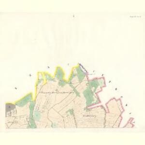
Maps of Újezd

Augezdl (Augezdo) - c8202-1-004 - Kaiserpflichtexemplar der Landkarten des stabilen Katasters
1 : 2880
Augezdl (Augezdo) - c8202-1-001 - Kaiserpflichtexemplar der Landkarten des stabilen Katasters
1 : 2880
Augezdl (Augezdo) - c8202-1-003 - Kaiserpflichtexemplar der Landkarten des stabilen Katasters
1 : 2880
Augezdl (Augezdo) - c8202-1-006 - Kaiserpflichtexemplar der Landkarten des stabilen Katasters
1 : 2880
Augezdl (Augezdo) - c8202-1-002 - Kaiserpflichtexemplar der Landkarten des stabilen Katasters
1 : 2880
Augezdl (Augezdo) - c8202-1-005 - Kaiserpflichtexemplar der Landkarten des stabilen Katasters
1 : 2880
Skica hranic parcel velkostatku Trhanov a cizích parcel na katastrech obcí Trhanov a Újezd
1 : 2880
Katastrální mapa obce Chodov
1 : 2880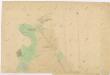
Katastrální mapa obce Trhanov
1 : 2880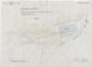
Plán znovunapuštění rybníka Hadrovce u obce Újezd
1 : 2880
Katastrální mapa panských pozemků obce Chodov
1 : 2880
Babilon - c0053-1-006 - Kaiserpflichtexemplar der Landkarten des stabilen Katasters
1 : 2880
Babilon - c0053-1-004 - Kaiserpflichtexemplar der Landkarten des stabilen Katasters
1 : 2880
Babilon - c0053-1-008 - Kaiserpflichtexemplar der Landkarten des stabilen Katasters
1 : 2880
Babilon - c0053-1-003 - Kaiserpflichtexemplar der Landkarten des stabilen Katasters
1 : 2880
Babilon - c0053-1-005 - Kaiserpflichtexemplar der Landkarten des stabilen Katasters
1 : 2880
Babilon - c0053-1-007 - Kaiserpflichtexemplar der Landkarten des stabilen Katasters
1 : 2880
Babilon - c0053-1-002 - Kaiserpflichtexemplar der Landkarten des stabilen Katasters
1 : 2880
Babilon - c0053-1-001 - Kaiserpflichtexemplar der Landkarten des stabilen Katasters
1 : 2880
Babilon - c0053-1-009 - Kaiserpflichtexemplar der Landkarten des stabilen Katasters
1 : 2880
Katastrální mapa obce Klenčí
1 : 2880
Hawlowitz (Hawlowice) - c1798-1-003 - Kaiserpflichtexemplar der Landkarten des stabilen Katasters
1 : 2880
Hawlowitz (Hawlowice) - c1798-1-002 - Kaiserpflichtexemplar der Landkarten des stabilen Katasters
1 : 2880
Hawlowitz (Hawlowice) - c1798-1-001 - Kaiserpflichtexemplar der Landkarten des stabilen Katasters
1 : 2880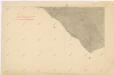
Katastrální mapa obce Trhanov
1 : 2880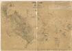
Přehledová mapa panství Trhanov se Staněticemi a Zahořany
1 : 21072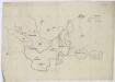
Hraniční mapa lesů velkostatku Kout-Trhanov a lesů města Domažlice
1 : 25520
Gradkartenblatt
1 : 25000 Domažlice-oblast (Česko) Bulla, Eduard
III. vojenské mapování 4250/1
1 : 25000