Maps of Studnice

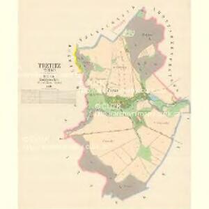
Trztitz (Třtyc) - c8087-1-001 - Kaiserpflichtexemplar der Landkarten des stabilen Katasters
1 : 2880
Kleny - c3153-1-003 - Kaiserpflichtexemplar der Landkarten des stabilen Katasters
1 : 2880
Kleny - c3153-1-002 - Kaiserpflichtexemplar der Landkarten des stabilen Katasters
1 : 2880
Kleny - c3153-1-004 - Kaiserpflichtexemplar der Landkarten des stabilen Katasters
1 : 2880
Kleny - c3153-1-005 - Kaiserpflichtexemplar der Landkarten des stabilen Katasters
1 : 2880
Kleny - c3153-1-001 - Kaiserpflichtexemplar der Landkarten des stabilen Katasters
1 : 2880
Lhotta Rzeschetowa - c6705-1-001 - Kaiserpflichtexemplar der Landkarten des stabilen Katasters
1 : 2880
Lhotta Rzeschetowa - c6705-1-002 - Kaiserpflichtexemplar der Landkarten des stabilen Katasters
1 : 2880
Zlitsch (Zlič) - c9278-1-002 - Kaiserpflichtexemplar der Landkarten des stabilen Katasters
1 : 2880
Zlitsch (Zlič) - c9278-1-001 - Kaiserpflichtexemplar der Landkarten des stabilen Katasters
1 : 2880
Plan des Gefechtsfeldes von Nachod, Skalitz und Schweinschaedel am 27, 28 u. 29. Juni 1866
1 : 25000 Náchod-oblast (Česko) Baumann
Plan des Gefechtsfeldes von Nachod, Skalitz und Schweinschaedel am 27, 28 u. 29 Juni 1866
1 : 25000 Náchod-oblast (Česko) Baumann Karten-debit königl. preussische Landesaufnahme
Plan zu dem Treffen bey Wysokow (Nachod) bei Skalitz und zum Gefechte bei Schweinschädel
1 : 28800 Náchod (Česko)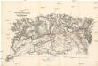
Plan zu dem Treffen bey Wysokow (Nachod), bei Skalitz und zum Gefechte bei Schweinschädel
1 : 28800 Náchod (Česko)
Gefechtsfeld von Nachod Skalitz und Schweinschädel
1 : 29300 Dolany (Česko : zaniklá obec)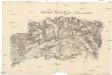
Gefechtsfeld von Nachod Skalitz und Schweinschädel
1 : 29300 Dolany (Česko : zaniklá obec)


Plan des glückl. Treffens Sr. Königl. Maj. in Preussen den 30ten Sept. 1745 bey Sahr in Böhmen, Königin Graetzer Creÿss der Gegend Trautenau in einer accuraten Charte selbigen Terrains
1 : 110000 Mollova mapová sbírka Werner, Bedřich Bernard
Náchod
1 : 75000 Náchod-oblast (Česko) Vojenský zeměpisný ústav
Josefov a Náchod
1 : 75000 Náchod (Česko : oblast) Vojenský zeměpisný ústav
Úpice a okolí

Josefstadt und Nachod
1 : 75000 Dobruška (Česko : oblast) Neumann K. u. k. militär-geographisches Institut
Josefstadt und Nachod
1 : 75000 Dobruška (Česko : oblast) Neumann K. u. k. Militärgeographisches Institut
Josefstadt und Nachod
1 : 75000 Dobruška (Česko : oblast) Neumann K. u. k. Militärgeographisches Institut
Josefstadt und Nachod
1 : 75000 Jaroměř (Česko : oblast) K. u. k. Militärgeographisches Institut
Josefov a Náchod
1 : 75000 Dobruška (Česko : oblast) Vojenský zeměpisný ústav
III. vojenské mapování 3856
1 : 75000