Maps of Třebosice

Třebositz - c8047-1-002 - Kaiserpflichtexemplar der Landkarten des stabilen Katasters
1 : 2880
Třebositz - c8047-1-001 - Kaiserpflichtexemplar der Landkarten des stabilen Katasters
1 : 2880
Alt Jesnitschan (Stary Jesniczany) - c7263-1-003 - Kaiserpflichtexemplar der Landkarten des stabilen Katasters
1 : 2880
Alt Jesnitschan (Stary Jesniczany) - c7263-1-001 - Kaiserpflichtexemplar der Landkarten des stabilen Katasters
1 : 2880
Alt Jesnitschan (Stary Jesniczany) - c7263-1-002 - Kaiserpflichtexemplar der Landkarten des stabilen Katasters
1 : 2880
Indikační skica mapy stabilního katastru pro obec Staré Jesenčany IV., V.
1 : 2880
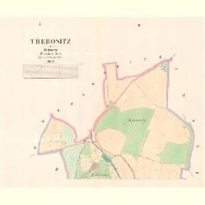
Duban - c1580-1-001 - Kaiserpflichtexemplar der Landkarten des stabilen Katasters
1 : 2880
Indikační skica mapy stabilního katastru pro obec Staré Jesenčany II., III.
1 : 2880
Popkowitz - c6011-1-002 - Kaiserpflichtexemplar der Landkarten des stabilen Katasters
1 : 2880
Popkowitz - c6011-1-001 - Kaiserpflichtexemplar der Landkarten des stabilen Katasters
1 : 2880
Indikační skica mapy stabilního katastru pro město Pardubice XIV.
1 : 2880
Indikační skica mapy stabilního katastru pro obec Čepí I.-III.
1 : 2880
Mateřow - c7304-1-002 - Kaiserpflichtexemplar der Landkarten des stabilen Katasters
1 : 2880
Mateřow - c7304-1-001 - Kaiserpflichtexemplar der Landkarten des stabilen Katasters
1 : 2880
Czepě - c0852-1-001 - Kaiserpflichtexemplar der Landkarten des stabilen Katasters
1 : 2880
Czepě - c0852-1-002 - Kaiserpflichtexemplar der Landkarten des stabilen Katasters
1 : 2880
Drzenitz - c1557-1-001 - Kaiserpflichtexemplar der Landkarten des stabilen Katasters
1 : 2880
Drzenitz - c1557-1-002 - Kaiserpflichtexemplar der Landkarten des stabilen Katasters
1 : 2880
Waldbestandskarte des zur kais. könig. Kameralherrschaft Pardubitz gehörigen Mietitzer Reviers
1 : 3000 Pardubice-oblast (Česko) Jiřička, Josef
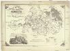
Mapa politického okresu Pardubického

Mapa politického okresu Pardubického...

III. vojenské mapování 4055/2
1 : 25000

Eisenbahn Karte Wien-Dresden, Ollmütz-Trübau
1 : 72000 Blatt 10 Minarzik, Anselm J. Rauh
8. Kraj Pardubický

Chrudim a okolí
1 : 75000 Chrudim (Česko : oblast) Vojenský zeměpisný ústav
Pardubice a okolí
1 : 75000 Pardubice (Česko : oblast) Vojenský zeměpisný ústav
Katastrální mapa města Rabštejn WC-IX-16 af
1 : 2880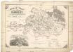
General-Karte der k. k. Reichsdomaine Pardubitz
1 : 96000 Pardubice-oblast (Česko) Urban, Joseph Jelínek, J.