Maps of Trnov

Trnow - c7974-1-003 - Kaiserpflichtexemplar der Landkarten des stabilen Katasters
1 : 2880
Trnow - c7974-1-004 - Kaiserpflichtexemplar der Landkarten des stabilen Katasters
1 : 2880
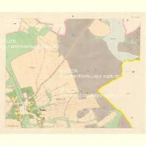
Trnow - c7974-1-001 - Kaiserpflichtexemplar der Landkarten des stabilen Katasters
1 : 2880
Trnow - c7974-1-002 - Kaiserpflichtexemplar der Landkarten des stabilen Katasters
1 : 2880
Semechnitz (Semechnice) - c6826-1-004 - Kaiserpflichtexemplar der Landkarten des stabilen Katasters
1 : 2880
Semechnitz (Semechnice) - c6826-1-003 - Kaiserpflichtexemplar der Landkarten des stabilen Katasters
1 : 2880
Semechnitz (Semechnice) - c6826-1-002 - Kaiserpflichtexemplar der Landkarten des stabilen Katasters
1 : 2880
Semechnitz (Semechnice) - c6826-1-005 - Kaiserpflichtexemplar der Landkarten des stabilen Katasters
1 : 2880
Semechnitz (Semechnice) - c6826-1-001 - Kaiserpflichtexemplar der Landkarten des stabilen Katasters
1 : 2880
Zadol - c9034-1-001 - Kaiserpflichtexemplar der Landkarten des stabilen Katasters
1 : 2880
Zadol - c9034-1-002 - Kaiserpflichtexemplar der Landkarten des stabilen Katasters
1 : 2880
Hroschka (Hrosska) - c2363-1-004 - Kaiserpflichtexemplar der Landkarten des stabilen Katasters
1 : 2880
Hroschka (Hrosska) - c2363-1-005 - Kaiserpflichtexemplar der Landkarten des stabilen Katasters
1 : 2880
Hroschka (Hrosska) - c2363-1-003 - Kaiserpflichtexemplar der Landkarten des stabilen Katasters
1 : 2880
Hroschka (Hrosska) - c2363-1-002 - Kaiserpflichtexemplar der Landkarten des stabilen Katasters
1 : 2880
Hroschka (Hrosska) - c2363-1-001 - Kaiserpflichtexemplar der Landkarten des stabilen Katasters
1 : 2880
Haudkowitz (Haudkowice) - c2274-1-003 - Kaiserpflichtexemplar der Landkarten des stabilen Katasters
1 : 2880
Haudkowitz (Haudkowice) - c2274-1-001 - Kaiserpflichtexemplar der Landkarten des stabilen Katasters
1 : 2880
Haudkowitz (Haudkowice) - c2274-1-002 - Kaiserpflichtexemplar der Landkarten des stabilen Katasters
1 : 2880
Mapa dřevin revírů Kunštátského, Černovodského, Říčeckého a Zdobnického, patřících svěřenskému statku Rychnovu
Rychnov nad Kněžnou-oblast (Česko) Barth, Antoš Meinhard, Carl

Okres Rychnov nad Kněžnou

Mapa okresního hejtmanství Rychnovského
1 : 100000 Rychnov nad Kněžnou-oblast (Česko) Erben, Josef nákladem Karla Janského
Josefov a okolí
1 : 75000 Jaroměř (Česko : oblast) Vojenský zeměpisný ústav
Mapa okresního hejtmanství Rychnovského

Mapa okresního hejtmanství Rychnovského

Mapa okresního hejtmanství Novoměstského n/M
1 : 100000 Nové Město nad Metují-oblast (Česko) Erben, Josef nákladem Karla Janského
Politický okres novoměstský
Nové Město nad Metují-oblast (Česko) Srp, Jan Luther, Th. Jos. R. Vilímek
Camp que l'armée de Sa Majesté l'imperatrice sous les ordres du prince Picolomini á occupe pour observer la retraite de l'armée prussienne sous le comandement du comte Swerin
1 : 110000 Hradec Králové-oblast (Česko)