Maps of Štichovice

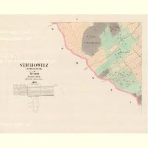
Stichowitz (Stichowice) - c7786-1-004 - Kaiserpflichtexemplar der Landkarten des stabilen Katasters
1 : 2880
Stichowitz (Stichowice) - c7786-1-002 - Kaiserpflichtexemplar der Landkarten des stabilen Katasters
1 : 2880
Stichowitz (Stichowice) - c7786-1-003 - Kaiserpflichtexemplar der Landkarten des stabilen Katasters
1 : 2880
Stichowitz (Stichowice) - c7786-1-001 - Kaiserpflichtexemplar der Landkarten des stabilen Katasters
1 : 2880
Stichowitz (Stichowice) - c7786-1-005 - Kaiserpflichtexemplar der Landkarten des stabilen Katasters
1 : 2880
Daubrawitz (Daubrawice) - c0949-1-002 - Kaiserpflichtexemplar der Landkarten des stabilen Katasters
1 : 2880
Daubrawitz (Daubrawice) - c0949-1-001 - Kaiserpflichtexemplar der Landkarten des stabilen Katasters
1 : 2880
Daubrawitz (Daubrawice) - c0949-1-003 - Kaiserpflichtexemplar der Landkarten des stabilen Katasters
1 : 2880
Hodowies (Hodowyze) - c1938-1-003 - Kaiserpflichtexemplar der Landkarten des stabilen Katasters
1 : 2880
Hodowies (Hodowyze) - c1938-1-002 - Kaiserpflichtexemplar der Landkarten des stabilen Katasters
1 : 2880
Hodowies (Hodowyze) - c1938-1-004 - Kaiserpflichtexemplar der Landkarten des stabilen Katasters
1 : 2880
Hodowies (Hodowyze) - c1938-1-001 - Kaiserpflichtexemplar der Landkarten des stabilen Katasters
1 : 2880
Krzeczowa (Křečowa) - c3607-1-002 - Kaiserpflichtexemplar der Landkarten des stabilen Katasters
1 : 2880
Krzeczowa (Křečowa) - c3607-1-003 - Kaiserpflichtexemplar der Landkarten des stabilen Katasters
1 : 2880
Krzeczowa (Křečowa) - c3607-1-001 - Kaiserpflichtexemplar der Landkarten des stabilen Katasters
1 : 2880
Katastrální mapa obce Dražeň
1 : 2880
Stradischt (Stradisste) - c7400-1-001 - Kaiserpflichtexemplar der Landkarten des stabilen Katasters
1 : 2880
Stradischt (Stradisste) - c7400-1-002 - Kaiserpflichtexemplar der Landkarten des stabilen Katasters
1 : 2880
Planes (Plaň) - c5806-1-002 - Kaiserpflichtexemplar der Landkarten des stabilen Katasters
1 : 2880
Planes (Plaň) - c5806-1-003 - Kaiserpflichtexemplar der Landkarten des stabilen Katasters
1 : 2880
Planes (Plaň) - c5806-1-001 - Kaiserpflichtexemplar der Landkarten des stabilen Katasters
1 : 2880
Brdo - c0493-1-003 - Kaiserpflichtexemplar der Landkarten des stabilen Katasters
1 : 2880
Brdo - c0493-1-001 - Kaiserpflichtexemplar der Landkarten des stabilen Katasters
1 : 2880
Brdo - c0493-1-002 - Kaiserpflichtexemplar der Landkarten des stabilen Katasters
1 : 2880
III. vojenské mapování 4050/2
1 : 25000
[Kartenblatt]
1 : 25000 Dolní Bělá (Česko : oblast) Reichsamt für Landesaufnahme
Gradkartenblatt
1 : 25000 Manětín-oblast (Česko) Brzesina, Julius von

Přehledná mapa velkostatku Manětín podle stavu k roku 1905
1 : 37500