Maps of Studánka

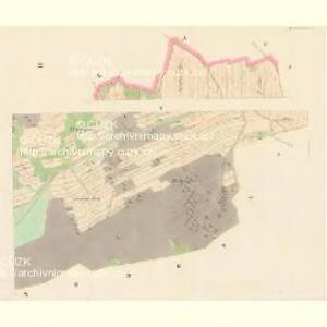
Schönbrunn - c7497-3-003 - Kaiserpflichtexemplar der Landkarten des stabilen Katasters
1 : 2880
Schönbrunn - c7497-3-001 - Kaiserpflichtexemplar der Landkarten des stabilen Katasters
1 : 2880
Schönbrunn - c7497-3-004 - Kaiserpflichtexemplar der Landkarten des stabilen Katasters
1 : 2880
Schönbrunn - c7497-3-002 - Kaiserpflichtexemplar der Landkarten des stabilen Katasters
1 : 2880
Přehledová mapa velkostatku Tachov
1 : 5747
Katastrální mapa obce Studánky
1 : 2880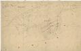
Katastrální mapa obce Studánky
1 : 2880
Katastrální mapa obce Studánky
1 : 2880
Katastrální mapa obce Studánky
1 : 2880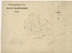
Hospodářská mapa revíru Tachov-Studánka
1 : 5760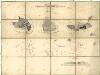
Porostní mapa lesního hospodářského okresu A. Svatá, B. Studánka, C. Trnová
1 : 11493
Katastrální mapa obce Studánky
1 : 2880
Porostní mapa revíru Pořejov-Dörflas
1 : 11520
Langendörflas - c1151-1-002 - Kaiserpflichtexemplar der Landkarten des stabilen Katasters
1 : 2880
Langendörflas - c1151-1-001 - Kaiserpflichtexemplar der Landkarten des stabilen Katasters
1 : 2880
Langendörflas - c1151-1-003 - Kaiserpflichtexemplar der Landkarten des stabilen Katasters
1 : 2880
Langendörflas - c1151-1-005 - Kaiserpflichtexemplar der Landkarten des stabilen Katasters
1 : 2880
Langendörflas - c1151-1-004 - Kaiserpflichtexemplar der Landkarten des stabilen Katasters
1 : 2880
Porostní mapa revíru Pořejov-Dörflas
1 : 11520
Porostní mapa revíru Pořejov-Dörflas
1 : 11520
Porostní mapa revíru Pořejov, oddělení Dörflas
1 : 9726
Přehledná mapa panství Planá
1 : 25000
Tachau - c7823-1-004 - Kaiserpflichtexemplar der Landkarten des stabilen Katasters
1 : 2880
Tachau - c7823-1-008 - Kaiserpflichtexemplar der Landkarten des stabilen Katasters
1 : 2880
Tachau - c7823-1-003 - Kaiserpflichtexemplar der Landkarten des stabilen Katasters
1 : 2880
Tachau - c7823-1-002 - Kaiserpflichtexemplar der Landkarten des stabilen Katasters
1 : 2880
Tachau - c7823-1-011 - Kaiserpflichtexemplar der Landkarten des stabilen Katasters
1 : 2880
Tachau - c7823-1-006 - Kaiserpflichtexemplar der Landkarten des stabilen Katasters
1 : 2880
Tachau - c7823-1-005 - Kaiserpflichtexemplar der Landkarten des stabilen Katasters
1 : 2880
Tachau - c7823-1-010 - Kaiserpflichtexemplar der Landkarten des stabilen Katasters
1 : 2880
Tachau - c7823-1-009 - Kaiserpflichtexemplar der Landkarten des stabilen Katasters
1 : 2880
Tachau - c7823-1-007 - Kaiserpflichtexemplar der Landkarten des stabilen Katasters
1 : 2880