Maps of Mnichov

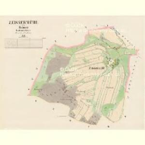
Zeissermühl - c6857-1-001 - Kaiserpflichtexemplar der Landkarten des stabilen Katasters
1 : 2880
Schefernau - c7722-1-001 - Kaiserpflichtexemplar der Landkarten des stabilen Katasters
1 : 2880
Schefernau - c7722-1-002 - Kaiserpflichtexemplar der Landkarten des stabilen Katasters
1 : 2880
Porostní mapa revíru Herštejnské Chalupy
1 : 5760
Natschetin - c4935-1-001 - Kaiserpflichtexemplar der Landkarten des stabilen Katasters
1 : 2880
Natschetin - c4935-1-002 - Kaiserpflichtexemplar der Landkarten des stabilen Katasters
1 : 2880
Přehledná mapa kultur velkostatku Kout-Trhanov
1 : 51605

Chodsko
1 : 100000 Chodsko (Česko) Klub českých turistů
Chodsko
1 : 100000 Chodsko (Česko) Klub českých turistů
Domažlice a okolí
1 : 75000 Domažlice (Česko : oblast) Vojenský zeměpisný ústav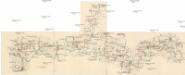
Böhmerwald-Verbindungsbahn
1 : 75000 Domažlice-Planá u Mariánských Lázní (Česko : železniční trať) Technisches Bureau Ing. Max Picha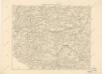
Podrobná místopisná mapa Království Českého

Podrobná mapa Království českého
1 : 100000 Domažlice (Česko : oblast) Srp, Jan Jaroslav Bursík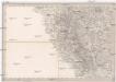
Umgebungen von Klentsch
1 : 750000 Klenčí pod Čerchovem (Česko : oblast) Kiss, Josef K. k. militär-geographisches Institut
II. vojenské mapování 23
1 : 144000
Das Tauser Grenzgebiet
1 : 200000 Chodsko (Česko)
Pfraumberg.
from Spezialkarte der osterreichisch-ungarischen Monarchie.
Klentsch.
from Spezialkarte der osterreichisch-ungarischen Monarchie.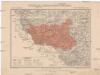
Generální mapa okresního hejtmanství Domažlického
1 : 220000 Domažlice-oblast (Česko) Wagner, Jan Eduard F. Kytka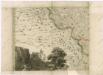
Müllerova mapa Čech
1 : 132000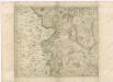
Müllerova mapa Čech
1 : 132000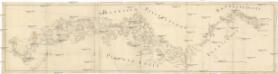
[Böhmerwald und die Umgebung von Eger]
1 : 80000 Cheb-oblast (Česko)
Fischerei-Karte des Radbusa-Gebietes
Radbuza-oblast (Česko) Schubert, Ottokar Deutsche agrarische Druckerei
Nová mapa království Českého

Sacri Romani imperii circuli et electoratus Bavariae tabula, 2
4 Blätter : s.n.
Mappa geographica regni Bohemiae in duodecim circulos divisae ...

Charte vom Klattauer Kreise ...

Charte vom Klattauer Kreise des Königreiches Böheim
1 : 260000 Klatovy-oblast (Česko) Kreibich, František Jakub Jindřich Pluth, Fr. C. W. Enders
Charte vom Klattauer Kreise des Königreiches Böheim
1 : 260000 Klatovy-oblast (Česko) Kreibich, František Jakub Jindřich Pluth, Fr. C. W. Enders
Charte vom Klattauer Kreise des Königreiches Böheim
1 : 246000 Klatovy-oblast (Česko) Kreibich, František Jakub Jindřich Enders, C. W. C.W. Enders
Charte vom Klattauer Kreise des Königreiches Böheim
1 : 246000 Klatovy-oblast (Česko) Kreibich, František Jakub Jindřich Enders, C. W. C.W. Enders
Charte vom Klattauer Kreise des Königreiches Böheim
1 : 246000 Klatovy-oblast (Česko) Kreibich, František Jakub Jindřich Enders, C. W. C.W. Enders
Charte vom Klattauer Kreise des Königreiches Böheim
1 : 246000 Klatovy-oblast (Česko) Kreibich, František Jakub Jindřich Enders, C. W. C.W. Enders
Charte vom Klattauer Kreise des Königreiches Böheim
1 : 246000 Klatovy-oblast (Česko) Kreibich, František Jakub Jindřich Enders, C. W. C.W. Enders
Charte vom Klattauer Kreise des Königreiches Böheim
1 : 246000 Klatovy-oblast (Česko) Kreibich, František Jakub Jindřich Enders, C. W. C.W. Enders
Charte vom Klattauer Kreise des Königreiches Böheim
1 : 246000 Klatovy-oblast (Česko) Kreibich, František Jakub Jindřich Enders, C. W. C.W. Enders
Charte vom Königgrätzer Kreise des Königreiches Böheim
1 : 241000 Hradec Králové-oblast (Česko) Kreibich, František Jakub Jindřich Enders, C. W. C.W. Enders
Charte vom Königgrätzer Kreise des Königreiches Böheim
1 : 260000 Hradec Králové-oblast (Česko) Kreibich, František Jakub Jindřich C. W. Enders
Charte vom Königgrätzer Kreise des Königreiches Böheim
1 : 260000 Hradec Králové-oblast (Česko) Kreibich, František Jakub Jindřich Enders, C. W. C.W. Enders
Charte vom Königgrätzer Kreise des Königreiches Böheim
1 : 260000 Hradec Králové-oblast (Česko) Kreibich, František Jakub Jindřich Enders, C. W. C.W. Enders
Charte vom Königgrätzer Kreise des Königreiches Böheim
1 : 241000 Hradec Králové-oblast (Česko) Kreibich, František Jakub Jindřich Enders, C. W. C.W. Enders
Charte vom Königgrätzer Kreise des Königreiches Böheim
1 : 241000 Hradec Králové-oblast (Česko) Kreibich, František Jakub Jindřich Enders, C. W. C.W. Enders
Charte vom Königgrätzer Kreise des Königreiches Böheim
1 : 241000 Hradec Králové-oblast (Česko) Kreibich, František Jakub Jindřich Enders, C. W. C.W. Enders
Charte vom Königgrätzer Kreise des Königreiches Böheim
1 : 241000 Hradec Králové-oblast (Česko) Kreibich, František Jakub Jindřich Enders, C. W. C.W. Enders
Charte vom Königgrätzer Kreise des Königreiches Böheim
1 : 241000 Hradec Králové-oblast (Česko) Kreibich, František Jakub Jindřich Enders, C. W. C.W. Enders
Charte vom Königgrätzer Kreise des Königreiches Böheim
1 : 260000 Hradec Králové-oblast (Česko) Kreibich, František Jakub Jindřich Kolowrat-Liebsteinský, František Antonín C. W. Enders
Charte vom Königgrätzer Kreise des Königreiches Böheim
1 : 241000 Hradec Králové-oblast (Česko) Kreibich, František Jakub Jindřich Enders, C. W. C.W. Enders
Charte vom Königgrätzer Kreise des Königreiches Böheim
1 : 241000 Hradec Králové-oblast (Česko) Kreibich, František Jakub Jindřich Enders, C. W. C.W. Enders