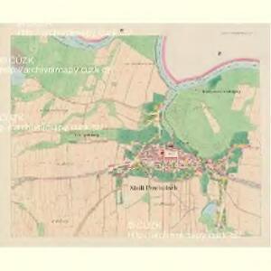
Maps of Přelouč

Przelautsch (Przelaucz) - c6194-1-005 - Kaiserpflichtexemplar der Landkarten des stabilen Katasters
1 : 2880
Przelautsch (Przelaucz) - c6194-1-006 - Kaiserpflichtexemplar der Landkarten des stabilen Katasters
1 : 2880
Przelautsch (Przelaucz) - c6194-1-003 - Kaiserpflichtexemplar der Landkarten des stabilen Katasters
1 : 2880
Przelautsch (Przelaucz) - c6194-1-004 - Kaiserpflichtexemplar der Landkarten des stabilen Katasters
1 : 2880
Przelautsch (Przelaucz) - c6194-1-002 - Kaiserpflichtexemplar der Landkarten des stabilen Katasters
1 : 2880
Przelautsch (Przelaucz) - c6194-1-007 - Kaiserpflichtexemplar der Landkarten des stabilen Katasters
1 : 2880
Przelautsch (Przelaucz) - c6194-1-001 - Kaiserpflichtexemplar der Landkarten des stabilen Katasters
1 : 2880
Indikační skica mapy stabilního katastru pro město Přelouč I.-VIII.
1 : 2880
Indikační skica mapy stabilního katastru pro město Přelouč IV.
1 : 2880
Indikační skica mapy stabilního katastru pro město Přelouč VII.
1 : 2880
Indikační skica mapy stabilního katastru pro město Přelouč III.
1 : 2880
Indikační skica mapy stabilního katastru pro obec Břehy VIII., IX.
1 : 2880
Indikační skica mapy stabilního katastru pro obec Břehy IX.
1 : 2880
Indikační skica mapy stabilního katastru pro město Přelouč V.
1 : 2880
Indikační skica mapy stabilního katastru pro obec Břehy V.
1 : 2880
Indikační skica mapy stabilního katastru pro obec Lhota pod Přeloučí IV.
1 : 2880
Indikační skica mapy stabilního katastru pro obec Břehy VI.
1 : 2880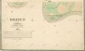
Indikační skica mapy stabilního katastru pro obec Břehy VIII.
1 : 2880
Indikační skica mapy stabilního katastru pro město Přelouč II.
1 : 2880
Indikační skica mapy stabilního katastru pro město Přelouč I.
1 : 2880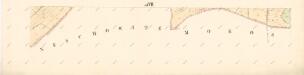
Indikační skica mapy stabilního katastru pro město Přelouč ad VII.
1 : 2880
Indikační skica mapy stabilního katastru pro obec Mokošín I.
1 : 2880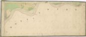
Indikační skica mapy stabilního katastru pro obec Semín ad IV.
1 : 2880
Indikační skica mapy stabilního katastru pro obec Škudly II.
1 : 2880
Indikační skica mapy stabilního katastru pro obec Lhota pod Přeloučí I.-IV.
1 : 2880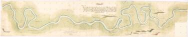
Situační plán řeky Labe u Kladrub nad Labem
1 : 2107
Brzech - c0549-1-006 - Kaiserpflichtexemplar der Landkarten des stabilen Katasters
1 : 2880
Brzech - c0549-1-003 - Kaiserpflichtexemplar der Landkarten des stabilen Katasters
1 : 2880
Brzech - c0549-1-005 - Kaiserpflichtexemplar der Landkarten des stabilen Katasters
1 : 2880
Brzech - c0549-1-004 - Kaiserpflichtexemplar der Landkarten des stabilen Katasters
1 : 2880
Brzech - c0549-1-002 - Kaiserpflichtexemplar der Landkarten des stabilen Katasters
1 : 2880