Maps of Předměřice nad Labem

Przedmierzitz (Předměric) - c6171-1-001 - Kaiserpflichtexemplar der Landkarten des stabilen Katasters
1 : 2880
Przedmierzitz (Předměric) - c6171-1-003 - Kaiserpflichtexemplar der Landkarten des stabilen Katasters
1 : 2880
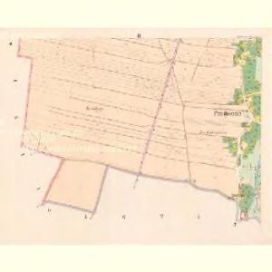
Przedmierzitz (Předměric) - c6171-1-002 - Kaiserpflichtexemplar der Landkarten des stabilen Katasters
1 : 2880
Bez titulu: Čechy – část

Lochenitz (Lochenice) - c4200-1-002 - Kaiserpflichtexemplar der Landkarten des stabilen Katasters
1 : 2880
Lochenitz (Lochenice) - c4200-1-004 - Kaiserpflichtexemplar der Landkarten des stabilen Katasters
1 : 2880
Lochenitz (Lochenice) - c4200-1-003 - Kaiserpflichtexemplar der Landkarten des stabilen Katasters
1 : 2880
Lochenitz (Lochenice) - c4200-1-001 - Kaiserpflichtexemplar der Landkarten des stabilen Katasters
1 : 2880
Plotischt (Plotisste) - c5843-1-005 - Kaiserpflichtexemplar der Landkarten des stabilen Katasters
1 : 2880
Plotischt (Plotisste) - c5843-1-004 - Kaiserpflichtexemplar der Landkarten des stabilen Katasters
1 : 2880
Plotischt (Plotisste) - c5843-1-002 - Kaiserpflichtexemplar der Landkarten des stabilen Katasters
1 : 2880
Plotischt (Plotisste) - c5843-1-001 - Kaiserpflichtexemplar der Landkarten des stabilen Katasters
1 : 2880
Plotischt (Plotisste) - c5843-1-003 - Kaiserpflichtexemplar der Landkarten des stabilen Katasters
1 : 2880
Rusek - c6630-1-001 - Kaiserpflichtexemplar der Landkarten des stabilen Katasters
1 : 2880
Rusek - c6630-1-002 - Kaiserpflichtexemplar der Landkarten des stabilen Katasters
1 : 2880
Rusek - c6630-1-003 - Kaiserpflichtexemplar der Landkarten des stabilen Katasters
1 : 2880
Swieti (Swietj) - c7613-1-001 - Kaiserpflichtexemplar der Landkarten des stabilen Katasters
1 : 2880
Swieti (Swietj) - c7613-1-002 - Kaiserpflichtexemplar der Landkarten des stabilen Katasters
1 : 2880
Wiekosch (Wěkoš) - c8543-1-003 - Kaiserpflichtexemplar der Landkarten des stabilen Katasters
1 : 2880
Wiekosch (Wěkoš) - c8543-1-002 - Kaiserpflichtexemplar der Landkarten des stabilen Katasters
1 : 2880
Wiekosch (Wěkoš) - c8543-1-004 - Kaiserpflichtexemplar der Landkarten des stabilen Katasters
1 : 2880
Wiekosch (Wěkoš) - c8543-1-001 - Kaiserpflichtexemplar der Landkarten des stabilen Katasters
1 : 2880
Unter Nedielischt (Nedielisst Dolni dil) - c1347-1-002 - Kaiserpflichtexemplar der Landkarten des stabilen Katasters
1 : 2880
Unter Nedielischt (Nedielisst Dolni dil) - c1347-1-001 - Kaiserpflichtexemplar der Landkarten des stabilen Katasters
1 : 2880
Schlachtfeld von Königgrätz
1 : 200000 Hradec Králové (Region) Schlacht bei Königgrätz
Übersichts-Karte der Reichsdomaine Smiřitz und Hořennowes
1 : 28000 Smiřice-oblast (Česko)
Plan des Schlachtfeldes von Königgrätz
1 : 50000 Hradec Králové (Česko : oblast)
Plan des Schlachtfeldes von Königgrätz
1 : 50000
Plan des Schlachtfeldes von Königsgrätz
1 : 25000 Kgl. Preussischer Generalstab