Maps of Mnichov

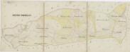
Stockau (Piwonka) - c5794-1-003 - Kaiserpflichtexemplar der Landkarten des stabilen Katasters
1 : 2880
Stockau (Piwonka) - c5794-1-001 - Kaiserpflichtexemplar der Landkarten des stabilen Katasters
1 : 2880
Stockau (Piwonka) - c5794-1-004 - Kaiserpflichtexemplar der Landkarten des stabilen Katasters
1 : 2880
Stockau (Piwonka) - c5794-1-002 - Kaiserpflichtexemplar der Landkarten des stabilen Katasters
1 : 2880
Stockau (Piwonka) - c5794-1-005 - Kaiserpflichtexemplar der Landkarten des stabilen Katasters
1 : 2880
Porostní mapa revíru Herštejn
1 : 10000
Katastrální mapa obce Postřekov s obcí Nuzarov
1 : 2880
Katastrální mapa obce Postřekov
1 : 2880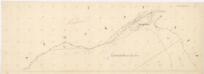
Katastrální mapa obce Novosedly
1 : 2880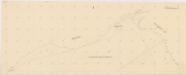
Katastrální mapa obce Novosedly WC-XIV-24 bi, ci
1 : 2880
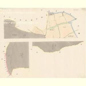
Glasserau - c6932-1-001 - Kaiserpflichtexemplar der Landkarten des stabilen Katasters
1 : 2880
Glasserau - c6932-1-002 - Kaiserpflichtexemplar der Landkarten des stabilen Katasters
1 : 2880
Porostní mapa polesí Novosedlské Hutě
1 : 11520
Porostní mapa revíru Herštejnské Chalupy
1 : 5760
Přehledná mapa revíru Herštejnské Chalupy
1 : 3224
Mauthaus (Meyto) - c4927-1-002 - Kaiserpflichtexemplar der Landkarten des stabilen Katasters
1 : 2880
Mauthaus (Meyto) - c4927-1-001 - Kaiserpflichtexemplar der Landkarten des stabilen Katasters
1 : 2880
Mauthaus (Meyto) - c4927-1-005 - Kaiserpflichtexemplar der Landkarten des stabilen Katasters
1 : 2880
Mauthaus (Meyto) - c4927-1-003 - Kaiserpflichtexemplar der Landkarten des stabilen Katasters
1 : 2880
Mauthaus (Meyto) - c4927-1-004 - Kaiserpflichtexemplar der Landkarten des stabilen Katasters
1 : 2880
Porostní mapa revíru Novosedlské Hutě
1 : 5760
Hospodářská mapa revíru Novosedlské Hutě
1 : 5760
Katastrální mapa obce Novosedly WC-XIV-25 bc
1 : 2880
Zeissermühl - c6857-1-001 - Kaiserpflichtexemplar der Landkarten des stabilen Katasters
1 : 2880
Katastrální mapa obce Mýtnice spolu s obcemi Herštejnské Chalupy a Křížová Huť WC-XIV-24 dh, cdf
1 : 2880
Gradkartenblatt
1 : 25000 Klenčí pod Čerchovem-oblast (Česko) Bulla, Eduard
III. vojenské mapování 4249/2
1 : 25000
III. vojenské mapování 4249/2
1 : 25000
III. vojenské mapování 4249/2
1 : 25000