Maps of Nový Hrádek

Neuhradek (Nowy Hradek) - c5312-1-003 - Kaiserpflichtexemplar der Landkarten des stabilen Katasters
1 : 2880
Neuhradek (Nowy Hradek) - c5312-1-001 - Kaiserpflichtexemplar der Landkarten des stabilen Katasters
1 : 2880
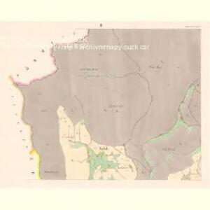
Neuhradek (Nowy Hradek) - c5312-1-004 - Kaiserpflichtexemplar der Landkarten des stabilen Katasters
1 : 2880
Neuhradek (Nowy Hradek) - c5312-1-002 - Kaiserpflichtexemplar der Landkarten des stabilen Katasters
1 : 2880
Dlauhey - c1140-1-002 - Kaiserpflichtexemplar der Landkarten des stabilen Katasters
1 : 2880
Dlauhey - c1140-1-003 - Kaiserpflichtexemplar der Landkarten des stabilen Katasters
1 : 2880
Dlauhey - c1140-1-001 - Kaiserpflichtexemplar der Landkarten des stabilen Katasters
1 : 2880
Borowa - c0385-1-002 - Kaiserpflichtexemplar der Landkarten des stabilen Katasters
1 : 2880
Borowa - c0385-1-001 - Kaiserpflichtexemplar der Landkarten des stabilen Katasters
1 : 2880
Mesles - c4567-1-001 - Kaiserpflichtexemplar der Landkarten des stabilen Katasters
1 : 2880
Mesles - c4567-1-002 - Kaiserpflichtexemplar der Landkarten des stabilen Katasters
1 : 2880
Meßtischblatt 3293 : Tassau, 1919
1 : 250000 Tassau. - Aufn. 1881, hrsg. 1883, bericht. 1919. - 1:25000. - [Berlin]: Reichsamt für Landesaufnahme, 1919. - 1 Kt.
Bohdaschin - c0309-1-003 - Kaiserpflichtexemplar der Landkarten des stabilen Katasters
1 : 2880
Bohdaschin - c0309-1-001 - Kaiserpflichtexemplar der Landkarten des stabilen Katasters
1 : 2880
Bohdaschin - c0309-1-002 - Kaiserpflichtexemplar der Landkarten des stabilen Katasters
1 : 2880
Böhmisch-Czerma (Čzeska-Čerma) - c0946-1-002 - Kaiserpflichtexemplar der Landkarten des stabilen Katasters
1 : 2880
Böhmisch-Czerma (Čzeska-Čerma) - c0946-1-004 - Kaiserpflichtexemplar der Landkarten des stabilen Katasters
1 : 2880
Böhmisch-Czerma (Čzeska-Čerma) - c0946-1-001 - Kaiserpflichtexemplar der Landkarten des stabilen Katasters
1 : 2880
Böhmisch-Czerma (Čzeska-Čerma) - c0946-1-005 - Kaiserpflichtexemplar der Landkarten des stabilen Katasters
1 : 2880
Böhmisch-Czerma (Čzeska-Čerma) - c0946-1-003 - Kaiserpflichtexemplar der Landkarten des stabilen Katasters
1 : 2880
Sniežney - c7103-1-003 - Kaiserpflichtexemplar der Landkarten des stabilen Katasters
1 : 2880
Sniežney - c7103-1-001 - Kaiserpflichtexemplar der Landkarten des stabilen Katasters
1 : 2880
Sniežney - c7103-1-004 - Kaiserpflichtexemplar der Landkarten des stabilen Katasters
1 : 2880
Sniežney - c7103-1-002 - Kaiserpflichtexemplar der Landkarten des stabilen Katasters
1 : 2880
Tys - c7907-1-002 - Kaiserpflichtexemplar der Landkarten des stabilen Katasters
1 : 2880
Tys - c7907-1-001 - Kaiserpflichtexemplar der Landkarten des stabilen Katasters
1 : 2880
Gradkartenblatt
1 : 25000 Dobruška-oblast (Česko) Böhm, Karl

Náchod
1 : 75000 Náchod-oblast (Česko) Vojenský zeměpisný ústav