Maps of Horka u Staré Paky

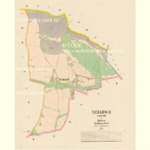
Nedarsch (Nedařiž) - c4995-1-001 - Kaiserpflichtexemplar der Landkarten des stabilen Katasters
1 : 2880
Widach (Widachow) - c8568-1-003 - Kaiserpflichtexemplar der Landkarten des stabilen Katasters
1 : 2880
Widach (Widachow) - c8568-1-002 - Kaiserpflichtexemplar der Landkarten des stabilen Katasters
1 : 2880
Widach (Widachow) - c8568-1-001 - Kaiserpflichtexemplar der Landkarten des stabilen Katasters
1 : 2880
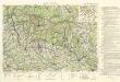
[Kartenblatt]
1 : 25000 Jilemnice (Česko : oblast) Reichsamt für Landesaufnahme
Gradkartenblatt
1 : 25000 Jilemnice-oblast (Česko) Bellschan, Anton
[Gradkartenblatt]
1 : 25000 Jilemnice-oblast (Česko) Vojenský zeměpisný ústav


Hohenelbe
1 : 75000 Vrchlabí (Česko : oblast) K. u. k. Militärgeographisches Institut
III. vojenské mapování 3755
1 : 75000
Vrchlabí
1 : 75000 Vrchlabí (Česko : oblast) Vojenský zeměpisný ústav
Hohenelbe
1 : 75000 Krkonoše (Česko a Polsko : pohoří : oblast) Charlemont K. u. k. Militärgeographisches Institut
Hohenelbe
1 : 75000 Vrchlabí (Česko : oblast) K. u. k. Militärgeographisches Institut
Umgebung von Jičín II.

Vilímkovy místopisné mapy zemí Koruny české
1 : 100000 Dvůr Králové nad Labem (Česko : oblast) Srp, Jan Jos. R. Vilímek
Specialkarte des Riesengebirges
1 : 75000 Krkonoše (Česko a Polsko : pohoří : oblast) Section Riesengebirge des Gebirgvereines für Böhmen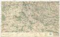
[Český ráj]
1 : 75000 Český ráj (Česko) nákladem odboru KČST
Vilímkovy podrobné mapy politických okresů

Karte der Bezirkshauptmannschaften Hohenelbe und Starkenbach
Jilemnice-oblast (Česko) Erben, Josef Flemming, C. Karl Janský
Mapa okresního hejtmanství jičínského
1 : 100000 Jičín-oblast (Česko) Erben, Josef nákladem Karla Janského
Mapa okresních hejtmanství Jilemnického a Vrchlabského
Krkonoše

Karte der Bezirkshauptmannschaft Trautenau
1 : 100000 Trutnov-oblast (Česko) Erben, Josef Karl Janský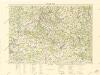
Český ráj

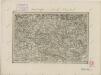
Horitz und Jicin.
from Spezialkarte der osterreichisch-ungarischen Monarchie.
Mapa okresního hejtmanství Jičínského

Hohenelbe.
from Spezialkarte der osterreichisch-ungarischen Monarchie.
Mapa okresního hejtmanství Jičínského