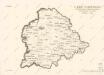
Maps of Zdechovice

Moraschitz - c4829-1-002 - Kaiserpflichtexemplar der Landkarten des stabilen Katasters
1 : 2880
Moraschitz - c4829-1-003 - Kaiserpflichtexemplar der Landkarten des stabilen Katasters
1 : 2880
Moraschitz - c4829-1-001 - Kaiserpflichtexemplar der Landkarten des stabilen Katasters
1 : 2880
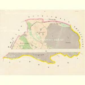
Indikační skica mapy stabilního katastru pro obec Kozašice I., III.
1 : 2880
Hospodářská mapa Zámeckého revíru sekce Obora
1 : 5760
Litoschitz - c4174-1-001 - Kaiserpflichtexemplar der Landkarten des stabilen Katasters
1 : 2880
Litoschitz - c4174-1-004 - Kaiserpflichtexemplar der Landkarten des stabilen Katasters
1 : 2880
Litoschitz - c4174-1-002 - Kaiserpflichtexemplar der Landkarten des stabilen Katasters
1 : 2880
Litoschitz - c4174-1-003 - Kaiserpflichtexemplar der Landkarten des stabilen Katasters
1 : 2880
Litoschitz - c4174-1-006 - Kaiserpflichtexemplar der Landkarten des stabilen Katasters
1 : 2880
Litoschitz - c4174-1-005 - Kaiserpflichtexemplar der Landkarten des stabilen Katasters
1 : 2880
Zdechowitz - c9209-1-001 - Kaiserpflichtexemplar der Landkarten des stabilen Katasters
1 : 2880
Zdechowitz - c9209-1-002 - Kaiserpflichtexemplar der Landkarten des stabilen Katasters
1 : 2880
Zdechowitz - c9209-1-004 - Kaiserpflichtexemplar der Landkarten des stabilen Katasters
1 : 2880
Zdechowitz - c9209-1-005 - Kaiserpflichtexemplar der Landkarten des stabilen Katasters
1 : 2880
Zdechowitz - c9209-1-003 - Kaiserpflichtexemplar der Landkarten des stabilen Katasters
1 : 2880
Indikační skica mapy stabilního katastru pro obec Kozašice I.-IV.
1 : 2880
Kosaschitz - c3443-1-002 - Kaiserpflichtexemplar der Landkarten des stabilen Katasters
1 : 2880
Kosaschitz - c3443-1-001 - Kaiserpflichtexemplar der Landkarten des stabilen Katasters
1 : 2880
Spittowitz - c7189-1-001 - Kaiserpflichtexemplar der Landkarten des stabilen Katasters
1 : 2880
Spittowitz - c7189-1-002 - Kaiserpflichtexemplar der Landkarten des stabilen Katasters
1 : 2880

Mapa politického okresu Pardubického

Nástěnná mapa hejtmanství Čáslavského
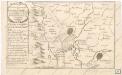
Accurater Plan der bludigen Battalie bey Czaslav in Böhmen...

Eisenbahn Karte Wien-Dresden, Ollmütz-Trübau
1 : 72000 Blatt 11 Minarzik, Anselm J. Rauh
Podrobné mapy zemí Koruny české v měřítku 1:75.000 a mapa vzdáleností všech míst při silnici ležících
1 : 75000 Chlumec nad Cidlinou-oblast (Česko) Bělohlav, Josef Kučera, Karel F. Topič
8. Kraj Pardubický

Kutná Hora a okolí
1 : 75000 Kutná Hora (Česko : oblast) Vojenský zeměpisný ústav