Maps of Nová Ves v Horách

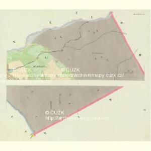
Einsiedl - c4784-1-003 - Kaiserpflichtexemplar der Landkarten des stabilen Katasters
1 : 2880
Einsiedl - c4784-1-004 - Kaiserpflichtexemplar der Landkarten des stabilen Katasters
1 : 2880
Einsiedl - c4784-1-001 - Kaiserpflichtexemplar der Landkarten des stabilen Katasters
1 : 2880
Einsiedl - c4784-1-005 - Kaiserpflichtexemplar der Landkarten des stabilen Katasters
1 : 2880
Einsiedl - c4784-1-002 - Kaiserpflichtexemplar der Landkarten des stabilen Katasters
1 : 2880
Gebirgsneudorf - c5254-1-004 - Kaiserpflichtexemplar der Landkarten des stabilen Katasters
1 : 2880
Gebirgsneudorf - c5254-1-001 - Kaiserpflichtexemplar der Landkarten des stabilen Katasters
1 : 2880
Gebirgsneudorf - c5254-1-002 - Kaiserpflichtexemplar der Landkarten des stabilen Katasters
1 : 2880
Gebirgsneudorf - c5254-1-005 - Kaiserpflichtexemplar der Landkarten des stabilen Katasters
1 : 2880
Gebirgsneudorf - c5254-1-003 - Kaiserpflichtexemplar der Landkarten des stabilen Katasters
1 : 2880
Meßtischblatt 131 : Neuwernsdorf, 1938
1 : 250000 Neuwernsdorf. - Umdr.-Ausg., aufgen. 1910, hrsg. 1911, bericht. 1923. - 1:25000. - Leipzig, 1938. - 1 Kt.
Meßtischblatt 131 : Neuwernsdorf, 1920
1 : 250000 Neuwernsdorf. - Aufgen. 1910. - 1:25000. - Leipzig, 1920. - 1 Kt.
Meßtischblatt 131 : Neuwernsdorf, 1919
1 : 250000 Neuwernsdorf. - Aufgen. 1910. - 1:25000. - Leipzig, 1919. - 1 Kt.
Kreuzweg - c3666-1-003 - Kaiserpflichtexemplar der Landkarten des stabilen Katasters
1 : 2880
Kreuzweg - c3666-1-001 - Kaiserpflichtexemplar der Landkarten des stabilen Katasters
1 : 2880
Kreuzweg - c3666-1-002 - Kaiserpflichtexemplar der Landkarten des stabilen Katasters
1 : 2880
Göhrn - c3168-1-002 - Kaiserpflichtexemplar der Landkarten des stabilen Katasters
1 : 2880
Göhrn - c3168-1-004 - Kaiserpflichtexemplar der Landkarten des stabilen Katasters
1 : 2880
Göhrn - c3168-1-003 - Kaiserpflichtexemplar der Landkarten des stabilen Katasters
1 : 2880
Göhrn - c3168-1-001 - Kaiserpflichtexemplar der Landkarten des stabilen Katasters
1 : 2880
Československo v mapách

Soubor přehledných map pro plánování a statistiku: 3751 – Teplice

III. vojenské mapování 3751
1 : 75000
Podrobná mapa Království českého
1 : 100000 Hora Svaté Kateřiny (Česko : oblast) Srp, Jan Jaroslav Bursík
Brüx, Dux und Teplitz
1 : 75000 Duchcov (Česko : oblast) Hübner K. u. k. militär-geographisches Institut
Brüx, Dux und Teplitz
1 : 75000 Duchcov (Česko : oblast) Hübner K. u. k. Militärgeographisches Institut
Brüx, Dux und Teplitz
1 : 75000 Duchcov (Česko : oblast) K. u. k. Militärgeographisches Institut
Mapy plánování ČSR