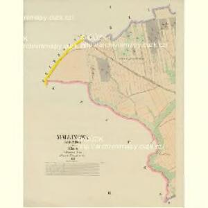
Maps of Malinová

Mallinowa (Malinowa) - c4425-1-001 - Kaiserpflichtexemplar der Landkarten des stabilen Katasters
1 : 2880
Mallinowa (Malinowa) - c4425-1-002 - Kaiserpflichtexemplar der Landkarten des stabilen Katasters
1 : 2880
Krakow - c3485-1-002 - Kaiserpflichtexemplar der Landkarten des stabilen Katasters
1 : 2880
Krakow - c3485-1-001 - Kaiserpflichtexemplar der Landkarten des stabilen Katasters
1 : 2880
Krakow - c3485-1-003 - Kaiserpflichtexemplar der Landkarten des stabilen Katasters
1 : 2880
Petrowitz (Petrowic) - c5733-1-001 - Kaiserpflichtexemplar der Landkarten des stabilen Katasters
1 : 2880
Petrowitz (Petrowic) - c5733-1-005 - Kaiserpflichtexemplar der Landkarten des stabilen Katasters
1 : 2880
Petrowitz (Petrowic) - c5733-1-003 - Kaiserpflichtexemplar der Landkarten des stabilen Katasters
1 : 2880
Petrowitz (Petrowic) - c5733-1-002 - Kaiserpflichtexemplar der Landkarten des stabilen Katasters
1 : 2880
Petrowitz (Petrowic) - c5733-1-004 - Kaiserpflichtexemplar der Landkarten des stabilen Katasters
1 : 2880
Przitschina (Prziczina) - c6234-1-003 - Kaiserpflichtexemplar der Landkarten des stabilen Katasters
1 : 2880
Przitschina (Prziczina) - c6234-1-001 - Kaiserpflichtexemplar der Landkarten des stabilen Katasters
1 : 2880
Przitschina (Prziczina) - c6234-1-002 - Kaiserpflichtexemplar der Landkarten des stabilen Katasters
1 : 2880
Rothschloss (Czerweny Zamek) - c3488-1-002 - Kaiserpflichtexemplar der Landkarten des stabilen Katasters
1 : 2880
Rothschloss (Czerweny Zamek) - c3488-1-005 - Kaiserpflichtexemplar der Landkarten des stabilen Katasters
1 : 2880
Rothschloss (Czerweny Zamek) - c3488-1-004 - Kaiserpflichtexemplar der Landkarten des stabilen Katasters
1 : 2880
Rothschloss (Czerweny Zamek) - c3488-1-003 - Kaiserpflichtexemplar der Landkarten des stabilen Katasters
1 : 2880
Rothschloss (Czerweny Zamek) - c3488-1-001 - Kaiserpflichtexemplar der Landkarten des stabilen Katasters
1 : 2880
Hwozd - c2448-1-001 - Kaiserpflichtexemplar der Landkarten des stabilen Katasters
1 : 2880
Hwozd - c2448-1-002 - Kaiserpflichtexemplar der Landkarten des stabilen Katasters
1 : 2880
[Kartenblatt]
1 : 25000 Rakovník (Česko : oblast) Reichsamt für Landesaufnahme
Gradkartenblatt
1 : 25000 Rakovník-oblast (Česko) Bulla, Eduard
III. vojenské mapování 3951/4
1 : 25000


Karte des Rakonitzer Bezirkes im Prager Kreise
1 : 70000 Rakovník-oblast (Česko) Wagner, Jan Eduard Karl André
Karte des Rakonitzer Bezirkes im Prager Kreise
1 : 70000 Rakovník-oblast (Česko) Wagner, Jan Eduard Karl André
Situations-Plan der Fürst zu Fürstenberg'schen Herrschaft Pürglitz, Kruschowitz, dann des Gutes Nischburg, Wschetatt und Wolleschna etc
1 : 84000 Křivoklát-oblast (Česko) Bohutinský, Friedrich Fürstenberg, Karl Egon
Rakovník
1 : 75000 Podbořany (Česko : oblast) Vojenský zeměpisný ústav