Maps of Pecka

Wellhotta - c3944-1-002 - Kaiserpflichtexemplar der Landkarten des stabilen Katasters
1 : 2880
Wellhotta - c3944-1-001 - Kaiserpflichtexemplar der Landkarten des stabilen Katasters
1 : 2880
Stankau (Stankow) - c7227-1-002 - Kaiserpflichtexemplar der Landkarten des stabilen Katasters
1 : 2880
Stankau (Stankow) - c7227-1-001 - Kaiserpflichtexemplar der Landkarten des stabilen Katasters
1 : 2880
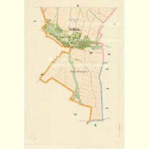
Petzka (Pecka) - c5677-1-004 - Kaiserpflichtexemplar der Landkarten des stabilen Katasters
1 : 2880
Petzka (Pecka) - c5677-1-003 - Kaiserpflichtexemplar der Landkarten des stabilen Katasters
1 : 2880
Petzka (Pecka) - c5677-1-001 - Kaiserpflichtexemplar der Landkarten des stabilen Katasters
1 : 2880
Petzka (Pecka) - c5677-1-002 - Kaiserpflichtexemplar der Landkarten des stabilen Katasters
1 : 2880
Gross Borowitz (Hrubá Borowice) - c0396-1-001 - Kaiserpflichtexemplar der Landkarten des stabilen Katasters
1 : 2880
Gross Borowitz (Hrubá Borowice) - c0396-1-002 - Kaiserpflichtexemplar der Landkarten des stabilen Katasters
1 : 2880
Gross Borowitz (Hrubá Borowice) - c0396-1-003 - Kaiserpflichtexemplar der Landkarten des stabilen Katasters
1 : 2880
Gross Borowitz (Hrubá Borowice) - c0396-1-005 - Kaiserpflichtexemplar der Landkarten des stabilen Katasters
1 : 2880
Gross Borowitz (Hrubá Borowice) - c0396-1-004 - Kaiserpflichtexemplar der Landkarten des stabilen Katasters
1 : 2880
Kall - c2978-1-002 - Kaiserpflichtexemplar der Landkarten des stabilen Katasters
1 : 2880
Kall - c2978-1-003 - Kaiserpflichtexemplar der Landkarten des stabilen Katasters
1 : 2880
Kall - c2978-1-001 - Kaiserpflichtexemplar der Landkarten des stabilen Katasters
1 : 2880
Widonitz (Widonice) - c8570-1-002 - Kaiserpflichtexemplar der Landkarten des stabilen Katasters
1 : 2880
Widonitz (Widonice) - c8570-1-001 - Kaiserpflichtexemplar der Landkarten des stabilen Katasters
1 : 2880
Gradkartenblatt
1 : 25000 Dvůr Králové nad Labem-oblast (Česko) Bellschan, Anton
III. vojenské mapování 3855/2
1 : 25000

III. vojenské mapování 3855
1 : 75000
Jičín
1 : 75000 Dvůr Králové nad Labem (Česko : oblast) Vojenský zeměpisný ústav
Hořitz und Jičin
1 : 75000 Dvůr Králové nad Labem (Česko : oblast) Richter K. u. k. militär-geographisches Institut
Hořitz und Jičin
1 : 75000 Dvůr Králové nad Labem (Česko : oblast) Richter K. u. k. Militärgeographisches Institut
Hořitz und Jičin
1 : 75000 Hořice (Jičín, Česko : oblast) K. u. k. Militärgeographisches Institut
Uebersichtsblatt zum Kriegsspielplan der Umgebung von Trautenau

Uebersichtsblatt zum Kriegsspielplan der Umgebung von Trautenau

Umgebung von Jičín II.