Maps of Záblatí u Ponědraže

Lhotta - c3930-1-004 - Kaiserpflichtexemplar der Landkarten des stabilen Katasters
1 : 2880
Lhotta - c3930-1-001 - Kaiserpflichtexemplar der Landkarten des stabilen Katasters
1 : 2880
Lhotta - c3930-1-003 - Kaiserpflichtexemplar der Landkarten des stabilen Katasters
1 : 2880
Lhotta - c3930-1-002 - Kaiserpflichtexemplar der Landkarten des stabilen Katasters
1 : 2880
Hospodářská mapa pozemků dvora Lhota 1

Mapa pozemků dvora Lhota (s vyznačením meliorací) 1
1 : 5760
Mapy činžovních pozemků I. sekce třeboňského velkostatku pro obce: Borkovice, Bošilec, Drahotěšice, Frahelž, Hamr, Horusice, Lhota, Líšnice, Mažice, Mezimostí, Ponědraž, Ponědrážka, Řípec, Val, Vlkov 1
1 : 2880
Půdorysný plán lhotského ovčína 1

Mapa pozemků dvora Lhota 1
Geometrický plán Bošileckého rybníka a přilehlých pozemků 1
Geometrický plán bošileckého lesa, rybníků Linýř, Kvíčadlo a Švambírek, činžovních, deputátních a farních pozemků 1
Geometrický plán rybníků Bošilec, Ponědráž a Švarcenberk

Generální mapa panství Třeboň a inkorporovaných statků Bzí, Lomnice, Borovany, Třeboň, Hamr a Val 1

Přehledná mapa polesí Bošilec 1
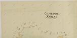
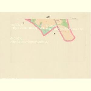
Záblatí o. Jindřichův Hradec 1
1 : 2880
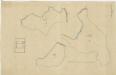
Zablat - c9004-1-005 - Kaiserpflichtexemplar der Landkarten des stabilen Katasters
1 : 2880
Zablat - c9004-1-004 - Kaiserpflichtexemplar der Landkarten des stabilen Katasters
1 : 2880
Zablat - c9004-1-002 - Kaiserpflichtexemplar der Landkarten des stabilen Katasters
1 : 2880
Zablat - c9004-1-001 - Kaiserpflichtexemplar der Landkarten des stabilen Katasters
1 : 2880
Zablat - c9004-1-003 - Kaiserpflichtexemplar der Landkarten des stabilen Katasters
1 : 2880
Zablat - c9004-1-006 - Kaiserpflichtexemplar der Landkarten des stabilen Katasters
1 : 2880
Boschilletz - c0425-1-003 - Kaiserpflichtexemplar der Landkarten des stabilen Katasters
1 : 2880
Boschilletz - c0425-1-001 - Kaiserpflichtexemplar der Landkarten des stabilen Katasters
1 : 2880
Boschilletz - c0425-1-005 - Kaiserpflichtexemplar der Landkarten des stabilen Katasters
1 : 2880
Boschilletz - c0425-1-002 - Kaiserpflichtexemplar der Landkarten des stabilen Katasters
1 : 2880
Boschilletz - c0425-1-006 - Kaiserpflichtexemplar der Landkarten des stabilen Katasters
1 : 2880
Boschilletz - c0425-1-004 - Kaiserpflichtexemplar der Landkarten des stabilen Katasters
1 : 2880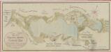
Geometrický plán rybníků Ponědráž, Polní, Blatný, Nový a zrušeného rybníka Vyskočil a sádek 1

Dinin - c1639-1-010 - Kaiserpflichtexemplar der Landkarten des stabilen Katasters
1 : 2880
Dinin - c1639-1-003 - Kaiserpflichtexemplar der Landkarten des stabilen Katasters
1 : 2880
Dinin - c1639-1-006 - Kaiserpflichtexemplar der Landkarten des stabilen Katasters
1 : 2880
Dinin - c1639-1-005 - Kaiserpflichtexemplar der Landkarten des stabilen Katasters
1 : 2880
Dinin - c1639-1-001 - Kaiserpflichtexemplar der Landkarten des stabilen Katasters
1 : 2880
Dinin - c1639-1-007 - Kaiserpflichtexemplar der Landkarten des stabilen Katasters
1 : 2880
Dinin - c1639-1-002 - Kaiserpflichtexemplar der Landkarten des stabilen Katasters
1 : 2880
Dinin - c1639-1-009 - Kaiserpflichtexemplar der Landkarten des stabilen Katasters
1 : 2880
Dinin - c1639-1-011 - Kaiserpflichtexemplar der Landkarten des stabilen Katasters
1 : 2880