Maps of Nebahovy

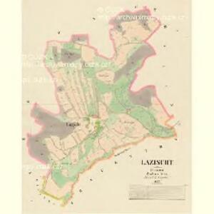
Lazischt - c3833-1-001 - Kaiserpflichtexemplar der Landkarten des stabilen Katasters
1 : 2880
Frauenthal - c1683-1-002 - Kaiserpflichtexemplar der Landkarten des stabilen Katasters
1 : 2880
Frauenthal - c1683-1-004 - Kaiserpflichtexemplar der Landkarten des stabilen Katasters
1 : 2880
Frauenthal - c1683-1-009 - Kaiserpflichtexemplar der Landkarten des stabilen Katasters
1 : 2880
Frauenthal - c1683-1-010 - Kaiserpflichtexemplar der Landkarten des stabilen Katasters
1 : 2880
Frauenthal - c1683-1-005 - Kaiserpflichtexemplar der Landkarten des stabilen Katasters
1 : 2880
Frauenthal - c1683-1-007 - Kaiserpflichtexemplar der Landkarten des stabilen Katasters
1 : 2880
Frauenthal - c1683-1-008 - Kaiserpflichtexemplar der Landkarten des stabilen Katasters
1 : 2880
Frauenthal - c1683-1-003 - Kaiserpflichtexemplar der Landkarten des stabilen Katasters
1 : 2880
Frauenthal - c1683-1-006 - Kaiserpflichtexemplar der Landkarten des stabilen Katasters
1 : 2880
Frauenthal - c1683-1-001 - Kaiserpflichtexemplar der Landkarten des stabilen Katasters
1 : 2880
Nebahau (Nebahow) - c4971-1-004 - Kaiserpflichtexemplar der Landkarten des stabilen Katasters
1 : 2880
Nebahau (Nebahow) - c4971-1-003 - Kaiserpflichtexemplar der Landkarten des stabilen Katasters
1 : 2880
Nebahau (Nebahow) - c4971-1-001 - Kaiserpflichtexemplar der Landkarten des stabilen Katasters
1 : 2880
Nebahau (Nebahow) - c4971-1-002 - Kaiserpflichtexemplar der Landkarten des stabilen Katasters
1 : 2880
Gellemka - c2816-1-001 - Kaiserpflichtexemplar der Landkarten des stabilen Katasters
1 : 2880
Gellemka - c2816-1-002 - Kaiserpflichtexemplar der Landkarten des stabilen Katasters
1 : 2880
Kralln - c3495-1-002 - Kaiserpflichtexemplar der Landkarten des stabilen Katasters
1 : 2880
Kralln - c3495-1-001 - Kaiserpflichtexemplar der Landkarten des stabilen Katasters
1 : 2880
[Gradkartenblatt]
1 : 25000 Prachatice-oblast (Česko)
Administrativ Karte der Hochfürstlich Schwarzenberg ́schen Herrschaft... In Böhmen

Topographische Karte der in Böhmen budweiser Kreises liegenden

Topographische Karte ... Herrschaft Krummau ...


Prachatice a okolí
1 : 75000 Prachatice (Česko : oblast) Vojenský zeměpisný ústav
Protiwin und Prachatitz
1 : 75000 Prachatice (Česko : oblast) K. u. k. Militärgeographisches Institut
Podrobná mapa království Českého: Prachatice – Volary - Hor. Planá

Prachatice - Volary - Hor. Planá
1 : 100000 Horní Planá-oblast (Česko)