Maps of Kněžnice

Knischnitz (Knižnice) - c3206-1-003 - Kaiserpflichtexemplar der Landkarten des stabilen Katasters
1 : 2880
Knischnitz (Knižnice) - c3206-1-002 - Kaiserpflichtexemplar der Landkarten des stabilen Katasters
1 : 2880
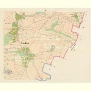
Knischnitz (Knižnice) - c3206-1-001 - Kaiserpflichtexemplar der Landkarten des stabilen Katasters
1 : 2880
Knischnitz (Knižnice) - c3206-1-004 - Kaiserpflichtexemplar der Landkarten des stabilen Katasters
1 : 2880
Libun - c4060-1-002 - Kaiserpflichtexemplar der Landkarten des stabilen Katasters
1 : 2880
Libun - c4060-1-003 - Kaiserpflichtexemplar der Landkarten des stabilen Katasters
1 : 2880
Libun - c4060-1-001 - Kaiserpflichtexemplar der Landkarten des stabilen Katasters
1 : 2880
Ginolitz - c2919-1-002 - Kaiserpflichtexemplar der Landkarten des stabilen Katasters
1 : 2880
Ginolitz - c2919-1-001 - Kaiserpflichtexemplar der Landkarten des stabilen Katasters
1 : 2880
Hollenitz (Holenice) - c1957-1-003 - Kaiserpflichtexemplar der Landkarten des stabilen Katasters
1 : 2880
Hollenitz (Holenice) - c1957-1-001 - Kaiserpflichtexemplar der Landkarten des stabilen Katasters
1 : 2880
Hollenitz (Holenice) - c1957-1-002 - Kaiserpflichtexemplar der Landkarten des stabilen Katasters
1 : 2880
Koschow (Kossow) - c3403-1-001 - Kaiserpflichtexemplar der Landkarten des stabilen Katasters
1 : 2880
Koschow (Kossow) - c3403-1-002 - Kaiserpflichtexemplar der Landkarten des stabilen Katasters
1 : 2880
Podulsch - c5932-1-001 - Kaiserpflichtexemplar der Landkarten des stabilen Katasters
1 : 2880
Plan des Gefechtsfeldes von Gitschin den 29ten Juni 1866
1 : 25000 Jičín-oblast (Česko) Leithold, von Beelitz
Plan des Gefechtsfeldes von Gitschin den 29ten Juni 1866
1 : 25000 Jičín-oblast (Česko) Leithold, von Beelitz
Plan zum Treffen bei Jičin 29. Juni 1866
1 : 28880 Jičín (Česko) Ditfurth, Moritz von des K. u. k. Militärgeographischen Instituts
Plan zum Treffen bei Jičin 29. Juni 1866
1 : 28500 Jičín-oblast (Česko)
Prachovské skály u Jičína
1 : 10000 Prachovské skály (Česko) Lepař, Zdeněk Filipovský, Karel Jan Pašek
Cidlina - c0755-1-002 - Kaiserpflichtexemplar der Landkarten des stabilen Katasters
1 : 2880
Cidlina - c0755-1-003 - Kaiserpflichtexemplar der Landkarten des stabilen Katasters
1 : 2880
Cidlina - c0755-1-001 - Kaiserpflichtexemplar der Landkarten des stabilen Katasters
1 : 2880
Břeska - c0587-1-001 - Kaiserpflichtexemplar der Landkarten des stabilen Katasters
1 : 2880
Břeska - c0587-1-003 - Kaiserpflichtexemplar der Landkarten des stabilen Katasters
1 : 2880
Břeska - c0587-1-002 - Kaiserpflichtexemplar der Landkarten des stabilen Katasters
1 : 2880
Libunetz - c4059-1-002 - Kaiserpflichtexemplar der Landkarten des stabilen Katasters
1 : 2880
Libunetz - c4059-1-001 - Kaiserpflichtexemplar der Landkarten des stabilen Katasters
1 : 2880