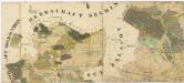
Maps of Zálší

Kletschat - c3140-1-001 - Kaiserpflichtexemplar der Landkarten des stabilen Katasters
1 : 2880
Kletschat - c3140-1-004 - Kaiserpflichtexemplar der Landkarten des stabilen Katasters
1 : 2880
Kletschat - c3140-1-003 - Kaiserpflichtexemplar der Landkarten des stabilen Katasters
1 : 2880
Kletschat - c3140-1-002 - Kaiserpflichtexemplar der Landkarten des stabilen Katasters
1 : 2880
Hartmanice o. České Budějovice 1
1 : 2880
Přehledná mapa polesí Borkovice 1

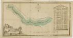
Generální mapa panství Třeboň a inkorporovaných statků Bzí, Lomnice, Borovany, Třeboň, Hamr a Val 1

Komarow - c3296-1-002 - Kaiserpflichtexemplar der Landkarten des stabilen Katasters
1 : 2880
Komarow - c3296-1-005 - Kaiserpflichtexemplar der Landkarten des stabilen Katasters
1 : 2880
Komarow - c3296-1-003 - Kaiserpflichtexemplar der Landkarten des stabilen Katasters
1 : 2880
Komarow - c3296-1-001 - Kaiserpflichtexemplar der Landkarten des stabilen Katasters
1 : 2880
Komarow - c3296-1-004 - Kaiserpflichtexemplar der Landkarten des stabilen Katasters
1 : 2880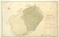
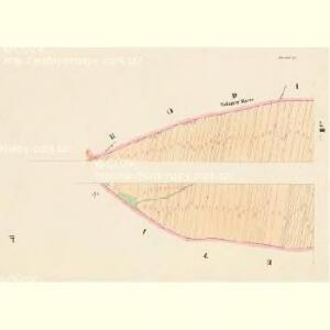
Geometrický plán odstoupených pozemků vsím Mažice, Zálší a Klečaty 1

Zalschy - c9117-1-003 - Kaiserpflichtexemplar der Landkarten des stabilen Katasters
1 : 2880
Zalschy - c9117-1-001 - Kaiserpflichtexemplar der Landkarten des stabilen Katasters
1 : 2880
Zalschy - c9117-1-002 - Kaiserpflichtexemplar der Landkarten des stabilen Katasters
1 : 2880
Zalschy - c9117-1-006 - Kaiserpflichtexemplar der Landkarten des stabilen Katasters
1 : 2880
Zalschy - c9117-1-005 - Kaiserpflichtexemplar der Landkarten des stabilen Katasters
1 : 2880
Zalschy - c9117-1-004 - Kaiserpflichtexemplar der Landkarten des stabilen Katasters
1 : 2880
Záměrná mapa-brouillon-lesních pozemků a pastvin na statku Bzí

Maschitz - c4538-1-001 - Kaiserpflichtexemplar der Landkarten des stabilen Katasters
1 : 2880
Maschitz - c4538-1-005 - Kaiserpflichtexemplar der Landkarten des stabilen Katasters
1 : 2880
Maschitz - c4538-1-002 - Kaiserpflichtexemplar der Landkarten des stabilen Katasters
1 : 2880
Maschitz - c4538-1-003 - Kaiserpflichtexemplar der Landkarten des stabilen Katasters
1 : 2880
Maschitz - c4538-1-004 - Kaiserpflichtexemplar der Landkarten des stabilen Katasters
1 : 2880
Geometrický plán borkovických blat 1
Hraniční mapa mezi panstvím Bechyně a statkem Bzí
Hraniční mapa mezi panstvím Bechyně a statkem Bzí
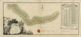
Administrativní mapa třeboňského panství se statky Bzí,Lomnice, Borovany,Hamr a Val 1