Maps of Sloveč

Kamillowes - c3029-1-003 - Kaiserpflichtexemplar der Landkarten des stabilen Katasters
1 : 2880
Kamillowes - c3029-1-001 - Kaiserpflichtexemplar der Landkarten des stabilen Katasters
1 : 2880
Kamillowes - c3029-1-002 - Kaiserpflichtexemplar der Landkarten des stabilen Katasters
1 : 2880
Strihow - c7474-1-003 - Kaiserpflichtexemplar der Landkarten des stabilen Katasters
1 : 2880
Strihow - c7474-1-002 - Kaiserpflichtexemplar der Landkarten des stabilen Katasters
1 : 2880
Strihow - c7474-1-001 - Kaiserpflichtexemplar der Landkarten des stabilen Katasters
1 : 2880
Knieschitz (Kněžice) - c3200-1-004 - Kaiserpflichtexemplar der Landkarten des stabilen Katasters
1 : 2880
Knieschitz (Kněžice) - c3200-1-005 - Kaiserpflichtexemplar der Landkarten des stabilen Katasters
1 : 2880
Knieschitz (Kněžice) - c3200-1-003 - Kaiserpflichtexemplar der Landkarten des stabilen Katasters
1 : 2880
Knieschitz (Kněžice) - c3200-1-006 - Kaiserpflichtexemplar der Landkarten des stabilen Katasters
1 : 2880
Knieschitz (Kněžice) - c3200-1-001 - Kaiserpflichtexemplar der Landkarten des stabilen Katasters
1 : 2880
Knieschitz (Kněžice) - c3200-1-002 - Kaiserpflichtexemplar der Landkarten des stabilen Katasters
1 : 2880
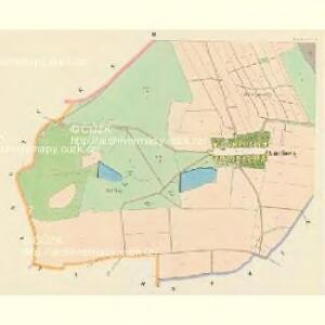
Slowetsch (Slowecz) - c7050-1-004 - Kaiserpflichtexemplar der Landkarten des stabilen Katasters
1 : 2880
Slowetsch (Slowecz) - c7050-1-002 - Kaiserpflichtexemplar der Landkarten des stabilen Katasters
1 : 2880
Slowetsch (Slowecz) - c7050-1-001 - Kaiserpflichtexemplar der Landkarten des stabilen Katasters
1 : 2880
Slowetsch (Slowecz) - c7050-1-003 - Kaiserpflichtexemplar der Landkarten des stabilen Katasters
1 : 2880
III. vojenské mapování 3955/1
1 : 25000
III. vojenské mapování 3955/1
1 : 25000

Podrobné mapy zemí Koruny české v měřítku 1:75.000 a mapa vzdáleností všech míst při silnici ležících
1 : 75000 Libáň-oblast (Jičín, Česko) Bělohlav, Josef Kučera, Karel F. Topič
Podrobné mapy zemí Koruny české v měřítku 1:75.000 a mapa vzdáleností všech míst při silnici ležících - Libáň - Král. Městec - Nový Bydžov. Průvodce statisticko-historický po všech místech na těchto mapách uvedených a rejstřík věcný názvů hor, potoků, řek, rybníků atd. Sešit 19. List 80,
1 : 75000
Königgratz, Elbeteinitz und Pardubitz
1 : 75000 Hradec Králové (Česko : oblast) Fenzl K. u. k. militär-geographisches Institut
Königgratz, Elbeteinitz und Pardubitz
1 : 75000 Hradec Králové (Česko : oblast) Fenzl K. u. k. Militärgeographisches Institut
Königgratz, Elbeteinitz und Pardubitz
1 : 75000 Hradec Králové (Česko : oblast) K. u. k. Militärgeographisches Institut
Vilímkovy podrobné mapy politických okresů

Okres poděbradský
1 : 100000 Poděbrady-oblast (Česko) Myška, Josef Mapový ateliér Ed. Fastra
Indikační skica mapy stabilního katastru pro město Přelouč VI.
1 : 2880
Horitz und Jicin.
from Spezialkarte der osterreichisch-ungarischen Monarchie.
Juncbunzlau und Liban.
from Spezialkarte der osterreichisch-ungarischen Monarchie.