Maps of Kakejcov

Kakegczow - c2975-1-001 - Kaiserpflichtexemplar der Landkarten des stabilen Katasters
1 : 2880
Meschno - c4556-1-001 - Kaiserpflichtexemplar der Landkarten des stabilen Katasters
1 : 2880
Meschno - c4556-1-003 - Kaiserpflichtexemplar der Landkarten des stabilen Katasters
1 : 2880
Meschno - c4556-1-002 - Kaiserpflichtexemplar der Landkarten des stabilen Katasters
1 : 2880
Meschno - c4556-1-004 - Kaiserpflichtexemplar der Landkarten des stabilen Katasters
1 : 2880
Meschno - c4556-1-005 - Kaiserpflichtexemplar der Landkarten des stabilen Katasters
1 : 2880
Mapa porostů a revírů Dobřiv a Padrť patřících ku velkostatku Zbirov

III. vojenské mapování 4151/2
1 : 25000
Gradkartenblatt
1 : 25000 Rokycany-oblast (Česko) Berger, J.
Uibersichtskarte der südlich der böhm. Westbahn gelegenen Fürst Colloredo Mannsfeld'schen Herrschaft Zbirov'er Revieren Padrť, Dobřív, Strašic, Volešna u. Hůrek
1 : 46080 Rokycany-oblast (Česko) Ladman, Fr.

Regni Bohemiae Circulus Pilsnensis
1 : 220000 Plzeň-oblast (Česko) Müller, Johann Christoph ab Homannianis Heredibus
Regni Bohemiae Circulus Pilsnensis
1 : 220000 Plzeň-oblast (Česko) Müller, Johann Christoph ab Homannianis Heredibus
Regni Bohemiae Circulus Pilsnensis
1 : 200000 Plzeň-oblast (Česko) Müller, Johann Christoph ab Homannianis Heredibus
Regni Bohemiae Circulus Pilsnensis
1 : 220000 Plzeň-oblast (Česko) Müller, Johann Christoph ab Homannianis Heredibus
III. vojenské mapování 4151
1 : 75000
Pilsen und dessen Umgebung přehledka

Plzeň
1 : 75000 Blovice (Česko : oblast) Vojenský zeměpisný ústav
Mapa školního a politického okresu Rokycanského
1 : 75000 Rokycany-oblast (Česko) Voj. zeměpisný ústav
Plzeň
1 : 75000 Plzeň-oblast (Česko) Vojenský zeměpisný ústav
Plzeň
1 : 75000 Plzeň (Česko : oblast) Vojenský zeměpisný ústav
Pilsen und Blowitz
1 : 75000 Blovice (Česko : oblast) Suchánek, F. K. u. k. militär-geographisches Institut
Pilsen und Blowitz
1 : 75000 Blovice (Česko : oblast) Suchánek, F. K. u. k. Militärgeographisches Institut
Pilsen und Blowitz
1 : 75000 Blovice (Česko : oblast) K. u. k. Militärgeographisches Institut
Rokycany a okolí
1 : 75000 Rokycany (Česko : oblast) Vojenský zeměpisný ústav
Soubor map okresů Pražského kraje

Podrobná mapa Království českého
1 : 100000 Plzeň (Česko : oblast) Srp, Jan Jaroslav Bursík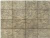
[Umgebung von Pilsen]
1 : 75000 Plzeň (Česko : oblast) K. u. k. Militärgeographisches Institut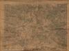
Okolí města Plzně
Mapa okolí města Plzně, vydaná na podkladu vojenských speciálek. Zachycena oblast od Nýřan po Padrťské rybníky a od Krašovic po Snapoušovy.


