Maps of Hluboká nad Vltavou

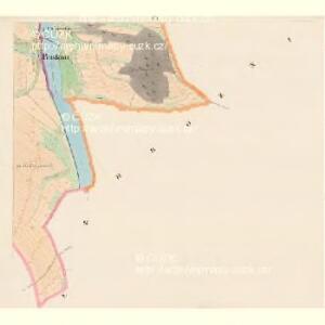
Jaroslawitz - c2775-1-006 - Kaiserpflichtexemplar der Landkarten des stabilen Katasters
1 : 2880
Jaroslawitz - c2775-1-001 - Kaiserpflichtexemplar der Landkarten des stabilen Katasters
1 : 2880
Jaroslawitz - c2775-1-007 - Kaiserpflichtexemplar der Landkarten des stabilen Katasters
1 : 2880
Jaroslawitz - c2775-1-004 - Kaiserpflichtexemplar der Landkarten des stabilen Katasters
1 : 2880
Jaroslawitz - c2775-1-005 - Kaiserpflichtexemplar der Landkarten des stabilen Katasters
1 : 2880
Jaroslawitz - c2775-1-003 - Kaiserpflichtexemplar der Landkarten des stabilen Katasters
1 : 2880
Jaroslawitz - c2775-1-002 - Kaiserpflichtexemplar der Landkarten des stabilen Katasters
1 : 2880
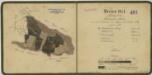
Geometrický plán lesů, činžovních, farních a služebních pozemků v okolí Kostelce 1

Porostní mapa polesí Dolejška 1
Porostní mapa polesí Bzí 1
1 : 10000
Mapy činžovních pozemků I. sekce třeboňského velkostatku pro obce: Borkovice, Bošilec, Drahotěšice, Frahelž, Hamr, Horusice, Lhota, Líšnice, Mažice, Mezimostí, Ponědraž, Ponědrážka, Řípec, Val, Vlkov 1
1 : 2880
Hrožniowitz - c2365-1-001 - Kaiserpflichtexemplar der Landkarten des stabilen Katasters
1 : 2880
Hrožniowitz - c2365-1-002 - Kaiserpflichtexemplar der Landkarten des stabilen Katasters
1 : 2880
Hrožniowitz - c2365-1-003 - Kaiserpflichtexemplar der Landkarten des stabilen Katasters
1 : 2880
Hrožniowitz - c2365-1-004 - Kaiserpflichtexemplar der Landkarten des stabilen Katasters
1 : 2880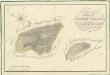
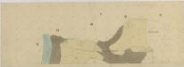
Geometrický plán lesů Paseky a Pasečka na statku Bzí 1
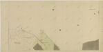
Líšnice o. České Budějovice 1
1 : 2880
Líšnice o. České Budějovice 1
1 : 2880
Geometrický plán lesů Paseky a Pasečka na statku Bzí 1
Líšnice o. České Budějovice 1
1 : 2880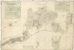
Geometrický plán vrchnostenských lesů v purkareckém a litoradlickém revíru 1

Littoradlitz - c4173-1-008 - Kaiserpflichtexemplar der Landkarten des stabilen Katasters
1 : 2880
Littoradlitz - c4173-1-009 - Kaiserpflichtexemplar der Landkarten des stabilen Katasters
1 : 2880
Littoradlitz - c4173-1-006 - Kaiserpflichtexemplar der Landkarten des stabilen Katasters
1 : 2880
Littoradlitz - c4173-1-007 - Kaiserpflichtexemplar der Landkarten des stabilen Katasters
1 : 2880
Littoradlitz - c4173-1-002 - Kaiserpflichtexemplar der Landkarten des stabilen Katasters
1 : 2880
Littoradlitz - c4173-1-005 - Kaiserpflichtexemplar der Landkarten des stabilen Katasters
1 : 2880
Littoradlitz - c4173-1-004 - Kaiserpflichtexemplar der Landkarten des stabilen Katasters
1 : 2880
Littoradlitz - c4173-1-003 - Kaiserpflichtexemplar der Landkarten des stabilen Katasters
1 : 2880