Maps of Záblatí

Sablath Ober - c2177-1-005 - Kaiserpflichtexemplar der Landkarten des stabilen Katasters
1 : 2880
Sablath Ober - c2177-1-004 - Kaiserpflichtexemplar der Landkarten des stabilen Katasters
1 : 2880
Sablath Ober - c2177-1-002 - Kaiserpflichtexemplar der Landkarten des stabilen Katasters
1 : 2880
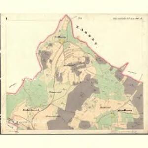
Sablath Ober - c2177-1-001 - Kaiserpflichtexemplar der Landkarten des stabilen Katasters
1 : 2880
Sablath Ober - c2177-1-006 - Kaiserpflichtexemplar der Landkarten des stabilen Katasters
1 : 2880
Sablath Ober - c2177-1-003 - Kaiserpflichtexemplar der Landkarten des stabilen Katasters
1 : 2880
Sablath Ober - c2177-1-007 - Kaiserpflichtexemplar der Landkarten des stabilen Katasters
1 : 2880
Sablath (Zablatj) - c9003-1-003 - Kaiserpflichtexemplar der Landkarten des stabilen Katasters
1 : 2880
Sablath (Zablatj) - c9003-1-001 - Kaiserpflichtexemplar der Landkarten des stabilen Katasters
1 : 2880
Sablath (Zablatj) - c9003-1-002 - Kaiserpflichtexemplar der Landkarten des stabilen Katasters
1 : 2880
Wolleschlag - c8765-1-001 - Kaiserpflichtexemplar der Landkarten des stabilen Katasters
1 : 2880
Wolleschlag - c8765-1-003 - Kaiserpflichtexemplar der Landkarten des stabilen Katasters
1 : 2880
Wolleschlag - c8765-1-002 - Kaiserpflichtexemplar der Landkarten des stabilen Katasters
1 : 2880
Wolleschlag - c8765-1-004 - Kaiserpflichtexemplar der Landkarten des stabilen Katasters
1 : 2880
Althütter Revier
1 : 27800 Prachatice-oblast (Česko) Schröter, Hugo Krejčí, Jan Verlag des böhm. Forstvereins
Perleschlag - c5694-1-002 - Kaiserpflichtexemplar der Landkarten des stabilen Katasters
1 : 2880
Perleschlag - c5694-1-001 - Kaiserpflichtexemplar der Landkarten des stabilen Katasters
1 : 2880
Perleschlag - c5694-1-005 - Kaiserpflichtexemplar der Landkarten des stabilen Katasters
1 : 2880
Perleschlag - c5694-1-003 - Kaiserpflichtexemplar der Landkarten des stabilen Katasters
1 : 2880
Perleschlag - c5694-1-004 - Kaiserpflichtexemplar der Landkarten des stabilen Katasters
1 : 2880
Mapka okolí Husince
Tschechische Republik Böhmen Husinec Hus, Jan
[Gradkartenblatt]
1 : 25000 Prachatice-oblast (Česko)

Podrobné mapy zemí Koruny české v měřítku 1:75.000 a mapa vzdáleností všech míst při silnici ležících
1 : 75000 Volary (Česko : oblast) Bělohlav, Josef F. Topič
Prachatice a okolí
1 : 75000 Prachatice (Česko : oblast) Vojenský zeměpisný ústav
Übersichtskarte der Herrschaft Winterberg
1 : 94800 Vimperk-oblast (Česko) Verlag des böhm. Forstverein's
Protiwin und Prachatitz
1 : 75000 Prachatice (Česko : oblast) K. u. k. Militärgeographisches Institut
Administrativ Karte der Hochfürstlich Schwarzenberg ́schen Herrschaft Winterberg...

Vimperk a okolí
1 : 75000 Vimperk (Česko : oblast) Vojenský zeměpisný ústav