Maps of Bradáčov

Ober und Unter Swietla - c2160-1-002 - Kaiserpflichtexemplar der Landkarten des stabilen Katasters
1 : 2880
Ober und Unter Swietla - c2160-1-001 - Kaiserpflichtexemplar der Landkarten des stabilen Katasters
1 : 2880
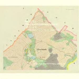
Bradatschow - c0450-1-002 - Kaiserpflichtexemplar der Landkarten des stabilen Katasters
1 : 2880
Bradatschow - c0450-1-001 - Kaiserpflichtexemplar der Landkarten des stabilen Katasters
1 : 2880
Lomna - c9027-1-002 - Kaiserpflichtexemplar der Landkarten des stabilen Katasters
1 : 2880
Lomna - c9027-1-001 - Kaiserpflichtexemplar der Landkarten des stabilen Katasters
1 : 2880
Pogbuk - c5963-1-001 - Kaiserpflichtexemplar der Landkarten des stabilen Katasters
1 : 2880
Pogbuk - c5963-1-004 - Kaiserpflichtexemplar der Landkarten des stabilen Katasters
1 : 2880
Pogbuk - c5963-1-003 - Kaiserpflichtexemplar der Landkarten des stabilen Katasters
1 : 2880
Pogbuk - c5963-1-002 - Kaiserpflichtexemplar der Landkarten des stabilen Katasters
1 : 2880
Domamischl - c1422-1-002 - Kaiserpflichtexemplar der Landkarten des stabilen Katasters
1 : 2880
Domamischl - c1422-1-004 - Kaiserpflichtexemplar der Landkarten des stabilen Katasters
1 : 2880
Domamischl - c1422-1-003 - Kaiserpflichtexemplar der Landkarten des stabilen Katasters
1 : 2880
Domamischl - c1422-1-001 - Kaiserpflichtexemplar der Landkarten des stabilen Katasters
1 : 2880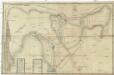
Mappa über den Herrschafftlichen na Lawiczkach und bey Chlistow genandten Wald wie solcher zu dem Domamischler Hoff vermög der Abschätzung de Anno 1692 solle zugetheilet sein worden
Domamyšl (Tábor, Česko) Willas, Heinrich Carl Merian, Matthaeus
Babschitz - c0037-1-002 - Kaiserpflichtexemplar der Landkarten des stabilen Katasters
1 : 2880
Babschitz - c0037-1-001 - Kaiserpflichtexemplar der Landkarten des stabilen Katasters
1 : 2880
Hinter Strziterz - c9029-1-003 - Kaiserpflichtexemplar der Landkarten des stabilen Katasters
1 : 2880
Hinter Strziterz - c9029-1-001 - Kaiserpflichtexemplar der Landkarten des stabilen Katasters
1 : 2880
Hinter Strziterz - c9029-1-002 - Kaiserpflichtexemplar der Landkarten des stabilen Katasters
1 : 2880
Gradkartenblatt
1 : 25000 Pacov-oblast (Pelhřimov, Česko) Bulla, Eduard
[Gradkartenblatt]
1 : 25000 Pacov-oblast (Pelhřimov, Česko)

Podrobné mapy zemí Koruny české v měřítku 1:75.000 a mapy vzdáleností všech míst při silnici ležících
1 : 75000 Mladá Vožice (Česko : oblast) Bělohlav, Josef F. Topič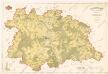
Polohopisná mapa silnic, cest a obecního majetku Táborského

III. vojenské mapování 4254
1 : 75000
Pelhřimov
1 : 75000 Pelhřimov-oblast (Česko) Vojenský zeměpisný ústav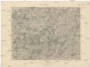
Pelhřimov
1 : 75000 Pelhřimov (Česko : oblast) Vojenský zeměpisný ústav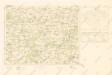
Mapy plánování ČSR