Maps of Hora Svatého Šebestiána

Sebastianberg - c1992-1-002 - Kaiserpflichtexemplar der Landkarten des stabilen Katasters
1 : 2880
Sebastianberg - c1992-1-001 - Kaiserpflichtexemplar der Landkarten des stabilen Katasters
1 : 2880
Sebastianberg - c1992-1-003 - Kaiserpflichtexemplar der Landkarten des stabilen Katasters
1 : 2880
Neudorf - c5216-1-002 - Kaiserpflichtexemplar der Landkarten des stabilen Katasters
1 : 2880
Neudorf - c5216-1-003 - Kaiserpflichtexemplar der Landkarten des stabilen Katasters
1 : 2880
Neudorf - c5216-1-004 - Kaiserpflichtexemplar der Landkarten des stabilen Katasters
1 : 2880
Neudorf - c5216-1-005 - Kaiserpflichtexemplar der Landkarten des stabilen Katasters
1 : 2880
Neudorf - c5216-1-001 - Kaiserpflichtexemplar der Landkarten des stabilen Katasters
1 : 2880
Neudorf - c5216-1-006 - Kaiserpflichtexemplar der Landkarten des stabilen Katasters
1 : 2880
Ulmbach - c2895-2-004 - Kaiserpflichtexemplar der Landkarten des stabilen Katasters
1 : 2880
Ulmbach - c2895-2-001 - Kaiserpflichtexemplar der Landkarten des stabilen Katasters
1 : 2880
Ulmbach - c2895-2-002 - Kaiserpflichtexemplar der Landkarten des stabilen Katasters
1 : 2880
Ulmbach - c2895-2-003 - Kaiserpflichtexemplar der Landkarten des stabilen Katasters
1 : 2880
Meßtischblatt 5445 : Sebastiansberg, 1939
1 : 250000 Sebastiansberg. - Aufn. 1914, 1919 u. 1920, hrsg. 1924, bericht. 1936 u. 1938. - 1:25000. - Leipzig, 1939. - 1 Kt.
Meßtischblatt 5445 : Reitzenhain, 1938
1 : 250000 Reitzenhain. - Umdr.-Ausg., aufgen. 1914, 1919 u. 1920, hrsg. 1924, einz. Nachtr. 1932. - 1:25000. - Leipzig, 1938. - 1 Kt.
III. vojenské mapování 3750/4
1 : 25000
III. vojenské mapování 3750/4
1 : 25000
III. vojenské mapování 3750/4
1 : 25000
III. vojenské mapování 3750/4
1 : 25000

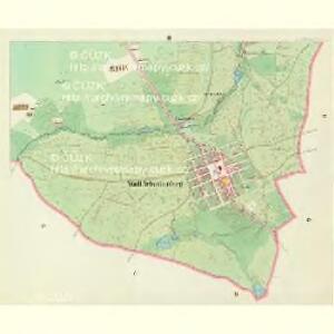
Karte des Bezirkes Sebastiansberg
1 : 37000 Hora Svatého Šebestiána-oblast (Česko) Hollmann, Vict. Jos. Mécsery de Tsóor, Karl Johann Freiherr von Friedrich Selner
[Kartenblatt]
1 : 25000 Hora Svatého Šebestiána-oblast (Česko) Reichsamt für Landesaufnahme
Hauungsplan-Karte der Hochwaldungen von der gräflich von Buquoy-Rottenhanschen Domaine Rothenhaus in Böhmen
1 : 35200 Červený Hrádek (Jirkov, Chomutov, Česko) Wagner, Jos.
Hora Sv. Šebestiána
1 : 75000 Hora Svatého Šebestiána (Česko) Vojenský zeměpisný ústav
Hora Sv. Šebestiána
1 : 75000 Hora Svatého Šebestiána-oblast (Česko) Vojenský zeměpisný ústav
Hora Sv. Šebestiána
1 : 75000 Hora Svatého Šebestiána (Česko) Vojenský zeměpisný ústav
Orientierungs-Plan des Strassennetzes der Komotau-Sebastiansberger-Bez. Vertretung mit Inbegriff der eventuell zum Flusbau Kommenden Strassen-Strecken
1 : 75000 Chomutov-oblast (Česko) Loquens, Jos. Bormann, E.
Chomutov a okolí
1 : 75000 Chomutov (Česko : oblast) Vojenský zeměpisný ústav
III. vojenské mapování 3750
1 : 75000
Sebastiansberg und Sächs. Annaberg
1 : 75000 Hora Svatého Šebestiána-oblast (Česko) K. u. k. Militärgeographisches Institut