Maps of Býšť

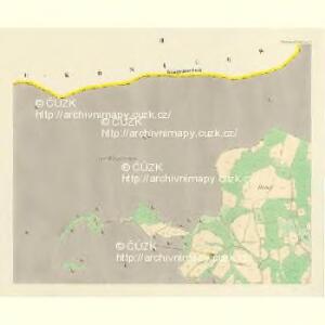
Hoděschowitz - c1925-1-001 - Kaiserpflichtexemplar der Landkarten des stabilen Katasters
1 : 2880
Hoděschowitz - c1925-1-003 - Kaiserpflichtexemplar der Landkarten des stabilen Katasters
1 : 2880
Hoděschowitz - c1925-1-004 - Kaiserpflichtexemplar der Landkarten des stabilen Katasters
1 : 2880
Hoděschowitz - c1925-1-002 - Kaiserpflichtexemplar der Landkarten des stabilen Katasters
1 : 2880
Mapa okolí Hoděšovic
1 : 2880
Mapa okolí Hoděšovic
1 : 2880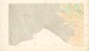
Indikační skica mapy stabilního katastru pro obec Hoděšovice IV.
1 : 2880
Indikační skica mapy stabilního katastru pro obec Hoděšovice I., V.
1 : 2880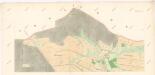
Indikační skica mapy stabilního katastru pro obec Býšť I.
1 : 2880
Indikační skica mapy stabilního katastru pro obec Hoděšovice ad IV.
1 : 2880
Indikační skica mapy stabilního katastru pro obec Běleč nad Orlicí IX.
1 : 2880
Indikační skica mapy stabilního katastru pro obec Hoděšovice ad II.
1 : 2880
Mapa revíru Vysoká nad Labem
1 : 5000
Indikační skica mapy stabilního katastru pro obec Bělečko VI.
1 : 2880
Indikační skica mapy stabilního katastru pro obec Býšť I., II.
1 : 2880
Indikační skica mapy stabilního katastru pro obec Běleč nad Orlicí VI.
1 : 2880
Přehlední [sic] mapa lesního majetku král. věnného města Hradce Králové
Hradec Králové-oblast (Česko) Rotter, Ottomar Renard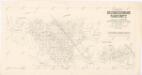
Porostní mapa revíru Vysoká nad Labem
1 : 15000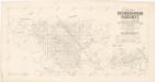
Mapa dřevin revíru Vysoká nad Labem
1 : 15000
Mapa revíru Běleč
1 : 10000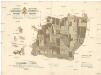
Lesy králov. věnného města Hradce Králové
Hradec Králové (Česko) Strachota, Josef Tykal, Josef
Mapa revíru Vysoká
1 : 10000
Mapa revíru Chvojenec
1 : 6000
Porostní mapa revíru Běleč
1 : 10000
Indikační skica mapy stabilního katastru pro obec Býšť I.-VI.
1 : 2880
Indikační skica mapy stabilního katastru pro obec Bělečko I.-VIII.
1 : 2880
Porostní mapa revíru Bělečko
1 : 10000
Mapa porostů revíru Nový Hradec a Svinary
Nový Hradec Králové (Hradec Králové, Česko) Rotter, Otto Renard
Indikační skica mapy stabilního katastru pro obec Běleč nad Orlicí I. - X.
1 : 2880
Neu-Koeniggratz (Nowy Hradec) - c5311-1-001 - Kaiserpflichtexemplar der Landkarten des stabilen Katasters
1 : 2880
Neu-Koeniggratz (Nowy Hradec) - c5311-1-008 - Kaiserpflichtexemplar der Landkarten des stabilen Katasters
1 : 2880
Neu-Koeniggratz (Nowy Hradec) - c5311-1-010 - Kaiserpflichtexemplar der Landkarten des stabilen Katasters
1 : 2880
Neu-Koeniggratz (Nowy Hradec) - c5311-1-007 - Kaiserpflichtexemplar der Landkarten des stabilen Katasters
1 : 2880
Neu-Koeniggratz (Nowy Hradec) - c5311-1-003 - Kaiserpflichtexemplar der Landkarten des stabilen Katasters
1 : 2880
Neu-Koeniggratz (Nowy Hradec) - c5311-1-009 - Kaiserpflichtexemplar der Landkarten des stabilen Katasters
1 : 2880
Neu-Koeniggratz (Nowy Hradec) - c5311-1-004 - Kaiserpflichtexemplar der Landkarten des stabilen Katasters
1 : 2880
Neu-Koeniggratz (Nowy Hradec) - c5311-1-011 - Kaiserpflichtexemplar der Landkarten des stabilen Katasters
1 : 2880
Neu-Koeniggratz (Nowy Hradec) - c5311-1-005 - Kaiserpflichtexemplar der Landkarten des stabilen Katasters
1 : 2880
Neu-Koeniggratz (Nowy Hradec) - c5311-1-002 - Kaiserpflichtexemplar der Landkarten des stabilen Katasters
1 : 2880