Maps of Chroustov

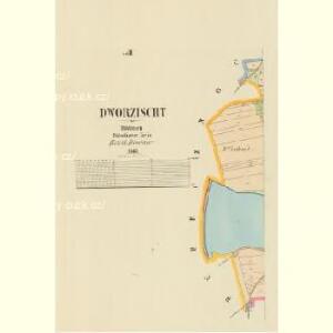
Dworzischt - c1636-1-001 - Kaiserpflichtexemplar der Landkarten des stabilen Katasters
1 : 2880
Dworzischt - c1636-1-002 - Kaiserpflichtexemplar der Landkarten des stabilen Katasters
1 : 2880
Wossek (Wosek) - c5525-1-003 - Kaiserpflichtexemplar der Landkarten des stabilen Katasters
1 : 2880
Wossek (Wosek) - c5525-1-002 - Kaiserpflichtexemplar der Landkarten des stabilen Katasters
1 : 2880
Wossek (Wosek) - c5525-1-001 - Kaiserpflichtexemplar der Landkarten des stabilen Katasters
1 : 2880
Chraustow - c2655-1-002 - Kaiserpflichtexemplar der Landkarten des stabilen Katasters
1 : 2880
Chraustow - c2655-1-001 - Kaiserpflichtexemplar der Landkarten des stabilen Katasters
1 : 2880
Chraustow - c2655-1-003 - Kaiserpflichtexemplar der Landkarten des stabilen Katasters
1 : 2880
Chraustow - c2655-1-004 - Kaiserpflichtexemplar der Landkarten des stabilen Katasters
1 : 2880
Dubeczno (Dubečno) - c1585-1-001 - Kaiserpflichtexemplar der Landkarten des stabilen Katasters
1 : 2880
Dubeczno (Dubečno) - c1585-1-002 - Kaiserpflichtexemplar der Landkarten des stabilen Katasters
1 : 2880
Dubeczno (Dubečno) - c1585-1-003 - Kaiserpflichtexemplar der Landkarten des stabilen Katasters
1 : 2880
Gradkartenblatt
1 : 25000 Nový Bydžov-oblast (Česko) Bellschan, Anton
Přehledová mapa velkostatku Kopidlno - Staré Hrady
1 : 23040

Přehledná mapa velkostatku Jičíněves - Kopidlno
1 : 23040
Podrobné mapy zemí Koruny české v měřítku 1:75.000 a mapa vzdáleností všech míst při silnici ležících
1 : 75000 Libáň-oblast (Jičín, Česko) Bělohlav, Josef Kučera, Karel F. Topič

Podrobné mapy zemí Koruny české v měřítku 1:75.000 a mapa vzdáleností všech míst při silnici ležících - Libáň - Král. Městec - Nový Bydžov. Průvodce statisticko-historický po všech místech na těchto mapách uvedených a rejstřík věcný názvů hor, potoků, řek, rybníků atd. Sešit 19. List 80,
1 : 75000
Hořitz und Jičin
1 : 75000 Dvůr Králové nad Labem (Česko : oblast) Richter K. u. k. militär-geographisches Institut
Hořitz und Jičin
1 : 75000 Dvůr Králové nad Labem (Česko : oblast) Richter K. u. k. Militärgeographisches Institut
Hořitz und Jičin
1 : 75000 Hořice (Jičín, Česko : oblast) K. u. k. Militärgeographisches Institut
Vilímkovy podrobné mapy politických okresů

Podrobná mapa Království českého, Markrabství moravského a Vévodství slezského
1 : 100000 Jičín (Česko : oblast) Srp, Jan Jos. R. Vilímek
Okres poděbradský
1 : 100000 Poděbrady-oblast (Česko) Myška, Josef Mapový ateliér Ed. Fastra
Mapa okresního hejtmanství jičínského
1 : 100000 Jičín-oblast (Česko) Erben, Josef nákladem Karla Janského
Horitz und Jicin.
from Spezialkarte der osterreichisch-ungarischen Monarchie.
Juncbunzlau und Liban.
from Spezialkarte der osterreichisch-ungarischen Monarchie.
Neu-Kolin.
from Spezialkarte der osterreichisch-ungarischen Monarchie.