Maps of Orlické Podhůří

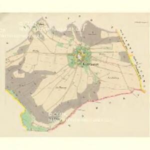
Gutwasser (Dobra-Woda) - c1172-1-002 - Kaiserpflichtexemplar der Landkarten des stabilen Katasters
1 : 2880
Gutwasser (Dobra-Woda) - c1172-1-001 - Kaiserpflichtexemplar der Landkarten des stabilen Katasters
1 : 2880
Schützendorf (Řjčka) - c6718-1-002 - Kaiserpflichtexemplar der Landkarten des stabilen Katasters
1 : 2880
Schützendorf (Řjčka) - c6718-1-003 - Kaiserpflichtexemplar der Landkarten des stabilen Katasters
1 : 2880
Schützendorf (Řjčka) - c6718-1-001 - Kaiserpflichtexemplar der Landkarten des stabilen Katasters
1 : 2880
Sudislau (Sudislaw) - c7526-1-005 - Kaiserpflichtexemplar der Landkarten des stabilen Katasters
1 : 2880
Sudislau (Sudislaw) - c7526-1-001 - Kaiserpflichtexemplar der Landkarten des stabilen Katasters
1 : 2880
Sudislau (Sudislaw) - c7526-1-004 - Kaiserpflichtexemplar der Landkarten des stabilen Katasters
1 : 2880
Sudislau (Sudislaw) - c7526-1-002 - Kaiserpflichtexemplar der Landkarten des stabilen Katasters
1 : 2880
Sudislau (Sudislaw) - c7526-1-003 - Kaiserpflichtexemplar der Landkarten des stabilen Katasters
1 : 2880
Rwischt (Rwisstě) - c6638-1-001 - Kaiserpflichtexemplar der Landkarten des stabilen Katasters
1 : 2880
Rwischt (Rwisstě) - c6638-1-002 - Kaiserpflichtexemplar der Landkarten des stabilen Katasters
1 : 2880
Rwischt (Rwisstě) - c6638-1-003 - Kaiserpflichtexemplar der Landkarten des stabilen Katasters
1 : 2880
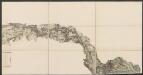
III. vojenské mapování 4057/1
1 : 25000


8. Kraj Pardubický
Eisenbahn Karte Wien-Dresden, Ollmütz-Trübau
1 : 72000 Blatt 8 Minarzik, Anselm J. Rauh
Choceň a okolí
1 : 75000 Choceň (Česko : oblast) Vojenský zeměpisný ústav
Podrobná mapa Království českého
1 : 100000 Rychnov nad Kněžnou (Česko : oblast) Srp, Jan Jaroslav Bursík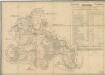
Silniční mapa zámeckého panství Litomyšl
1 : 100300
Landskorn und Mhr. Trubau.
from Spezialkarte der osterreichisch-ungarischen Monarchie.
Hohenmauth und Leitomischl.
from Spezialkarte der osterreichisch-ungarischen Monarchie.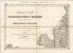
II. vojenské mapování 3
1 : 144000
Reichenau und Tinischt a.d. Adler.
from Spezialkarte der osterreichisch-ungarischen Monarchie.
II. vojenské mapování 3
1 : 144000
Senftenberg.
from Spezialkarte der osterreichisch-ungarischen Monarchie.
II. vojenské mapování 3
1 : 144000
II. vojenské mapování 22
1 : 144000