Maps of Stříbro

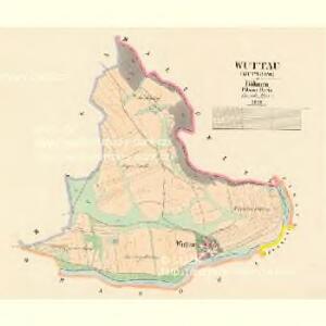
Wuttau (Wuttowo) - c0691-1-001 - Kaiserpflichtexemplar der Landkarten des stabilen Katasters
1 : 2880
Mallowitz - c4441-1-001 - Kaiserpflichtexemplar der Landkarten des stabilen Katasters
1 : 2880
Mallowitz - c4441-1-003 - Kaiserpflichtexemplar der Landkarten des stabilen Katasters
1 : 2880
Mallowitz - c4441-1-002 - Kaiserpflichtexemplar der Landkarten des stabilen Katasters
1 : 2880
Mallowitz - c4441-1-004 - Kaiserpflichtexemplar der Landkarten des stabilen Katasters
1 : 2880
Wranowa (Wraňowo) - c8795-1-001 - Kaiserpflichtexemplar der Landkarten des stabilen Katasters
1 : 2880
Wranowa (Wraňowo) - c8795-1-002 - Kaiserpflichtexemplar der Landkarten des stabilen Katasters
1 : 2880
[Kartenblatt]
1 : 25000 Stříbro (Česko : oblast) Reichsamt für Landesaufnahme
Gradkartenblatt
1 : 25000 Stříbro-oblast (Česko) Bulla, Eduard
III. vojenské mapování 4050/3
1 : 25000


Mieser Vicariat
Stříbro-oblast (Česko)
III. vojenské mapování 4050
1 : 75000
Stříbro a okolí
1 : 75000 Stříbro (Česko : oblast) Vojenský zeměpisný ústav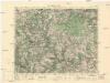
Město Teplá
1 : 75000 Teplá (Cheb, Česko : oblast) Vojenský zeměpisný ústav
Město Teplá
1 : 75000 Teplá-oblast (Cheb, Česko) Vojenský zeměpisný ústav
Tepl und Tuschkau
1 : 75000 Město Touškov (Česko : oblast) Bloschitz, Rudolf K. u. k. Militärgeographisches Institut
Tepl und Tuschkau
1 : 75000 Město Touškov-oblast (Česko) K. u. k. Militärgeographisches Institut
Teplá
1 : 75000 Bezdružice (Česko : oblast) Vojenský zeměpisný ústav
Podrobná mapa Království českého
1 : 100000 Planá (Tachov, Česko : oblast) Srp, Jan Jaroslav Bursík
Vilímkovy místopisné mapy zemí Koruny české
1 : 100000 Chodová Planá (Česko : oblast) Srp, Jan Jos. R. Vilímek
Tepl und Tuschkau.
from Spezialkarte der osterreichisch-ungarischen Monarchie.
[Okolí Plzně - západ]
Plzeň-oblast (Česko) Krejčí, Jan Schwarzenberg, Bedřich
Bischofteinitz und Nurschan.
from Spezialkarte der osterreichisch-ungarischen Monarchie.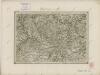
II. vojenské mapování 18
1 : 144000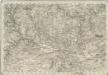
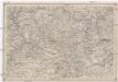
Special - Karte des Koenigreiches Boehmen
Spezial Karte von Böhmen

Karte des Bezirke Mies und Pilsen