Maps of Svojkovice

Borek - c0377-1-001 - Kaiserpflichtexemplar der Landkarten des stabilen Katasters
1 : 2880
Borek - c0377-1-002 - Kaiserpflichtexemplar der Landkarten des stabilen Katasters
1 : 2880
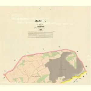
Rokitzan (Rokizan) - c6524-1-003 - Kaiserpflichtexemplar der Landkarten des stabilen Katasters
1 : 2880
Rokitzan (Rokizan) - c6524-1-006 - Kaiserpflichtexemplar der Landkarten des stabilen Katasters
1 : 2880
Rokitzan (Rokizan) - c6524-1-007 - Kaiserpflichtexemplar der Landkarten des stabilen Katasters
1 : 2880
Rokitzan (Rokizan) - c6524-1-009 - Kaiserpflichtexemplar der Landkarten des stabilen Katasters
1 : 2880
Rokitzan (Rokizan) - c6524-1-008 - Kaiserpflichtexemplar der Landkarten des stabilen Katasters
1 : 2880
Rokitzan (Rokizan) - c6524-1-005 - Kaiserpflichtexemplar der Landkarten des stabilen Katasters
1 : 2880
Rokitzan (Rokizan) - c6524-1-010 - Kaiserpflichtexemplar der Landkarten des stabilen Katasters
1 : 2880
Rokitzan (Rokizan) - c6524-1-002 - Kaiserpflichtexemplar der Landkarten des stabilen Katasters
1 : 2880
Rokitzan (Rokizan) - c6524-1-004 - Kaiserpflichtexemplar der Landkarten des stabilen Katasters
1 : 2880
Rokitzan (Rokizan) - c6524-1-001 - Kaiserpflichtexemplar der Landkarten des stabilen Katasters
1 : 2880
Sweikowitz (Sweikowitze) - c7660-1-002 - Kaiserpflichtexemplar der Landkarten des stabilen Katasters
1 : 2880
Sweikowitz (Sweikowitze) - c7660-1-001 - Kaiserpflichtexemplar der Landkarten des stabilen Katasters
1 : 2880
Uibersichtskarte der südlich der böhm. Westbahn gelegenen Fürst Colloredo Mannsfeld'schen Herrschaft Zbirov'er Revieren Padrť, Dobřív, Strašic, Volešna u. Hůrek
1 : 46080 Rokycany-oblast (Česko) Ladman, Fr.

Karte des Zbirower Bezirkes im Prager Kreise
1 : 72300 Zbiroh-oblast (Česko) Wagner, Jan Eduard Karl André
Regni Bohemiae Circulus Pilsnensis
1 : 220000 Plzeň-oblast (Česko) Müller, Johann Christoph ab Homannianis Heredibus
Regni Bohemiae Circulus Pilsnensis
1 : 220000 Plzeň-oblast (Česko) Müller, Johann Christoph ab Homannianis Heredibus
Regni Bohemiae Circulus Pilsnensis
1 : 200000 Plzeň-oblast (Česko) Müller, Johann Christoph ab Homannianis Heredibus
Regni Bohemiae Circulus Pilsnensis
1 : 220000 Plzeň-oblast (Česko) Müller, Johann Christoph ab Homannianis Heredibus
Pilsen und dessen Umgebung přehledka

Mapa školního a politického okresu Rokycanského
1 : 75000 Rokycany-oblast (Česko) Voj. zeměpisný ústav
Plzeň
1 : 75000 Plzeň-oblast (Česko) Vojenský zeměpisný ústav
Plzeň
1 : 75000 Plzeň (Česko : oblast) Vojenský zeměpisný ústav
Kralovice
1 : 75000 Kralovice-oblast (Plzeň-sever, Česko) Vojenský zeměpisný ústav
Kralovice
1 : 75000 Kralovice (Plzeň-sever, Česko : oblast) Vojenský zeměpisný ústav
Rokycany a okolí
1 : 75000 Rokycany (Česko : oblast) Vojenský zeměpisný ústav
III. vojenské mapování 4051
1 : 75000