Maps of Cologne Government Region

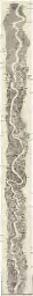
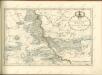
Der Rhein von Mainz bis Cöln
Kolín nad Rýnem (Německo) Kapp, D. Verlag von D. Kapp
Karte des Rheinlaufes von Mannheim bis Düsseldorf von der Bergstrasse, den Main- und Lahn- Gegenden und den Bädern am Taunus
1 : 290000 Düsseldorf (Německo) Hoffmeister, F.L. Engelmann, Joseph Joseph Engelman
[Kaart], uit: Gleumes' Rad- und Automobilkarte vom Mittelrhein
1 : 200000 Köln : Gleumes
[Kaart], uit: Rheinlauf von Mainz bis Köln
Annotatie: Met beschrijving en ill. van bezienswaardigheden aan weerszijden van de kaart Köln : Bremer
[Kaart], uit: Rheinlauf von Mainz bis Köln : mit seitlicher Beschreibung
Annotatie: Met beschrijving en ill. van bezienswaardigheden aan weerszijden van de kaart Köln : Bremer
6) III.E. ''Cologne'', uit: Carte géologique de France
1 : 500000 Annotatie: Voor aanwezige bladen zie bladoverzicht [S.l : s.n.]
Département de Rhin et Moselle
1 : 270000 Mosela, řeka-oblast Chanlaire, P. G. chez P.G. Chanlaire
[Kaart], uit: Relief-Panorama des Rheines
titelvariant: Rhein Panorama von Mainz bis Köln; Annotatie: Omslagtitel: Rhein Panorama von Mainz bis Köln Köln-Ehrenfeld : Hoursch & Bechstedt
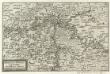
[Severní Porýní-Vestfálsko]
Severní Porýní-Vestfálsko (Německo)
Partie Orientale Du Temporel De L'Archevesché et Eslectorat De Treves. [Karte], in: Atlas nouveau, contenant toutes les parties du monde [...], Bd. 1, S. 200.
1 Karte aus Atlas Sanson, Nicolas Jaillot, Alexis Hubert und Mortier, Pieter
[Kaart], uit: Kleines Relief-Panorama des Rheines
titelvariant: Kleines farbiges Relief-Panorama des Rheines; Annotatie: Titel op omslag: Kleines farbiges Relief-Panorama des Rheines; Met ill. van bezienswaardigheden aan weerszijden van de kaart Köln am Rhein : Hoursch & Bechstedt
Militair Karte von Süd-Deutschland in 20 Sectionen
1 : 400000 1. Section Coulon, Alois von A. von Coulon
Du Haut Rhin ou sont L'Archevesché et Electorat de Treves, Partie de Ceux de Mayence et de Cologne de Treves de Mont Royal de Coblens de Mayence et de Franckfort levé sur les lieux pendt. les guerres
1 : 250000 Mollova mapová sbírka Jaillot, Alexis-Hubert Jaillot, Alexis Hubert
[21] Sec. Siegen, uit: Geologische Karte der Rheinprovinz und der Provinz Westphalen / ausgeführt durch H. von Dechen
1 : 80000 titelvariant: Dechen's geologische Karte vom Rheinland und Westphalen; Annotatie: Titel op bladoverzicht; Incompleet Heinrich von Dechen Berlin : Schropp
Nassovia Comitatus. [Karte], in: Novus Atlas, das ist, Weltbeschreibung, Bd. 1, S. 273.
1 Karte aus Atlas Blaeu, Joan Blaeu, Willem Janszoon
Nassovia Comitatus. [Karte], in: Theatrum orbis terrarum, sive, Atlas novus, Bd. 1, S. 254.
1 Karte aus Atlas Blaeu, Joan Blaeu, Willem Janszoon
Partie Orientale Du Temporel De L'Archevesché et Eslectorat, De Treves
1 : 210000 Mollova mapová sbírka Sanson, Guillaume Jaillot, Alexis Hubert

Nassovia Comitatus [Karte], in: Novus atlas absolutissimus, Bd. 2, S. 162.
1 Karte aus Atlas Janssonius Offizin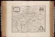
Nassovia comitatus / Salomon Rogiers sculpsit ; Guiljelm. Blaeuw excudit
1 : 300000 Annotatie: Origineel is Blad 104 in atlas factice; Annotatie geografische gegevens: Schaalstokken op de kaart: Miliaria Germanica communia, en: Horae itineris Salomon Rogiers ca 1592- v. 1640; Willem Jansz Blaeu 1571-1638 Amstelodami : Guiljelm. Blaeuw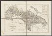
Nassovia Comitatus [Karte], in: Gerardi Mercatoris et I. Hondii Newer Atlas, oder, Grosses Weltbuch, Bd. 1, S. 200.
1 Karte aus Atlas Mercator, Gerhard und Hondius, Jodocus Jansson, Jan
Nassoviae Principatus et ad cum spectantes Ditiones
1 : 180000 Mollova mapová sbírka Seutter, Matthäus Seutter, Matthäus
Théatre de la Guerre ou Carte Nouvelle De le Cours du Rhin depuis Worms jusqu'a Bonne et Les Pays Adjacens
1 : 250000 Mollova mapová sbírka Delisle, Guillaume Ottens, Josua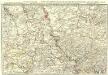
Exactissima totius Vederoviae laté sumtae Tabula
1 : 210000 Mollova mapová sbírka Buna, Wilhelm C. Broenner, Heinrich Ludwig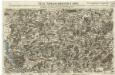
Neue Topographische Carte Der Sieg und Agger von ihrem Ursprunge bis zu ihrem Einflus in den Rhein mit Bemerkung der in dieser Gegend vorgefallenen Kriegsbegebenheiten von 1795 und 1796
Brand, Peter; Schalck, Anna Maria; Coentgen, Georg Joseph Brand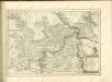
Mosella et Rheni Confluxus
Mollova mapová sbírka Person, Nikolaus Person, Nicolas
NASSOVIA | Comitatus
Salomon Rogiers sculpsit [Amsterdam : Joan Blaeu]