Maps of Paris
Nouveau plan routier de la ville et fabourgs de Paris divisé en douze mairies
Paříž (Francie) Journeaux Journeaux l'ainé
[Kaart], uit: Plan de Paris divisé en 20 arrondissements : indiquant tous les rues nouvelles ainsi que les numéros des maisons sur les grandes voies / dressé et gravé par L. Guilmin
1 : 20000 titelvariant: Plan de Paris au 1:20.000e; Annotatie: Omslagtitel: Plan de Paris au 1:20.000e Guilmin, L. Paris : Guilmin
Société des Transports en Commun de la Région Parisienne: Autobus Tramways Bateaux Lignes de Banlieue

Plán Paříže a přiléhajícího okolí

Nouveau Plan de Paris

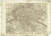
Plan de Paris

Nouveau plan de Paris

Nouveau plan de Paris
Vuillemin, Alexandre; George, E. Hachette
A plan of Paris [et]c
1 Karte : Kupferdruck ; 46 x 69 cm Rocque John Rocque in y.e Strand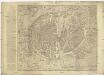
Plan en perspective de la ville de Paris tell qu'elle etoit sous la regne de Charles IX
Paříž (Francie) Dheulland, Guillaume Dheulland
Nouveau plan de Paris en relief
1 : 10900 Paříž (Francie) Bauerkeller & Co. Bauerkeller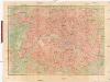
Nouveau plan de Paris
Paříž (Francie) Lanée Editerour-Geograph
Paris ses Monuments
Nouveau plan routier de la ville et fabourg de Paris
Paříž (Francie) Crepy Crepy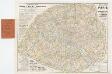
[Kaart], uit: Nouveau plan de Paris avec toutes les lignes du Métropolitain et du Nord-Sud / P. Bineteau del.
1 : 15000 titelvariant: Nouveau plan de Paris contenant toutes les lignes du Métropolitain et du Nord-Sud; Annotatie: Omslagtitel: Nouveau plan de Paris contenant toutes les lignes du Métropolitain et du Nord-Sud Bineteau, P. Paris : Taride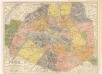
Paris ses Monuments
Paris et ses environs / dressé par E.D. Vorzet
1 : 12800 Annotatie: Met straatnaamregister Vorzet, E. D. [S.l.] : [s.n.]
Nouveau plan itinéraire de Paris comprenant toutes les rues, et les edifices publics
Paříž (Francie) Charpentier Danlos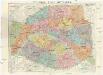
Nouveau plan de Paris
1 : 9000 Paříž (Francie) Dufrenoy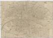
Plan routier de la ville et faubourg de Paris
1 : 9900 Paříž (Francie)
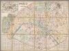
Paris - 1867
1 : 12000 Lallier, Justin Goyer
Plan pittoresque de la ville de Paris
Paříž (Francie) Librairie Renger Gebhardt et Wilisch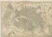
Plan de Paris en 1855

Plan de la ville de Paris en 1789
1 : 10000 Paris (France). Conseil municipal Conseil Municipal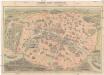
Nouveau Paris monumental
Paříž (Francie) Dufour, F. Garnier Freres
Plan touristique de Paris: chemin de fer métropolitain et principales lignes dautobus et de tramways, permettant la visite de la ville, de ses monuments, de ses musées et de ses promenades / fond de plan dressé et dessiné par G. Peltier
Syndicat dInitiative de Paris et du Département de la Seine ; Peltier, G.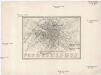
Plan von Paris 1835
Paříž (Francie) Meyer, Joseph Bibliographisches Institut
Le plan de Paris, ses faubourgs et ses environs, divisé suivant ses meridiens et paralleles par minutes et secondes
Paříž (Francie) Seutter, Matthäus Adrichem, Christiaan van Matthaeus Seutter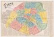
Paris 1867
1 : 12800 Dumas-Vorzet, Ed. (Eduard) Librairie du Petit Journal