Maps of Czech Republic
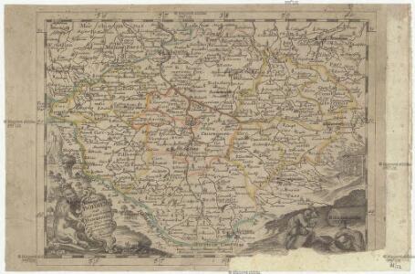
Das Königreich Böhmen mit seine zugehörigen Provintzien
1 : 1480000 Česko Bodenehr, Gabriel G. Bodenehr
Přehledná mapa úprav vodních v Království českém
1 : 500000 Čechy (Česko) Meliorační svaz v Království českém
Geognostisch montanistische Geschäftskarte des Kőnigreich Bőhmen
1 : 750000 Česko Schmidt z Bergenholdu, Jan Ferdinand Mecséry de Tsoor, Karl Freiherr von
Geognostisch montanistische Geschäftskarte des Kőnigreich Bőhmen
1 : 750000 Česko Schmidt z Bergenholdu, Jan Ferdinand Mecséry de Tsoor, Karl Freiherr von
Geognostisch montanistische Geschäftskarte des Kőnigreich Bőhmen
1 : 750000 Česko Schmidt z Bergenholdu, Jan Ferdinand Mecséry de Tsoor, Karl Freiherr von
Uibersichtskarte des Königreiches Böhmen
1 : 576000 Jablonec nad Nisou (Česko : oblast) Wagner, Jan Eduard F. Kytka
Das Königreich Boheim
1 : 1370000 Česko Reilly, Franz Johann Josef von F. J. J. von Reilly
Bohemia
1 : 673000 Česko
Bohemia
1 : 673000 Česko Aretin, Pavel z Ehrenfeldu W. J. Blaeu
Oro-hydrografische Karte von Böhmen
Čechy (Česko) Jelínek, Karel Langweil, Antonín K. André
Oro-hydrografische Karte von Böhmen
Čechy (Česko) Jelínek, Karel Langweil, Antonín
[Orografická mapa Čech]
Čechy (Česko) bei Eduard Hölzel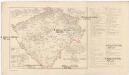
Mapa sídel velkoprůmyslu továrního v Čechách
Čechy (Česko) Wagner, Jan Eduard Otto, Jan J. Otto
Mapa sídel velkoprůmyslu zemědělského a příbuzného v Čechách
Praha (Česko) Wagner, Jan Eduard Otto, Jan J. Otto
Königreich Böhmen
Čechy (Česko) Carl Andre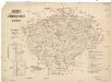
Gerichts- und Gendarmerie-Karte von Böhmen
1 : 600000 Čechy (Česko) Hoffstätter, L. Artaria u. Comp.
Übersichtskarte zur Landtags-Wahlordnung für das Königreich Boehmen
Čechy (Česko) Brdička, Leopold Leopold Brdiczka
Verwaltungs-Karte des Königreiches Böhmen
Čechy (Česko) Verlag des Landtages
Generální mapa Království českého
1 : 220000 Čechy (Česko) Wagner, Jan Eduard Mareš, František F. Kytka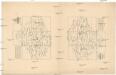
Mapa Království českého v 10 listech a v měřítku 1:200,000
1 : 200000 Čechy (Česko)
Králowství České
1 : 1350000 Čechy (Česko) sklad Karla André
Králowství České
Česko Schlieben Ausfeld, Johann Carl sklad Karla André
Karte des landtäflichen Grossgrund-Besitzes im Königreiche Böhmen nach der ehem. Domanial-Umgrenzung mit Angabe der positiven Grösse des Besitzes
1 : 600000 Čechy (Česko) Hickmann, Anton L. A.L. Hickmann
Karte der Kreisgerichts-Sprengel und Gerichts-Bezirke des Königreiches Böhmen nebst den fertigen und projectirten Eisenbahn-Linien
1 : 600000 Čechy (Česko) Hickmann, Anton L. A.L. Hickmann
Mapa jednot České obce sokolské v září 1889
Čechy (Česko) Podlipný
Mapa jednot České obce sokolské v září 1889
Čechy (Česko) Podlipný
Čechy
Čechy (Česko)
Post= Charte vom Königreiche Böheim
mapa VKOL Kreibich, František Jakub Jindřich Herausgegeben von C.E. Rainold
Reisekarte von Böhmen
1 : 600000 Bílina (Česko : oblast) Wagner, Jan Eduard F. Kytka
Karte des Königreiches Böhmen
1 : 430000 Čechy (Česko) Steinhauser, Anton Peucker, Karl Artaria