Maps of Thessaly - Central Greece
Turkey
1 : 1500000 Albánie Walker, C. Baldwin & Cradock
Ancient Greece, northern.
1 : 1500000 Society for the Diffusion of Useful Knowledge (Great Britain)
Turkey II. Northern Greece.
1 : 1500000 Society for the Diffusion of Useful Knowledge (Great Britain)
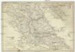
Ancient Greece : northern part
1 : 1500000 published under the superintendence of the Society for the Diffusion of Useful Knowledge engraved by J. & C. Walker London : Baldwin and Cradock
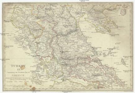
Turkey II : containing the northern part of Greece
published under the superintendence of the Society for the Diffusion of Useful Knowledge engraved by J. & C. Walker London : Baldwin and Cradock
Graeciae pars borealis.
1 : 3100000 Fenner, Rest.

Die türkisch-griechischen Grenzgebiete
1 : 600000 Balkánský poloostrov Handtke, Friedrich Carl Flemming
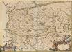
MACEDONIA, | EPIRVS | et | ACHAIA
G. Blaeu exc.
Grèce, Albanie et Thessalie
Nouvel atlas physique politique et historique de l'Empire ottoman et des états limitrophes en Europe, en Asie et en Afrique, en quarante feuilles Hellert, J.J. Bellizard, Dufour et Cie
Graeciae antiquae
1 : 1000000
Turkey in Europe, N. Greece.
1 : 1457280 Letts, Son & Co.
Graeciae antiquae specimen geographicum
1 : 1000000 Řecko Anville, Jean-Baptiste Bourguinon d' Berndt, Johann Christoph Officina Weigelio-Schneideriana
Greece.
1 : 950400 Stanford, Edward
Greece and the Ionian Islands.
1 : 1584000 Arrowsmith, John
Greece, Ionian Islands.
1 : 950000 Arrowsmith, John
Thessaliae accurata Descriptio [Karte], in: Novus atlas absolutissimus, Bd. 10, S. 89.
1 Karte aus Atlas Janssonius Offizin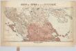
Carte de l'Épire et de la Thessalie : die griechisch-türkischen Grenzgebiete mit Angabe der griechischen Sprachgrenze / dressée par H. Kiepert
1 : 500000 titelvariant: Specialkarte der griechisch-türkischen Grenzgebiete; Annotatie: Omslagtitel: Carte de l'Épire et de la Thessalie : Specialkarte der griechisch-türkischen Grenzgebiete mit Angabe der griechischen Sprachgrenze; Boven de titel ook: Kriegsschauplatz; Gevouwen in omslag; Annotatie geografische gegevens: Met 7 schaalstokken; Legenda Johann Samuel Heinrich Kiepert 1818-1899 Berlin : Dietrich Reimer (Ernst Vohsen)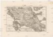
Hellas Thessalia Epirus
1 : 800000 Epirus (Řecko) Reichard, Christian Gottlieb Campius, D. a D. Campio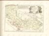

Graecia.
1 : 1250000 Kiepert, Heinrich, 1818-1899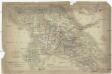
Graeciae
1 : 630000 Řecko Berra, Marco M. Berra
Balkans 1 000 000e. Salonique
1 : 1000000 France. Service géographique de l'armée [Paris] : Service géographique de l'armée
Graecia, Epirus, post bella Persia.
1 : 1400000 Menke, Th.
Greece.
1 : 917000 Johnston, Alexander Keith
Karte von dem Alten Macedonien Thessalien und Epirus
Epirus (Řecko) Baumgarten, Siegmund Jakob Johann Justinus Gebauer

Epirus, Thessalia et Hellas
Griechenland, Thessalien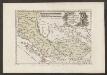
Der Südliche Theil Des Koenigreichs Albanien mit der Landschaft Thessalien
1 : 1300000 Albanien, Thessalien