Maps of Gemeinde Baden

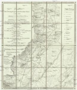
Plan des Übungslagers bei Traiskirchen im Jahre 1828
1 : 38400 Traiskirchen (Rakousko)
Plan des Übungslagers bei Traiskirchen im Jahre 1828

Umgebung von Baaden
1 : 42000 Baden (Rakousko)
[Vídeň-okolí]
Vídeň-oblast (Rakousko)
Wien-Raaber-Eisenbahn
1 : 100000 Rohrmann
Baden
1 : 25000 Baden (Rakousko) Kartographisches Institut
[Baden a okolí]
Baden (Rakousko)
Helenthal bei Baden in N. Oe.
K. k. Lustschloss und Park Laxenburg bey Wien

K. k. Lustschloss und Park Laxenburg
1 : 9800 Laxenburg (Rakousko) Amman, Ignaz Ambros von Stein, Carl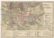
Grundriss der Stadt Baden
1 : 5800 Baden (Rakousko)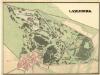
Laxenburg
Mollova mapová sbírka Hoch, Alfred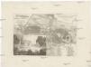
Schönau Freyherr. v. Braunisches Landguth bey Baden
1 : 13700 Baden (Rakousko) Viehbeck, Karl Ludwig Friedrich Artaria u. Comp.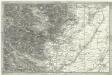
[Umgebung der Baaden]
1 : 43000 Baden (Rakousko)
Freytag & Berndt's Ausflugskarte
1 : 100000 Vídeň (Rakousko : oblast) Kartogr. Anst. Freytag & Berndt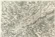
Archiducatus Austriae inferioris Geographica, et Nouiter Emendata Accuratissima Descriptio :
1 : 153333 Mollova mapová sbírka Vischer, Georg Matthaeus Hoffmann, Jakob
Freytag & Berndt's Ausflugskarte
1 : 100000 Vídeň (Rakousko : oblast) Kartogr. Anst. Freytag & Berndt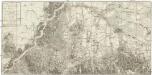
Neuster Grundrißs der Haupt und Residenzstadt Wien und der umliegenden Gegenden
1 : 15800 Vídeň (Rakousko : oblast) Iakubicska Mansfeld, Sebastian Artaria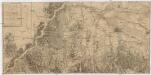
Neuester Grundriss der Haupt und Residenzstadt Wien und der umliegenden Gegenden
1 : 31600 Vídeň-oblast (Rakousko) Jakubicska, Stephan Mansfeld, Sebastian Artaria und Comp.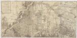
Neuester Grundriss der Haupt und Residenzstadt Wien und der umliegenden Gegenden
1 : 31000 Vídeň-oblast (Rakousko) Jakubicska, Stephan Mansfeld, Sebastian Artaria und Comp.
Carte topohydrographique de la ville de Vienne et des ses environs
1 : 24100 Vídeň-oblast (Rakousko) Maire, Francois Joseph Mollo, Tranquillo bey T. Mollo
G. Freytag ́s Ausflugskarte
1 : 100000 Vídeň (Rakousko : oblast) Freytag, Gustav Freytag & Berndt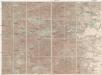
Laab i. W., Hetzendorf, Sittendorf, Mödling
1 : 25000 Mödling (Rakousko) R. Lechner
Kaltenleutgeben
1 : 25000 Kartographisches Institut
Baden und Neulengbach.
from Spezialkarte der osterreichisch-ungarischen Monarchie.
Karte des Wienerwaldes
1 : 75000 Vídeňský les (Rakousko : pohoří) R. Lechner
Topographische Karte der Gegenden um Wien seiner kays. Majestät Alexander I. Kayser und Selbstherscher aller Reussen &. &. &. in tiefester Ehrfurcht gewidmet
1 : 100000 Vídeň-oblast (Rakousko) Schmidt, Ludwig Gareis, Joseph bey Johann Cappi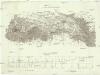
Eisenbahn von Wien bis Gloggnitz als ausgeführter Theil des Wien-Raaber Eisenbahnproject
1 : 110000 Gloggnitz (Rakousko) Ludwig Forster's
Wienns umgebungen