Maps of New Aquitaine

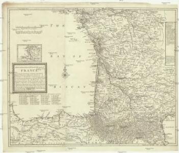
A new an exact map of ey south west part of France
1 : 957000 Berry (Francie) Picard, Jean La Hire, Philippe de
43 Sheet B, uit: France (North West), Belgium (West and Central), Holland (part of) ; France (South West), Spain (North)
1 : 1000000 [London : MI9]
Le royaume d'Aquitaine
1 Karte : Kupferdruck ; 40 x 49 cm, Bildgrösse 41 x 56 cm Duval chez l'auteur en l'isle du Palais sur le quay de l'Orloge au coin de la rüe de Harlay
France

Frankreich In 4 Blattern. Blatt 3.
1 : 1500000 Vogel, C.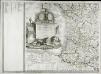
Carte de la France, 3
1 Blatt : 61 x 83 cm de Belleyme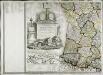
Carte de la France, 3
1 Blatt : mehrfarbig ; 61 x 83 cm de Belleyme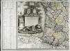
Carte de la France, 3
1 Blatt : 61 x 82 cm de Belleyme
[Frankreich, Blatt 3]
Adolf Stieler's Handatlas über alle Theile der Erde und über das Weltgebäude Stieler, Adolf Justus Perthes
[Frankreich in 4 Blättern, Blatt 3]
Handatlas über alle Theile der Erde und über das Weltgebäude Stieler, Adolf Justus Perthes
Frankreich SW.
1 : 1700000 Berghaus, Heinrich; Flemming, Carl; Handtke, Friedrich H.; Sohr, Karl
France Régionale Bassin d’Aquitaine Massif Central - Pyrénées carte politique
Gallois, Lucien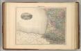
France S.O.
1 : 1615000 Migeon, J.
Postkarte von Frankreichs südwestlichen Departements oder von Gasconien und Poitou
Gaskoňsko (Francie) Engelmann, Johann Wenzel im von Reillyschen Landkarten und Kunstwerke Verschleiss Komptoir
France Régionale Bassin d’Aquitaine Massif Central - Pyrénées carte physique
Gallois, Lucien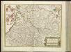
[14][14] Gouvernement de la Guienne & Gascogne, uit: Atlas sive Descriptio terrarum orbis
Annotatie: Gedigitaliseerde versie. Amsterdam. Heiloo : Picturae (vervaardiger), 2015. tiff-bestand. Gedigitaliseerd: 07-01-2015; Origineel: Universiteitsbibliotheek Vrije Universiteit (XL.05127.-) ; Netherlands; Titelpagina ontbreekt Wit, Frederik de Amsterdam : Frederick de Wit
Carte Michelin – Les Grandes Routes de France

Le royaume de France, 4
1 Blatt : 47 x 45 cm Jaillot
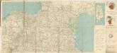
France - south-western section; Bordeaux.
1 : 1000000 John Bartholomew & Co.
Govvernement general de Gvienne et Gvascogne et pays circonvoisins
1 Karte : Kupferdruck ; 39 x 53 cm Sanson; Peyrounin chez l'auteur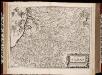
Gouvernement de la Guienne & Gascogne / [Joan Blaeu]
1 : 900000 Annotatie: Oorspr. verschenen in: Geographiae Blavianae volumen septimum ... - Amstelaedami : labore & sumptibus Ioannis Blaeu, 1662; Origineel is Blad 17 in atlas factice Blaeu, Joan [Amsterdam : Joan Blaeu]
Carte de Guienne et Gascogne
1 Karte auf 4 Blatt : Kupferdruck ; 79 x 89 cm Mondhare; Jean chez Mondhare et Jean rue St. Jean de Beauvais no. 4


GOVVERNEMENT | DE | LA GVIENNE | & GASCOGNE.
[Amsterdam : Joan Blaeu]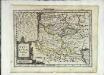
Aqvitaniæ descriptio
1 Karte : Kupferdruck ; 17 x 23 cm Mercator Cloppenburgh
France.
1 : 4400000 Vivien de St Martin, L.
Tabula Aquitaniae complectens gubernationem Guiennae et Vasconiae
1 : 800000 exhibita a Joh. Bapt. Homanno Norimbergae : [Johann Baptist Homann]