Maps of Lower Saxony

Königreich Westphalen samt dem Herzogthume Mecklenburg
1 : 2230000 Meklenbursko (Německo)
Nordwestliches Deutschland
Neuer Handatlas über alle Theile der Erde Kiepert, Heinrich Verlag von Dietrich Reimer
Germany - North. Pergamon World Atlas.
1 : 1250000 Polish Army Topography Service
Germany N. of Mayne.
1 : 1200000 Thomson, John
Allemagne du N.O.
1 : 1500000 Vivien St Martin, L.
German Empire 1.
1 : 1774080 Letts, Son & Co.
Germany.
1 : 1500000 Colton, G.W.
Northern and Central Germany.
1 : 2154240 Fullarton, A. & Co.
Germany north.
1 : 2800000 Arrowsmith, Aaron; Lewis, Samuel
Germany north.
1 : 2800000 Arrowsmith, Aaron; Lewis, Samuel
Germany. Deutschland I.
1 : 1760000 Society for the Diffusion of Useful Knowledge (Great Britain)
Niedersächsischer Kreis
Allgemeiner Atlas [Walch, Johannes] im Verlag bei Johannes Walch
Nordwest-Deutschland
1 : 2000000 Německo severozápadní Kocen, Blaž E. Hölzel
Germany (Deutschland)
1 : 1776000 Hannover (Německo) Walker, C. Baldwin & Cradock
Le Cercle De La Basse Saxe subdivisé en touts, Les Estats et Principautés qui le composent. [Karte], in: Atlas nouveau, contenant toutes les parties du monde [...], Bd. 1, S. 317.
1 Karte aus Atlas Sanson, Nicolas Jaillot, Alexis Hubert und Mortier, Pieter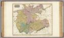
Germany north of the Mayn.
1 : 1180000 Pinkerton, John, 1758-1826
[Vestfálsko a okolí]
Vestfálsko (Německo)
Germany.
1 : 1500000 Colton, G.W.
Eisenbahnkarte von Nordwest-Deutschland
1 : 2000000 Německo severozápadní Geograph. Anstalt von Wagner & Debes
The North West Part of Germany
1 : 2500000 Mollova mapová sbírka Moll, Herman Moll, Hermann
Germany No.2.
1 : 1375000 Colton, G.W.
Karte von Deutschland in IV Blättern
1 : 825000 Nordwest-Blatt Sotzmann, Daniel Friedrich im Verlage der A. G. Schneider und Weigels
Germany No. 1.
1 : 1393920 Colton, G.W.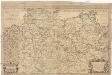
Le cercle de la Basse Saxe subdivisé en touts les estats et principautés qui le composent
1 : 3000000 Dolní Sasko (Německo) Sanson, Nicolas Jaillot, Alexis-Hubert H. Iaillot
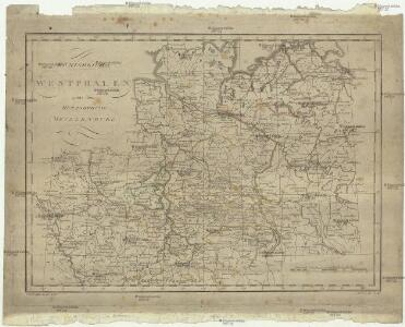
Westphalen
Allgemeiner Atlas [Walch, Johannes] im Verlag bei Johannes Walch
II, uit: General-Karte von Mittel-Europa in 12 Blättern, im Masse 1:1.200.000 / entworfen, bearb. und hrsg. von Josef Schlacher
1 : 1200000 Annotatie: Blad 6 ontbreekt; Annotatie geografische gegevens: 21 maatstokken op blad 9; Legenda op blad 9 Wien : K.K. Militär Geografisches Institut
Germany No. 1.
1 : 1500000 Colton, G.W.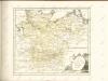

[Das Deutsches Reich, Blatt 1]
Adolf Stieler's Handatlas über alle Theile der Erde und über das Weltgebäude Stieler, Adolf Justus Perthes