Maps of Germany

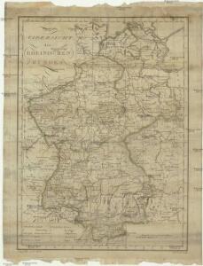
Uibersicht des Rheinischen Bundes
1 : 3250000 Německo
Rheinbund 1812
Deutschland Rheinbund Hundt, Michael
Schiffahrtsstraßen in Deutschland Stand 1989
Deutschland Wasserstraße, Binnenschifffahrt Kunz, Andreas ; Moeschl, Joachim Robert
Etats Secondaires de L'Allemagne.
Andriveau-Goujon, J.
Allemagne.
1 : 1850000 Brue, Adrien Hubert, 1786-1832
Germany, W. sheet.
1 : 1400000 Rand McNally and Company
German States.
1 : 2050000 Teesdale, Henry
Germany.
1 : 3168000 Tallis, J. & F.
German Empire W.
1 : 1330560 Stanford, Edward
Länder der Bundesrepublik 1993
Deutschland Kunz, Andreas ; Moeschl, Joachim Robert
Länder der Bundesrepublik 1989
Deutschland, Bundesrepublik Kunz, Andreas ; Moeschl, Joachim Robert
Länder der Bundesrepublik 31.12.1990
Deutschland Kunz, Andreas ; Moeschl, Joachim Robert
Länder der Bundesrepublik 1949
Deutschland, Bundesrepublik Kunz, Andreas ; Moeschl, Joachim Robert
Länder der Bundesrepublik 2003
Deutschland Kunz, Andreas ; Moeschl, Joachim Robert
Länder der Bundesrepublik 1952
Deutschland, Bundesrepublik Kunz, Andreas ; Moeschl, Joachim Robert
Geschichtl. Entwicklung des Königr. Preussen bis zum Frieden von Tilsit (1807)
Deutschland, Preußen, Tilsit / Friede
Composite: Germany.
1 : 1000000 John Bartholomew and Son
Besatzungszonen und Länder 1947
Deutschland Besatzungszone Kunz, Andreas ; Moeschl, Joachim Robert
L'Allemagne Occidentale.
1 : 1800000 Levasseur, E.
Länder 1947
Deutschland Kunz, Andreas ; Moeschl, Joachim Robert
Länder der Bundesrepublik 1957
Deutschland, Bundesrepublik Kunz, Andreas ; Moeschl, Joachim Robert
Germany.
1 : 1870000 Hughes, William
Allemagne occidentale.
1 : 1850000 Picquet, C.
[Historisch-geographischer Atlas zu den allgemeinen Geschichtswerken von C. v. Rotteck, Pölitz u. Becker] : Deutschland als Staatenbund seit dem Pariser Frieden 1814
von Julius Loewenberg Lithographie von B. Herder in Freiburg im Breisgau [Freiburg im Breisgau] : [Herder]
Germany.
1 : 1788000 Hammond, C.S.
Rheinbund 12. Juli 1806
Deutschland Rheinbund Kunz, Andreas ; Moeschl, Joachim Robert
Rheinbund 10. Januar 1810
Deutschland Rheinbund Kunz, Andreas ; Moeschl, Joachim Robert
Länder der Bundesrepublik 1955
Deutschland, Bundesrepublik Kunz, Andreas ; Moeschl, Joachim Robert
Germany.
1 : 3651000 Fisher, Richard Swainson