Maps of Central Moravia
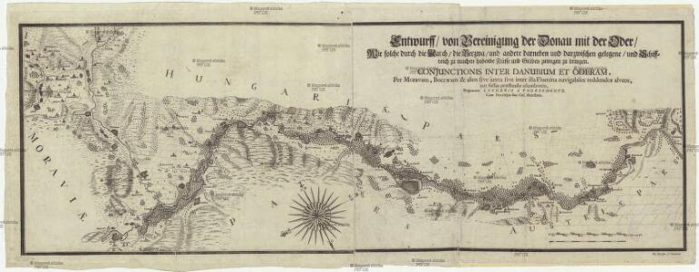
Entwurff von Vereinigung der Donau mit der Oder
1 : 22400 Bečva, řeka (Česko) Vogemont, Lothar Pfeiffer, M. Lothario a Vogesomonte
Die March
Morava, řeka-oblast
Strategische Situation der beiderseitigen Armeen am: 18. Juli, 21. Juli
1 : 576000 Morava (Česko)
Moravia Marchionatus =
1 : 440000 Mollova mapová sbírka Kaerius, Petrus
Moravia
Custos, David
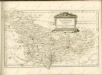
Moravia
Custos, David
La Moravia divisa ne suoi circoli Di Nuova projezione.
1 : 550000 Mollova mapová sbírka Zatta, Antonio Pitteri, Marco Alvise Zatta, Antonio
Moravia = Merhern
1 : 833000 Mollova mapová sbírka Custos, David Belli, Julius
Marchionatus Moraviae Tabula
1 : 650000 Mollova mapová sbírka Pfeffel, Johann Andreas Engelbrecht, Christian
Marchionatus Moraviae Tabula
1 : 650000 Mollova mapová sbírka Pfeffel, Johann Andreas Engelbrecht, Christian
Marchionatus Moraviae Tabula.
1 : 650000 Mollova mapová sbírka Pfeffel, Johann Andreas Engelbrecht, Christoph
Moravia Marchionatus
1 : 440000 Morava (Česko) Keere, Pieter van den
Moraviæ, qvae olim Marcomannorvm sedes, corographia
1 Karte : Kupferdruck ; 33 x 45 cm Fabritius; Ortelius s.n.
Moraviæ, qvae olim Marcomannorvm sedes, corographia
1 Karte : Kupferdruck ; 33 x 45 cm Fabritius; Ortelius s.n.
Tschecho-Slowakei
1 : 600000 Morava (Česko) Koch, Wilhelm Opitz, Carl Arnd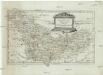
Die Markgrafschaft Maehren
1 : 640000 Brno-oblast (Česko)
Církevní mapa arcibiskupství Olomouckého
Soustavná elektrisace území západomoravských elektráren akc. spol. (ZME) v Brně
1 : 200000 Morava jižní (Česko) Vojenský zeměpisný ústav
Kraj Brněnský

Carte générale du marquisat de Moravie divisée en six cercles dressée sur les memoires les plus nouveaux
1 : 510000 Morava (Česko) Condet, Johannes Cóvens et Mortier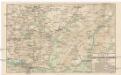
Karte der Kaiser Ferdinands-Nordbahn
Brno-oblast (Česko) R. v. Waldheim
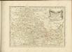
Marchionatus Moraviae Circulus Olomucensis

Lundenburg 133, uit: Special-Karte von Mittel-Europa / nach amtlichen Quellen bearbeitet von W. Liebenow
1 : 300000 titelvariant: W. Liebenow's Mittel-Europa; Annotatie: Titel boven de bladen: W. Liebenow's Mittel-Europa Johannes Wilhelm Liebenow 1822-1897 Frankfurt a. M. : Ludwig Ravenstein
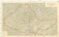
Der Olmützer Kreis
1 : 200000 Olomouc-oblast (Česko) Schenkl, Conrad Philipp Winiker, Karel Carl Winiker
Moravská část území župy Olomoucké

Moravská část území župy olomoucké
Olomouc-oblast (Česko) Lepař, Jan Raffelsperger, Franz nakladatelství R. Promberga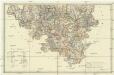
[Karte vom Olmützer-Kreise des Markgrafthumes Maehren]
1 : 140000 Olomouc-oblast (Česko) Hölzel, Eduard Eduard Hölzel