Maps of Czech Republic
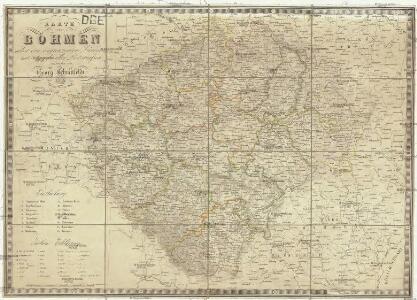
Karte von Böhmen
1 : 660000 Čechy (Česko) Schmitfeldt, Georg Tranquillo Mollo
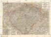
Neueste General-Post & Strassen-Karte des Königreichs Boehmen
1 : 650000 Čechy (Česko) Fried, Franz Artaria
General-Post & Strassen-Karte des Königreichs Boehmen
1 : 650000 Čechy (Česko) Fried, Franz Artaria & Comp.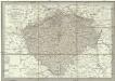
Neueste General-Post & Strassen-Karte des Königreichs Boehmen
1 : 650000 Česko Fried, Franz Artaria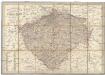
Neueste General-Post & Strassen-Karte des Königreichs Boehmen
Čechy (Česko) Fried, Franz Sartorius, Johann Christoph Artaria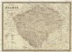
Karte von Böhmen
1 : 660000 Česko Schmitfeldt, Georg Mollo, Tranquillo Tranquillo Mollo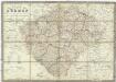
Karte von Böhmen
1 : 660000 Česko Schmitfeldt, Georg Mollo, Tranquillo Tranquillo Mollo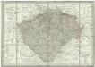
Neueste General-Post & Strassen-Karte des Königreichs Boehmen
1 : 650000 Česko Fried, Franz Artaria & Comp.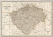
Neueste General-Post & Strassen-Karte des Königreichs Boehmen
1 : 650000 Česko Fried, Franz Artaria & Comp.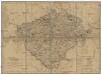
Königreich Böhmen
Česko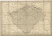
General Post & Strassen Karte des Königreichs Boehmen

Karte des Königreiches Böhmen
1 : 650000 Česko Raffelsperger, Franz in dem k. k. a. p. Civil-Geograpischen Institut
Charte der älteren und neueren Bergbaue in Böhmen
1 : 960000 Česko Hamernik, J.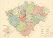
Mapa krajského rozdělení Čech r. 1654 na podkladě územní organisace soudních okresů r. 1946
Hölzelova generální mapa Království českého
Čechy (Česko) Wagner, Jan Eduard Lepař, Zdeněk v geografickém závodě Ed. Hölzela
Konigreich Boheim, Royaume de Boheme

Charte von Boehmen

Karte fon Königreiche Böhmen...

Charte von Boehmen
1 : 1000000 Česko Kipferling, Karl Joseph in J. Riedl's Kunsthandlung
Geognostische Karte des Königsreichs Böhmen
1 : 1020000 Čechy (Česko) Preininger, Andreas Biller, Dominicus
Přehledná hydrografická mapa povodí Labe, Odry a Dunaje v Čechách
1 : 750000 Dunaj (řeka : povodí) Vojenský zeměpisný ústav
Přehledná hydrografická mapa povodí Labe, Odry a Dunaje v Čechách
1 : 750000 Dunaj (řeka : povodí) Vojenský zeměpisný ústav
Přehledná hydrografická mapa povodí Labe, Odry a Dunaje v Čechách
1 : 750000 Dunaj-povodí Vojenský zeměpisný ústav
Special-Karte des Königreiches Boehmen
1 : 890000 Česko
Karte vom Königreiche Böhmen
1 : 690000 Česko Carl Wilhelm Medau
Karte vom Königreiche Böhmen
1 : 690000 Česko Carl Wilhelm Medau
Mapa Čech
1 : 500000
Bohemiae regnum in XII. circulos divisum cum com. Glac. et distr. Egrano ceterisq[ue] circumjacentibus terris
1 : 680000 Čechy (Česko) Müller, Johann Christoph per Homannianos Heredes
Bohemiae regnum in XVI. circulos divisum cum com. Glac. et distr Egrano ceterisq[ue] circumjacentibus terris
1 : 680000 Čechy (Česko) Müller, Johann Christoph per Homannianos Heredes
Bohemiae regnum in XII. circulos divisum cum com. Glac. et distr. Egrano ceterisq[ue] circumjacentibus terris ex Müllerianis aliisq[ue] chorographicis subsidiis delineatum
1 : 680000 Čechy (Česko) Müller, Johann Christoph Homannianos Heredes
Bohemiae regnum in XVI. circulos divisum cum com. Glac. et distr Egrano ceterisq[ue] circumjacentibus terris
1 : 680000 Čechy (Česko) Müller, Johann Christoph per Homannianos Heredes
Bohemia regnum in XVI circulos divisum
1 : 680000 Česko Müller, Johann Christoph Hommanianos Heredes
Bohemia regnum in XVI circulos divisum
1 : 680000 Česko Müller, Johann Christoph Hommanianos Heredes
Bohemiae regnum in XII. circulos divisum cum com. Glac. et distr. Egrano ceterisq[ue] circumjacentibus terris
1 : 680000 Čechy (Česko) Müller, Johann Christoph per Homannianos Heredes
Bohemiae regnum in XII. circulos divisum cum com. Glac. et distr. Egrano ceterisq[ue] circumjacentibus terris
1 : 680000 Čechy (Česko) Müller, Johann Christoph per Homannianos Heredes
Bohemiae regnum in XII. circulos divisum cum com. Glac. et distr. Egrano ceterisq[ue] circumjacentibus terris
1 : 680000 Čechy (Česko) Müller, Johann Christoph per Homannianos Heredes
Bohemiae regnum in XII. circulos divisum cum com. Glac. et distr. Egrano ceterisq[ue] circumjacentibus terris
1 : 680000 Čechy (Česko) Müller, Johann Christoph per Homannianos Heredes