Maps of Sahara

Charte der Nordküste Africas oder die Staaten Marocos, Fez, Algier, Tunis, Tripoli und AEgypten
1 : 14000000 Afrika severní Zuccheri, E. von Kunst und Industrie Comptoirs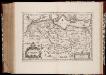
Nova Barbariae descriptio
1 : 12500000 Annotatie: Kaart uitg. tussen ca. 1647-ca. 1657; Origineel is Blad 205 in atlas factice; Annotatie geografische gegevens: Schaalstokken op kaart: 90 Milliaria Germanica (=5,5 cm), en: 90 Milliaria Hispanica (=4,6 cm). Amstelodami : apud Joannem Janssonium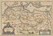
Nova Barbariae Descriptio. [Karte], in: Novus atlas absolutissimus, Bd. 6, S. 162.
1 Karte aus Atlas Janssonius Offizin
Nord Africa.
1 : 24000000 Reichard, C. G.
Northern Africa.
1 : 12000000 John Bartholomew and Son
North Africa.
1 : 16600000 Sharpe, J.
Africae antiquae, et quarundam Europae, Asiaeque adiacentium regionum
1 : 1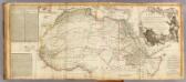
Africa (north)
1 : 8300000 Robert Laurie & James Whittle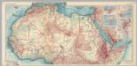
Africa - North. Pergamon World Atlas.
1 : 10000000 Polish Army Topography Service
Monde connu des Hebreux.
1 : 14000000 Picquet, C.
Afrique, septentrionale.
1 : 15000000 Brue, Adrien Hubert, 1786-1832
Karte von Africa
Afrika Robert de Vaugondy, Didier Alberti, Ignaz F.A. Schraembl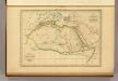
Afrique Ancienne.
1 : 27500000 Malte-Brun, Conrad, 1775-1826
Marocco, Algeria & Tunis. Central Africa.
1 : 4552426 Johnston, W. & A.K.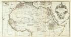
Afrique nord.
1 : 8300000 Anville, Jean Baptiste Bourguignon d, 1697-1782
Carte détaillée (en deux feuilles) de l'Afrique et des îles qui en dépendent (partie septentrionale)
1 : 16323500 par A. Brué, d'après les observations astronomiques, les découvertes et les hypothèses les plus récentes Paris : chez l'auteur
Mauritania, Morocco, Algeria, Tunisia, Libya, United Arab Republic, Chad, Sudan. Pergamon World Atlas.
Polish Army Topography Service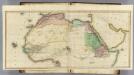
(Africa N sheets)
1 : 11200000 Lizars, Daniel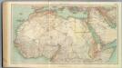
109-11. Africa nord.
1 : 10000000 Touring club italiano
Středomoří a Sev. Afrika

Carte du cours des rivieres de Salum, de Cazamance, de Cassini, de Pongo et de Mallecory
Afrika severní Malte-Brun, V. A. Erhard Schieble, Georges Societé de geographie
Libya et Aethiopia
Etiopie Reichard, Christian Gottlieb Campius, D. a D. Campio
N. Africa, S. Africa.
Thomson, John
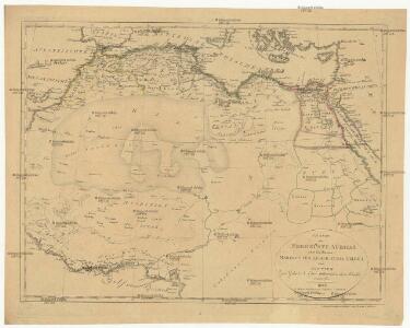
Carte d'une Partie de L'Afrique Septentrionale.
1 : 18500000 Vivien de St Martin, L.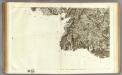
140 Saint-Jean-Pied-de-Port.
1 : 86400 Cassini family; Cassini, Cesar-Francois, 1714-1784
N.W. Africa.
1 : 8200000 Arrowsmith, John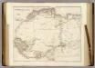
North Western Africa.
1 : 8236800 Arrowsmith, John
Africa vetus florentibus Romanorum rebus
1 : 27429000 Afrika subsaharská Martin Gleditsch