Mapa catalogado
Kolonien (Schutzgebiete) des Deutschen Reichs


Título completo:Kolonien (Schutzgebiete) des Deutschen Reichs
Año de ilustración:1882 - 1887
Fecha de publicación:1882 - 1887
Editorial:F.A. Brockhaus Geogr.-artist. Anstalt
Tamaño físico:20 x 30 cm
Escala del mapa:1:6 000 000
Kolonien (Schutzgebiete) des Deutschen Reichs
1887
F.A. Brockhaus Geogr.-artist. Anstalt
1:6m
Carte de l'Afrique occidentale française. Forcados
1903
France. Service géographique des colonies
1:2m
A chart of coast of BIAFRA from Foche Island to Corisco Island together with the Islands of FERNANDO POO and PRINCES
1707
Carte des possessions anglaises et françaises sur le Golfe de Guinée
1884
Paris : impr. de F. Menetrier
1:5m
Carte de la boucle du Niger / dressée par Spicq ; Service Géographique des Colonies
1897
Henri Eugène Spicq; Service Géographique des Colonies
1:2m
Aequatorial-West-Afrika
1893
Kiepert, Richard ; Sprigade, Paul
1:3m
Neueste Karte von Sudan und Guinea
1860
Meyer, J.
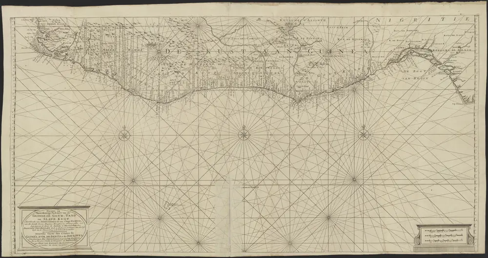
Verzameling van 20 door de firma Van Keulen uitgegeven paskaarten.
1800
Johannes en Gerard van Keulen;Ioan Heyteman;Iohn Heyteman;Joannes van Keulen;Iohn of Keulen;Iean van Keulen;Iohannis van Keulen;Ioannes van Keulen;G. v. Keulen;G: v: Keulen;Gerard van Keulen;Jean van Keulen;Pieter Goos;Iohannes van Kuelen;Pierre Mortier;Hadriano Relando;Iacob Lootsman
Cartes économiques de l'Afrique Occidentale Française. n6, faune
1922
Meunier, Alexandre, cartographe 18..-19..
1:3m

Atlas minor, mapa ze strany: 603
1610
Mercator Gerhard