Katalogisierte Karte
Kristiania


Vollständiger Titel:Kristiania
Jahr der Abbildung:1891 - 1895
Datum der Veröffentlichung:1891 - 1895
Herausgeber:F.A. Brockhaus' geogr.-artist. Anstalt
Physische Größe:20 x 30 cm
Maßstab der Karte:1:43 000
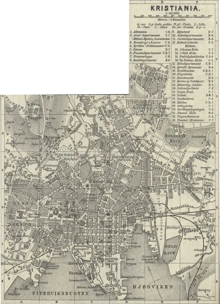
Norge 185: Kristiania
1879
Baedecker
1:20k
Kristiania
1895
F.A. Brockhaus' geogr.-artist. Anstalt
1:43k
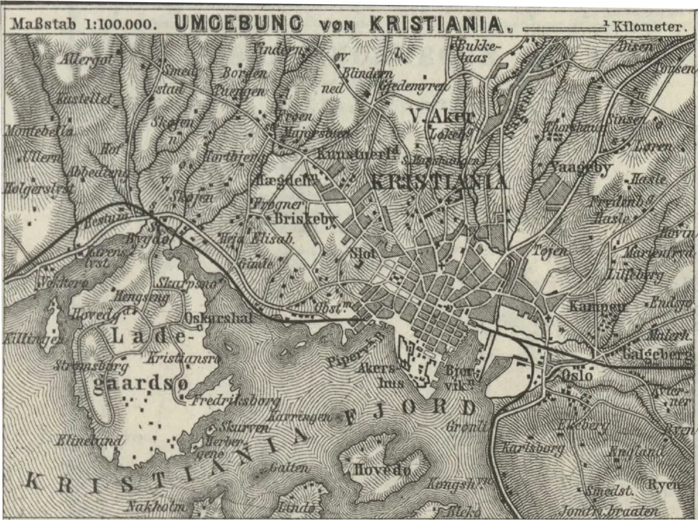
Norge 185: Umgebung von Kristiania
1879
Baedecker
1:100k
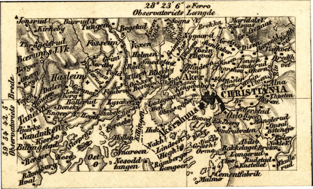
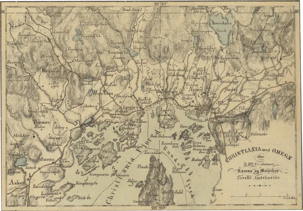
Norge 160 sør: Christiania med omgegn
1845
Peter Andreas Munch
1:350k
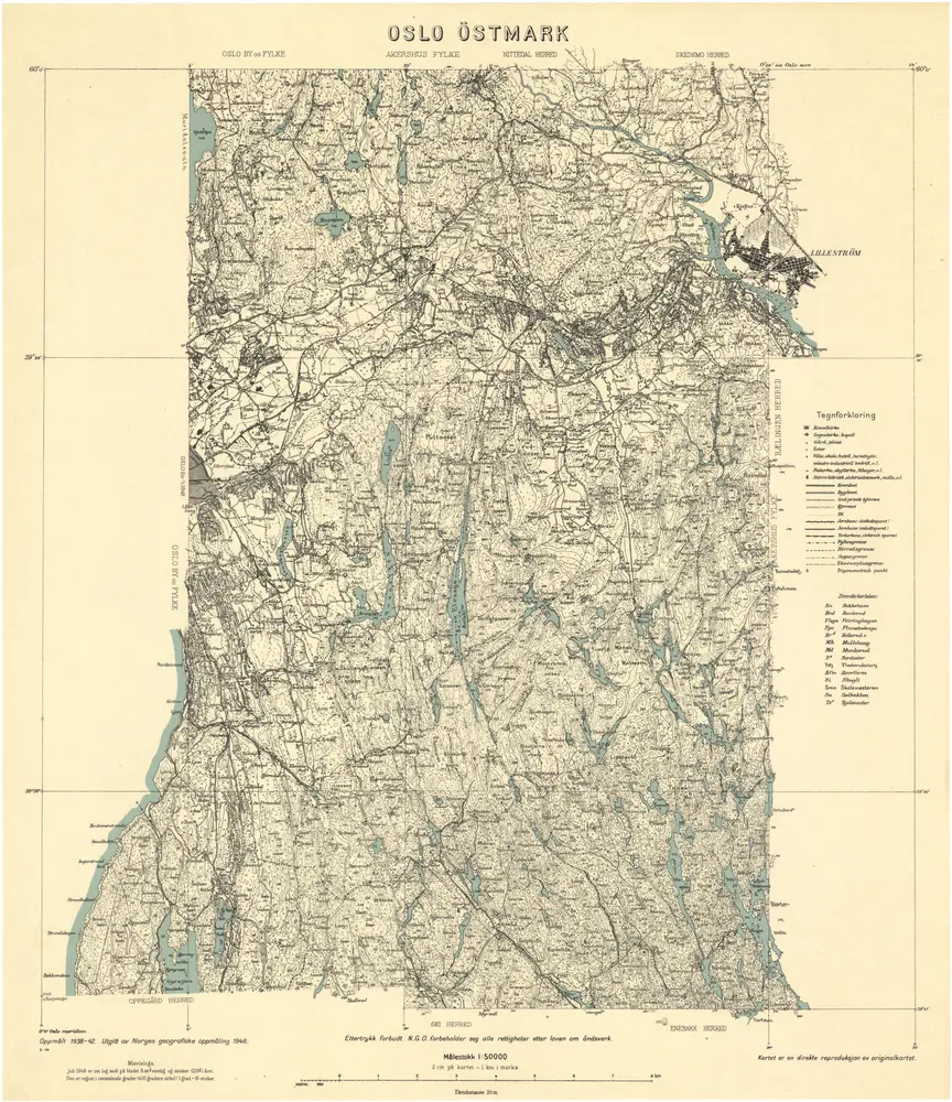
Oslo Østmark
1948
Norges geografiske oppmåling
1:50k
Norge 155: Christiania med Omegn
1839
I. C. Walter, G. C. C. W. Prahl
1:50k
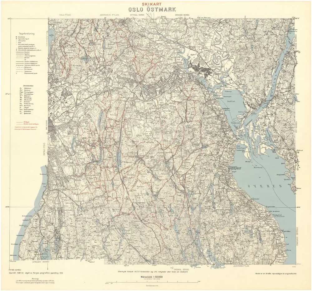
Oslo Østmark
1953
Norges geografiske oppmåling
1:50k
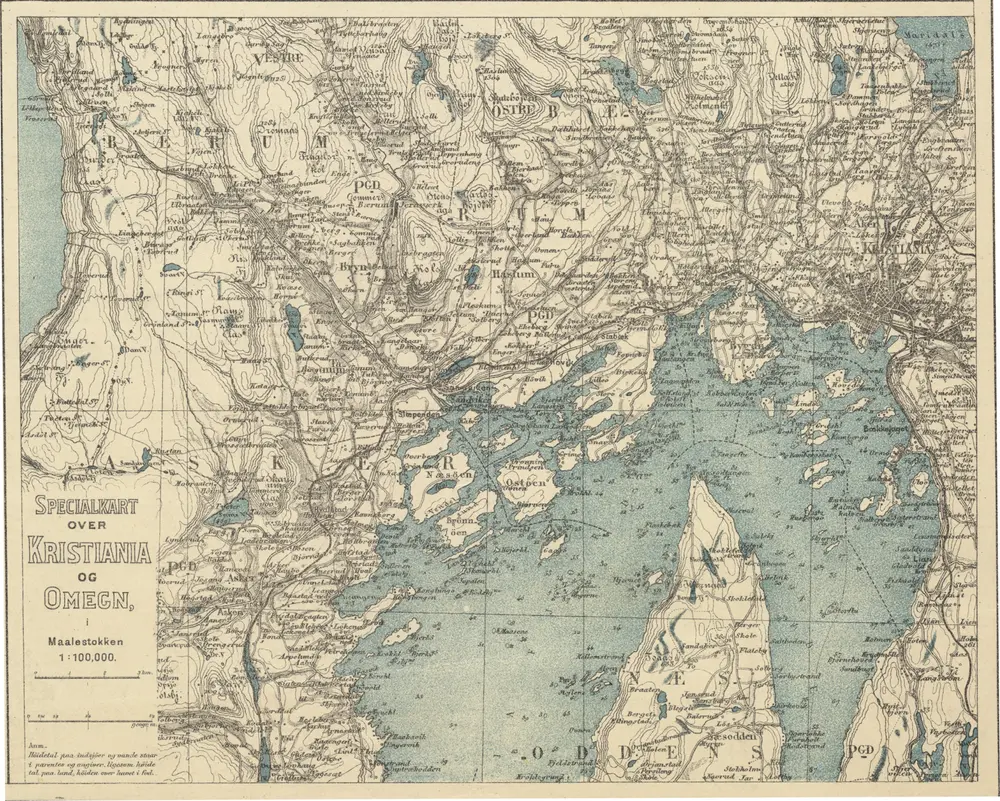
Norge 203: Specialkart over Kristiania og Omegn.
1902
Det Nordiske Forlag Bokforlaget Ernst Bojesen
1:100k

Kristiania omegn / Heliogravure efter Tegning af Karttegner J. Natrud ; Fjeldtonen af O. Engh
1908
J. Natrud; O. Engh
1:25k
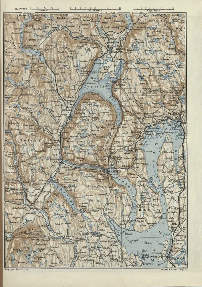
Norge 185: Tyrifjorden
1879
Baedecker
1:500k