Katalogisierte Karte
Istrien


Vollständiger Titel:Istrien
Jahr der Abbildung:1890
Datum der Veröffentlichung:1890
Herausgeber:Hydrographisches Amt der K. u. k. Kriegs-Marine, Seekarten-Depot
Physische Größe:20 x 30 cm
Maßstab der Karte:1:80 000
Istrien
1890
Hydrographisches Amt der K. u. k. Kriegs-Marine, Seekarten-Depot
1:80k
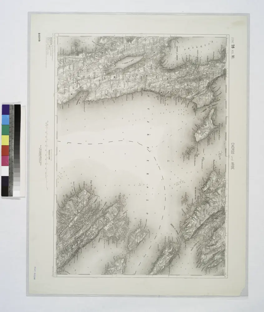
Cherso und Arbe.
1914
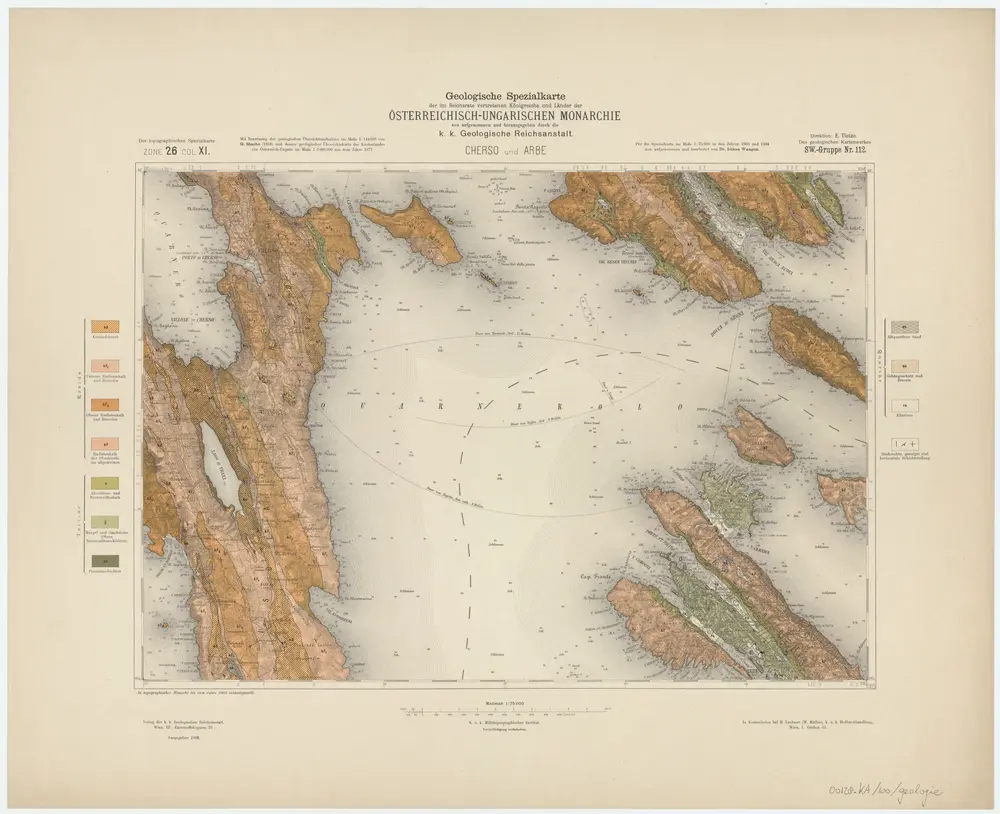
Zone 26, Col. XI, Cherso und Arbe, uit: Geologische Karte der im Reichsrathe vertretenen Königreiche und Länder der Österreich-Ungarischen Monarchie : auf Grundlage der Specialkarte i.M. 1:75.000 des k.u.k. Militär-geographischen Institutes / neu bearb. und als Kartenwerk von 341 Blattnummern in zwanglosen Lfg. hrsg. durch die k.k. Geologische Reichsanstalt in Wien
1898
Kaiserlich-Königliche Geologische Reichsanstalt, Wenen
1:75k
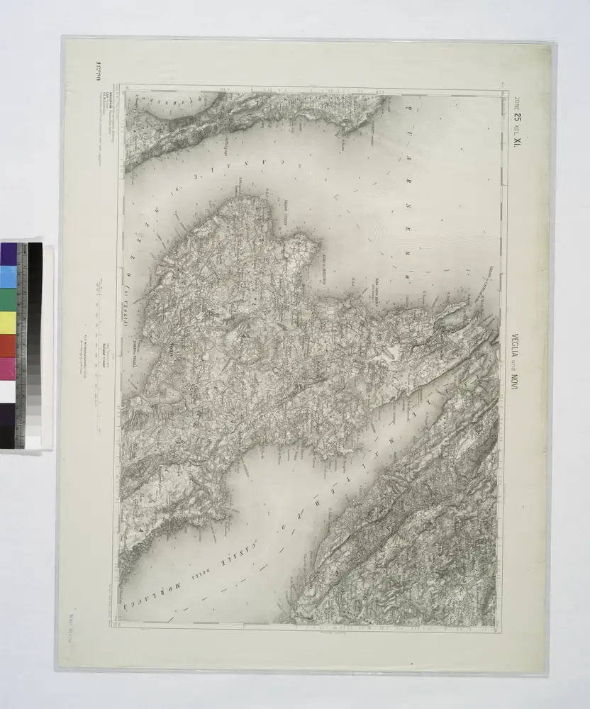
Veglia und Novi.
1914
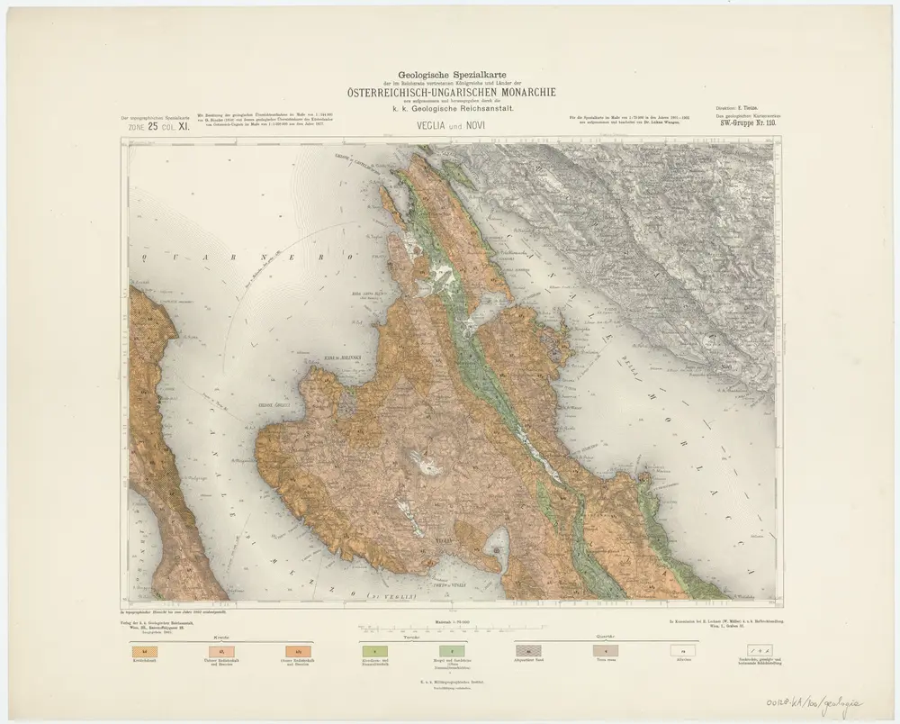
Zone 25, Col. XI, Veglia und Novi, uit: Geologische Karte der im Reichsrathe vertretenen Königreiche und Länder der Österreich-Ungarischen Monarchie : auf Grundlage der Specialkarte i.M. 1:75.000 des k.u.k. Militär-geographischen Institutes / neu bearb. und als Kartenwerk von 341 Blattnummern in zwanglosen Lfg. hrsg. durch die k.k. Geologische Reichsanstalt in Wien
1898
Kaiserlich-Königliche Geologische Reichsanstalt, Wenen
1:75k
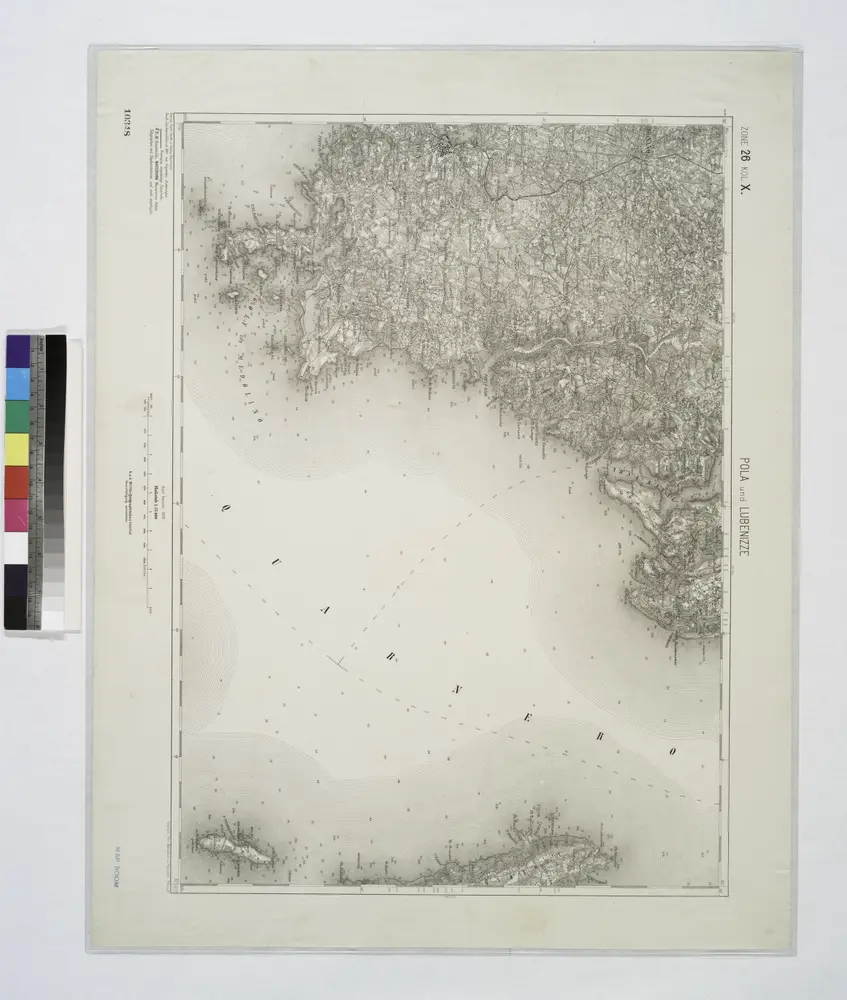
Pola und Lubenizze.
1914
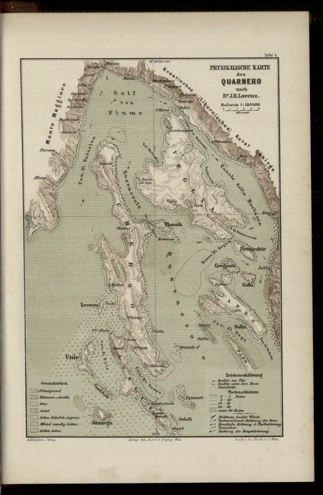
Physikalische Karte des Quarnero nach Dr. J. R. Lorenz
1883
Freytag, Gustav
1:580k
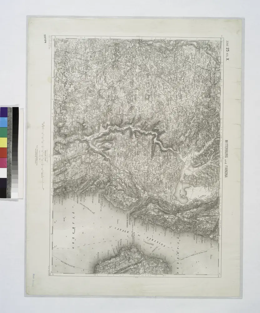
Mitterburg und Fianona.
1914
Adriatisches Meer, Küsten-Karte
1903
Oesterreicher, Tobias von
1:180k
Skelet-Karte für Curs-Skizzen
1918
K. u. k. Kriegs-Marine