Cataloged map
Nordsee


Full title:Nordsee
Depicted:1923
Pubdate:1923
Publisher:Reichs-Marine-Amt
Physical Size:20 x 30 cm
Map scale:1:150 000
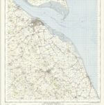
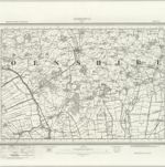
Grimsby - OS One-Inch Map
1951
Ordnance Survey
1:63k
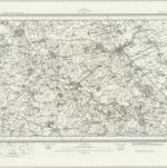
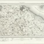
Louth (Hills) - OS One-Inch Revised New Series
1897
Ordnance Survey
1:63k
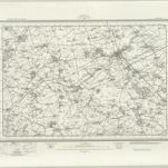
Louth (Outline) - OS One-Inch Revised New Series
1897
Ordnance Survey
1:63k
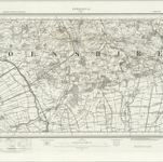
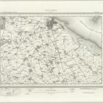
Horncastle (Hills) - OS One-Inch Revised New Series
1897
Ordnance Survey
1:63k
Horncastle (Outline) - OS One-Inch Revised New Series
1897
Ordnance Survey
1:63k
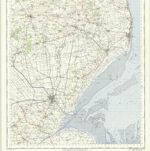
Boston and Skegness - OS One-Inch Map
1951
Ordnance Survey
1:63k
Great Grimsby (Hills) - OS One-Inch Revised New Series
1897
Ordnance Survey
1:63k
Great Grimsby (Outline) - OS One-Inch Revised New Series
1897
Ordnance Survey
1:63k
Lincolnia comitatus : Anglis Lincoln-Shire
1645
1:253k
Lincoln Woods, Sheet 10 - Bartholomew's "Half Inch to the Mile Maps" of England & Wales
1902
Bartholomew, John George
1:127k